3-58
3
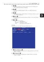
࠙
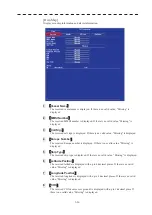
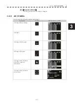
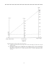
Water levels
ࠚ
The received information of country code, guage ID and water level is displayed. In
addition, the reception time(last Update) and the reception elapsed time(Age) are also
displayed. The elapsed reception time is displayed up to a maximum of 999 minutes,
and if it is longer than that, it is displayed as "Over".
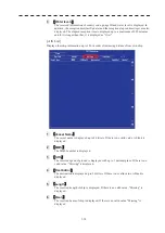
[AIS List]
Display other ship information up to 100 in order of increasing distance from own ship.
1
࠙
Vessel Name
ࠚ
The vessel name is displayed up to 20 letters. If there is no valid value, A blank is
displayed.
2
࠙
MMSI
ࠚ
The MMSI number is displayed.
3
࠙
SOG
ࠚ
The received speed of ground is displayed with up to 1 decimal place. If there is no
valid value, "Missing" is displayed.
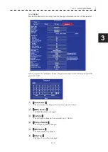
4
࠙
Destination
ࠚ
The destination is displayed up to 20 letters. If there is no valid value, A blank is
displayed.
5
࠙
Length
ࠚ
The received kength of ship is displayed. If there is no valid value, "Missing" is
displayed.
6
࠙
Beam
ࠚ
The received beam of ship is displayed. If there is no valid value, "Missing" is
displayed.
Содержание JMR-611
Страница 2: ......
Страница 24: ......
Страница 26: ......
Страница 28: ......
Страница 33: ...1 5 1 1 4 EXTERIOR DRAWINGS y Fig 1 1 Exterior Drawing of Scanner Unit Type NKE 387 Unit mm...
Страница 34: ...1 6 Fig 1 2 Exterior Drawing of Processing Unit Type NDC 1774 Unit mm...
Страница 35: ...1 7 1 1 4 EXTERIOR DRAWINGS y Fig 1 3 Exterior Drawing of Operating Unit Type NCE 5923 Unit mm...
Страница 38: ......
Страница 54: ......
Страница 116: ......
Страница 118: ......
Страница 124: ......
Страница 134: ......
Страница 136: ......
Страница 142: ......
Страница 144: ......
Страница 154: ......
Страница 156: ......
Страница 160: ......
Страница 164: ......
Страница 166: ......
Страница 172: ......
Страница 174: ......
Страница 177: ...APPENDIX Fig 1 Block Diagram of JMR 611...
Страница 181: ...APPENDIX Fig 5 Internal Connection Diagram of Control Unit NCM 994...
Страница 182: ......
Страница 184: ......
Страница 186: ......
Страница 187: ......

