- 36 -
Chartplotter menu
1. Map setting
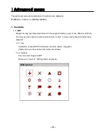
1.1. UserData Display
Setting up shown/hide the user data on the display.
1.2. INFO Display
Setting up shown/hide common item between the HY-MAP and the C-MAP on the display.
1.3. Map scale
Setting up the map scale on the display.
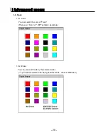
1.4. Palette
It is possible to the palette used to enhance the visibility of the screen depending on the
surround light condition. The possible choices are listed in the table below:
1.4.1. Normal
It set the maps are displayed in ordered to use colors as similar as possible to the ones used
in the original paper charts.
1.4.2. Sunlight
It is designed to enhance the visibility of the screen when HIS-70R is exposed to the sunlight.
The maps are much brighter than in the other displays.
1.4.3. NOAA
Allows setting NOAA paper chart colors presentation.
(*It is available NOAA menu on C_MAP mode.)
1.5. LAT. Modification
Though GPS information is accurate, there could be an error in the chart at latitude. The error
can be modified in the chart latitude modification.
1.6. LOT. Modification
Though GPS information is accurate, there could be an error in the chart at longitude. The error
can be modified in the chart longitude modification.
1.7. Map Select
Select the chart among HY-MAP,C-MAP and External map.
Содержание HIS-70R
Страница 12: ... 12 HIS 70R System HIS 70R Metal Front Rear Main Screen Keypad Knob Mounting Bracket Connector ...
Страница 13: ... 13 HIS 70R System HIS 70R Plastic Front Rear Main Screen Keypad Knob Mounting Bracket Connector ...
Страница 14: ... 14 HIS 70R System SPEC of the connectors Metal Plastic ...












![Humminbird ] 981 Installation & Operation Manual preview](http://thumbs.mh-extra.com/thumbs/humminbird/981/981_installation-and-operation-manual_2183846-01.webp)
