S
O F T W A R E
I
N S T A L L A T I O N
A N D
S
E T U P
Station Setup
21
Note: Note:Latitude and longitude are a way of identifying your position on the earth. Lati-
tude measures distance north or south of the equator. Longitude measures distance
east or west of the Prime Meridian, an imaginary line running north and south through
Greenwich, England.
If you do not know your latitude and longitude, there are many ways to find out.
Many atlases and maps include latitude and longitude lines. You can also talk to
the reference department of your local library, or try calling your local airport. If
you are installing your station in the United States, the US Geological Survey
(USGS) produces topographic maps with elevations. The more accurate you are,
the better; however; a reasonable estimate will work, too.
Here are some on-line resources for finding your latitude and longitude:
▲
http://www.geocode.com/eagle.html-ssi
▲
http://www.topozone.com/ (US only)
▲
http://www.calle.com/world/ (Outside US only)
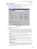
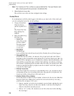
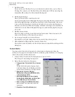
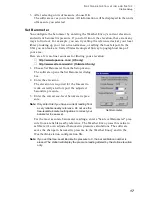
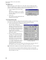
This dialog box includes text boxes to input your position. You can enter your lat-
itude and longitude as degrees, minutes, and seconds, or as fractions of a degree.
For example, Hayward, California, the home of Davis Instruments, lies at approx-
imately 37 degrees 38 minutes 10 seconds north of the equator and 122 degrees 7
minutes and 30 seconds west of the Prime Meridian.
You could also enter the latitude and longitude in decimal form by putting 37.6 in
the first box for the latitude and 122.1 in the first box for the longitude and leaving
the other boxes blank.
The dialog box also shows what the station’s current settings are. You can use this
dialog box to set the latitude and longitude for the NOAA reports, the sunrise and
sunset calculations, and APRS weather reports even if the weather station is not
connected to the PC. See the Reports section for more info.
Set Latitude and Longitude


