14.
15.
5. Guidance While Driving
After you have set a destination, the system will calculate a route. Once you
begin moving, the system will use the GPS information to update your position
on the map and start to give you guidance.
See the
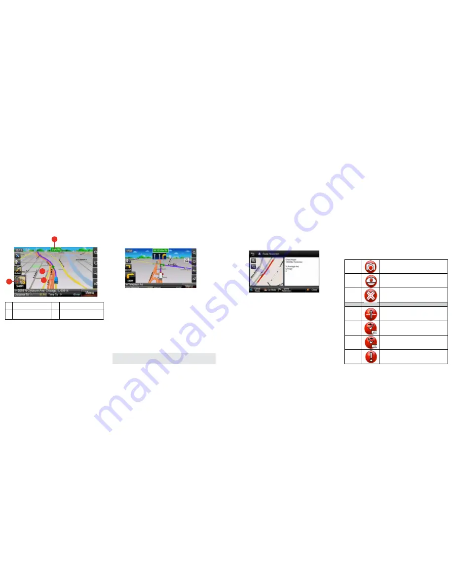
MAP SCREEN FEATURES – DRIVING GUIDANCE MODE
section for a more detailed description of all map objects.
Lane Guidance
Lane Guidance helps you safely prepare for your next maneuver by displaying
the correct lane(s) to stay in.
Lane Guidance appears below the Next Street Name box. The highlighted white
arrow indicates the correct lane(s) to be in. In the example below, there is one
highlighted lane turning right; this is the correct lane to stay in for the upcoming
maneuver. The other two grey lanes are going straight.
Signposts
Signposts provide a realistic representation of actual signposts at complex
highway junctions. As you approach a highway junction, the signpost displays
route shields, route directions, locality, exit, and lane information.
The Signpost replaces the normal Next street name box at some junctions. The
highlighted shield with white arrows indicates the correct lane(s) to be in. Please
be aware that Signposts are available for some, but not all highway junctions.
Junction View
Junction View, like Signposts, provides a realistic representation of the highway
as you approach the junction. The Junction View displays the highway lanes,
shields, directions, and lane information in a split mode view.
Junction View may be turned on or off in the Display Settings.
Settings
>
Display Settings
>
View Mode
. See
DISPLAY SETTINGS
for more information.
1
Highlighted route to follow.
3
Indicates the next turn to take.
2
Your current location.
4
The name of the next street to
turn onto.
1
4
2
3
Truck Restrictions
When you calculate a route, the navigation will attempt to find a route that does
not include any roads that are restricted for your vehicle.
However, if it is not possible to find a route without using such roads, a box will
be displayed with the option to review any restrictions that are present on your
route. When reviewing restrictions on your route, you will be presented with a
screen similar to the below, this screen allows you to view a map of the area
relating to the restriction and the restriction details.
On the Route Restriction screen you can choose: 1) ignore the restriction; 2)
switch to car mode; 3) cancel the route. If you choose to [Ignore Restriction], the
route given in navigation will use the restricted area of road highlighted on the
map. If you choose
Car Mode
, navigation will not take into account any truck
related information with any and all truck restrictions not considered in naviga-
tion. If you choose
Cancel Route
, your route will be canceled.
There may be multiple restrictions on your route, in this case each individual
restriction will be presented in the manner described above.
If you deviate from your active route while driving and a new route cannot be cal-
culated without using restricted roads, then a message will be displayed on the
main map screen with two options: 1) Keep active route; 2) Review restrictions.
By choosing
Keep Active Route
, your route will continue as calculated
including the area of road restricted for your vehicle.
By choosing
Review Restrictions
, you will be prompted to park in a safe
place prior to reviewing the restriction or restrictions individually in the same
manner as described above using the “Route Restriction” interface.
Alerts
Your unit will display visual alerts on the main map screen when approaching a
location that requires attention. Alerts can be divided into three groups:
AURA
®
alerts
(warnings of upcoming red light cameras, speed cameras, dangerous
intersections and mobile speed traps);
general trucker alerts
(warnings of
locations that are of potential importance to truck drivers, such as, state borders,
time zone changes and weigh stations);
restriction alerts
(warnings that you
are approaching a location or on a road for which your vehicle is prohibited).
An overview of the alert types is displayed below:
Please be aware that Lane Guidance, Signposts and Junction View are
available for some, but not all junctions.
Aura
Camera enforcement:
displayed when you
are approaching a location of a red light camera
or speed camera.
Mobile speed trap:
displayed when you
are approaching a location commonly used as
a speed trap.
Dangerous intersection:
displayed when
you are approaching a dangerous intersection.
General
State border:
displayed when you are
approaching a state border.
Time zone forward:
displayed when you are
approaching a change in time zone with the time
going forward by an hour.
Time zone backward:
displayed when you
are approaching a change in time zone with the
time going backward by an hour.
Weigh station:
displayed when you are
approaching a weigh station.
6100PROHD_MANL.indd 10
12/30/13 10:23 AM


