Helpful Hints
Installation
Your
Installation Code
can be found on your CD jewel case.
On Your Pocket PC
1.You can program one of the buttons on your Pocket PC for one-touch
access to Pocket CoPilot.
Select Settings
from the
Start
menu,
click the
Buttons icon
,
highlight the button
you would like to program by clicking
on it, and
select Pocket CoPilot
from the drop-down
Button assignment:
menu.
In future uses pressing the assigned button will immediately launch CoPilot.
GPS Tracks
1. Pocket CoPilot will automatically track your trips, and save them as
.gps
files
which you can play back at any time to review a route. You can save memory
space by emptying this folder occasionally and transferring the files to a folder
on your desktop PC that is not synchronized with your mobile device.
To do this
connect your Pocket PC to your desktop
,
select Explore
from the drop-down
File
menu in
ActiveSync
,
go into the GPS Tracks
folder,
and
transfer these files
to another folder on your hard drive.
1a.These files are also helpful to us. Occasionally, please take these files,
Zip them
, and
send them to [email protected]
. Or, open Pocket CoPilot on
your desktop PC while your Pocket PC is connected and select
E-mail tracks to Club CoPilot.
Using your GPS tracks we will be able to enhance
the street-level system to provide even more accurate map data with each new
release.
About GPS Technology
The Global Positioning System (GPS), developed by the U.S. Department
of Defense, is a constellation of 24 satellites that orbit the Earth twice daily.
Each satellite contains an atomic clock that is accurate to the nanosecond, and
constantly emitting radio waves toward Earth. GPS sensors (hardware devices
for receiving data) can receive these signals from the satellites, and using their
own internal clock can calculate the amount of time it has taken for the signal to
be received. GPS relies on the fact that radio waves travel at the speed of light
to calculate distances, and the exact location of the sensor is figured by combin-
ing the data received from four satellites. Using the data from these four satel-
lites, GPS is able to give you the latitude, longitude and elevation of your present
location, and also your road speed and direction of travel on a route. Given the
right conditions, a GPS sensor can identify your geographic position anywhere in
the world within a matter of a few meters.
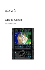
Trip - Map Screen
Select Trip Map
from the
drop-down
Window
menu.
Atlas
,
Start
, and
End
tabs will
zoom to the map view of
those places respectively.
Displays map orientation
.
Distance Scale
.
NOTE: By default these
screens will appear
together as a split screen.
To change view you must
select from the drop-
down
Window
menu.
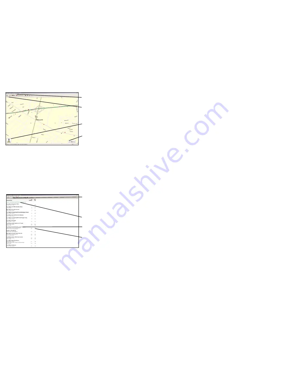
Trip - Driving Directions
Click Run
in the
Trip Planner
window and
select Trip
Directions
from the drop-
down
Window
menu.
Start location
.
Turn-by-turn
instructions.
Distance
and
time
between
turns.
-53-
-54-
Содержание CoPilot CoPilot 3.0
Страница 1: ......