


CHAPTER 7. GIS COLLECTION WITH PINPOINT-GIS OR OTHER APPLICATIONS
Table 7.5-4:
Type conversion for auto
fi
lled GNSS attributes
To be able to add extra attributes to a GIS database you will need to use either ArcGIS Online
or ArcGIS PRO Desktop SW. The steps below explain how to prepare a map for auto
fi
lling
of GNSS data using ArcGIS Online. Note that you need to have an Esri account which allows
editing of the Feature class. In ArcGIS Online, open a User map which includes the Feature
Class you want to use for the auto-
fi
lled GNSS data and follow steps below:
Public accounts do not allow new attributes in the layer to be de
fi
ned. Extra attributes are
useful for demonstrating how PinPoint-GIS automatically pushes not only position data but
also any other metadata which might be important (e.g. accuracy, height, Positioning Mode,
etc.). If you need this functionality you will need a payable Esri account.
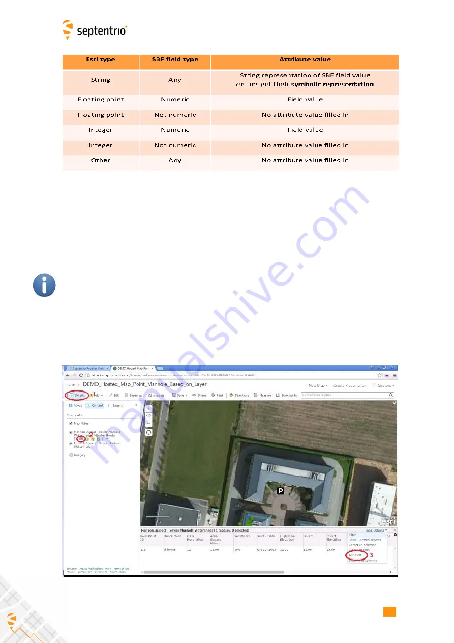
1. Select the in the Details menu the Feature class you want to edit
2. Click on the table view icon which will allow you to visualize all the
fi
elds of the Feature
class
3. Click on the Table Options menu and select the option Add a
fi
eld
Figure 7-10:
Adding a GNSS attribute in a feature class
90
Summary of Contents for ALTUS NR3
Page 1: ...Altus NR3 User Manual ...


