GA5000 Gas Analyzer
OMGA5KN4.6
Page
55
of
73
8.10 How to identify a borehole using the GPS feature (optional)
An optional GPS feature is available for the GA5000 gas analyzer. It enables the site
engineer to automatically locate borehole IDs using GPS satellite signal from predefined
borehole IDs uploaded from Landtec Systems Gas Analyzer Manager. The GPS reading
data is stored for each measurement reading.
Note:
Borehole IDs may be uploaded from LSGAM with or without location
information. If location details are not uploaded the location longitude and
latitude coordinates can be stored when the borehole is located and
downloaded to LSGAM with the reading measurements.
Screen navigation:
1)
Switch on the analyzer and wait for the self-test warm-up to complete and the
analyzer will display the ‘Main Gas Read Screen’.
2)
In order to use the navigation function if configured, you must switch ‘Navigation -
On’ on the analyzer. Select the ‘Menu’ key followed by ‘Key 5’ to toggle navigation to
on. Select the ‘Menu’ key to exit and return to the ‘Main Gas Read Screen’.
3)
Select the soft-key ‘Next ID’, then select a borehole ID from the list displayed and
press the ‘Enter ‘key to continue.
Warning
Before entering the GPS Navigation Screen for the first
time the following health and safety message will be
displayed.
“Please be aware of the terrain when using this screen.
You are responsible for your own safety while walking on-
site!”
4)
After reading the user warning message, select the soft-key ‘Dismiss’. Use the
tracking display to locate the borehole
Note:
There is often a wait time frame of between 30 seconds to two minutes
whilst getting a satellite signal. Be aware that heavy rain, trees
overhead etc. will give a bad fix.
5)
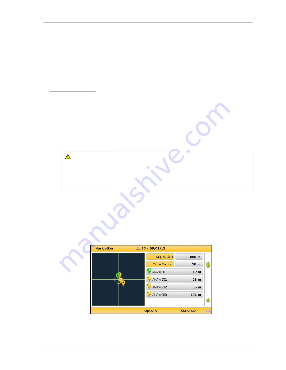
Once the operator selects a borehole ID the ‘GPS Navigation’ screen is displayed.
Navigation
6)
If required select soft-key ‘Options’ to go to the ‘Navigation Options’ menu and the
following screen is displayed:


