


LX Zeus v 3.4.3
10.9.2014
- 49 -
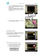
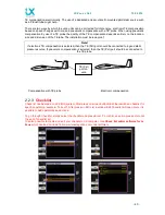
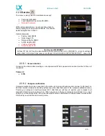
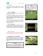
The bottom row consists of
NAV BOXes
. Bottom row variants are selectable by
1-4
push button. Any NAV
BOX content is custom programmable after using a very simple procedure.
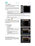
Editing NAV BOXes:
Long press Zoom
(orange frame will appear)
Move orange frame by rotating zoom to free space, or replace current NAV BOX by short press on
Zoom
Select the NAV BOX you want with rotating zoom and confirm it by Zoom press
If the row is full, press 1-4 push button and add new NAV BOX with the same procedure
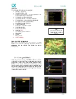
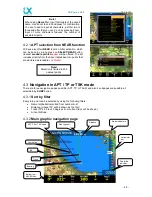
4.3.3
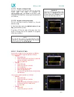
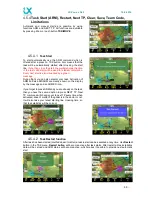
Second navigation page (subpage)
Second navigation page is divided into two sections; the
upper section consists of a vertical profile. The vertical
profile will show you the terrain, glide path distance,
Airspaces (yellow and red), selected TP/APT and a cone.
The cone depends on the MacCready setting. The lower
line is a MC setting 0 and upper line is your currently set
MC. If the glider icon is between upper and lower line it
means that you are still below glide path for your set MC,
but you will still reach your destination with a lower MC
setting. If the glider is below the lower line you are too low
and you won’t reach your destination even on MC 0.
The lower section shows APT / TP data such as:
Grass or asphalt runway with directions
Elevation
QNH alt
Flight level
QFE alt
Frequency of the APT
Your current radial
Your current distance from selected APT / TP
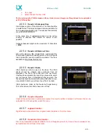
At TSK the lower section is a circling log page, wind
profile page and a statistics page with:
Legs
Speed
Distance flown
Duration
Vario average
Circling on task in percentage
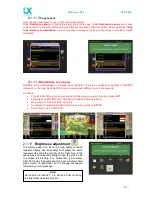
4.3.4
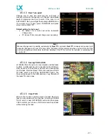
Third navigation page (2
nd
subpage)
The third navigation page shows terrain data that is split to
a map and an AHRS (artificial horizon). If the AHRS is not
purchased as a part of the Zeus system, then it is a vertical
profile.
Note!
This 3rd page can be disabled after command is
executed in Setup/User Interface.