p. 58
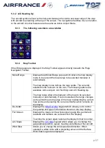
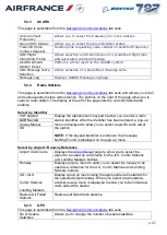
Touch the area map display to change the wind speed and
direction. The keypad readouts and the size and direction of the
arrow will change accordingly. Select OK on the keypad to
confirm the selection.
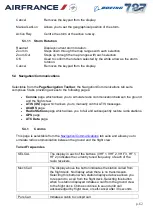
Rng/Brg
Allows you to determine the range and bearing to radio facilities
or a lat/long position. When selected, a white square frame
(centred at the map reference position) and the
Move the white square frame to select a lat/long position and use
the keypad to determine the range and bearing.
Sel On Map
When selected, a while circle and the
keypad are displayed. Move the white circle to select an area of
interest and use the keypad to select required facility.
When a facility has been successfully selected, the Select
Station menu is displayed to allow you to:
Display station information
Fail/restore the facility
Display range/bearing information
Set the facility as the map centre
Selecting range/bearing displays the ident, bearing and range
of the facility in the map display title bar.
Storm Ctrl
menu to allow you to control and
modify the storm models.
5.3.5
Map Declutter
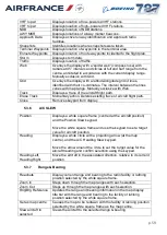
This popup is displayed when De-clutter is selected on the Map Toolbar.
Auto
Selects/deselects Auto mode.
In Auto mode, the display of symbols is automatically and
selectively controlled as the area covered increases or
decreases.
In Manual mode, the display of the symbols is controlled by this
keypad.
Freq
Displays radio station broadcast frequency details.
APT
Displays airport positions and ICAO codes, and enables the
RWY button.
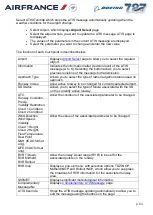
RWY
Only operable when APT is selected on. Displays and identifies
airport runways, and enables ILS and MKR buttons.
ILS
Only operable when RWY is selected on. Indicates where runway
ILS facilities exist.
MKR
Only operable when RWY is selected on. Displays location of
runway outer, middle and inner marker beacons.


