background image

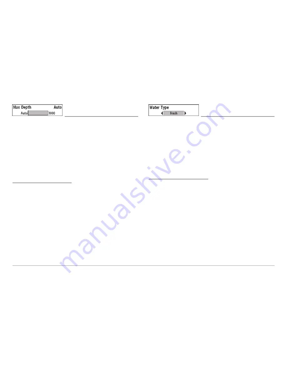
Max Depth 

(Advanced) 

Max Depth

adjusts the maximum depth of 2D operation. The performance

of your 900 Series™ can be tuned to the maximum depth you will be fishing
in by setting the Max Depth. When a maximum depth is set, your 
900 Series™ will not attempt to acquire sonar data below that depth, thus
increasing overall performance. When Max Depth is set to Auto, the 
900 Series™ will acquire bottom readings as needed (within the capacity of
the unit). If the bottom is deeper than the Max Depth setting, the digital
depth readout will flash, indicating that the 900 Series™ cannot locate the
bottom. The Max Depth menu choice is available when User Mode is set to
Advanced (see 

Setup Menu Tab: User Mode

). 

To change the Max Depth setting:

1.  Make sure you are in Advanced User Mode and in a 2D Sonar View,

then highlight Max Depth on the Sonar main menu.

2.  Use the LEFT or RIGHT 4-WAY Cursor Control keys to change the

Max Depth setting. (AUTO, 10 to 1000 feet; 3 to 330 meters

[International models only]

, Default = AUTO) 

Water Type 

(Advanced) 

Water Type

configures your unit for operation in fresh or salt water. The

Water Type menu choice is available when User Mode is set to Advanced
(see 

Setup Menu Tab: User Mode

). 

NOTE: 

In salt water, what would be considered a large fish might be 2 to 10

times bigger than a large fish in fresh water (depending on the type of fish you
are seeking).  The salt water setting allows for a greater range in fish size
adjustment to account for this. Also, make sure that the Water Type is set
accurately, especially in salt water, as this affects the accuracy of deep water
depth readings.

To change the Water Type setting:

1.  Make sure you are in Advanced User Mode, then highlight Water

Type on the Sonar main menu.

2.  Use the LEFT or RIGHT 4-WAY Cursor Control keys to change the

Water Type setting. (Fresh, Salt, Default = Fresh) 

87

Summary of Contents for 967C

Page 1: ......

Page 2: ...w time for you to react Always operate the boat at very slow speeds if you suspect shallow water or submerged objects WARNING Disassembly and repair of this electronic unit should only be performed by...

Page 3: ...Motor Transducer Options 20 Test and Finish the Transducer Installation 20 GPS Receiver Installation 21 Stem Mounting with an Existing 1 14 Thread Stem 22 Access Under Mounting Location 23 No Access U...

Page 4: ...iew 48 Chart 2D Combo View 49 Chart Orientation 50 Viewing Cartography 50 Navigation 51 Waypoints Routes and Tracks 52 Save Edit or Delete a Waypoint 53 Navigate to a Waypoint or Position 54 Add a Way...

Page 5: ...tion X Press Menu 71 Active Side 72 Split Position 72 Waypoint Name only with an active cursor on a waypoint 72 Cursor to Waypoint Chart or Combo view only 73 Save Current Track 73 Clear Current Track...

Page 6: ...Sonar Menu Tab 81 2D Sonar Colors 81 3D Bottom Style 81 3D Frame Style 82 2D Beam Select 82 Fish ID 82 Fish ID Sensitivity 83 Fish ID 3D Reference 83 Real Time Sonar RTS Window 84 Bottom View 84 Zoom...

Page 7: ...ith optional purchase temp probe or Temp Speed only 100 Temp Alarm 100 Off Course Alarm 101 Arrival Alarm 101 Drift Alarm 102 Alarm Tone 102 Setup Menu Tab 103 Units Depth 103 Units Temp International...

Page 8: ...ndix A Transducer Mounting Template SHS 7W 132 Contact Humminbird 135 NOTE Entries in this Table of Contents which list International only are only available on products sold outside of the US and Can...

Page 9: ...ave is reflected off of an object it then uses the reflected signal to interpret location size and composition of an object Sonar is very fast A sound wave can travel from the surface to a depth of 24...

Page 10: ...of reaching depths of 240 ft 75 m Each transmitted beam is 16 degrees in width and is symmetrical The six beams are lined up next to each other to provide a total coverage of 53 degrees from side to...

Page 11: ...lites and measuring the distance from the satellites All satellites broadcast a uniquely coded signal once per second at exactly the same time The GPS receiver on your boat receives signals from satel...

Page 12: ...mprove water resistance and may damage the cover Software Updates Use the MMC SD slot to update the software version of your control head To update the software in your control head plug in the approp...

Page 13: ...tion process NOTE Installation procedures will depend on product configuration The 900 Series has a wide variety of configurations Sonar Transducer w Temperature 1 Optional Y Cable 2 Power 3 Speed thr...

Page 14: ...e transducer position NOTE Accessories may require a separate purchase You can visit our website at www humminbird com to order these accessories online or contact our Customer Resource Center at 1 80...

Page 15: ...lass hulls it is best to start with a smaller bit and use progressively larger drill bits to reduce the chance of chipping or flaking the outer coating Fill all holes with marine grade silicone sealan...

Page 16: ...ark the position of the two mounting screws Remove the hole cover drill the two mounting holes using a 9 64 3 5 mm bit fill them with marine grade silicone then replace the hole cover and insert the 8...

Page 17: ...careful not to force the connectors into the wrong slots If you don t have a cable for every hole in the insert install the blank plugs to protect the control head from the weather 1 2 Cables Routed...

Page 18: ...tallation so be careful not to force the connectors into the wrong sockets Once the cable collector and all cables are plugged into the back of the control head lock the assembly into place by threadi...

Page 19: ...rotection through the proper selection and installation of a 3 Amp fuse NOTE In order to minimize the potential for interference with other marine electronics a separate power source such as a second...

Page 20: ...s bits a socket wrench 5 16 a Phillips head screwdriver and marine grade silicone sealant NOTE When drilling holes in fiberglass hulls it is best to start with a smaller bit and use progressively larg...

Page 21: ...transducer at least 15 380 mm to the side of the propeller s The best way to locate turbulence free water is to view the transom while the boat is moving This method is recommended if maximum high spe...

Page 22: ...chipping or flaking the outer coating Use a marine grade silicone sealant to fill the drilled holes 5 Align the metal mounting bracket with the mounting holes The center slot should be above the two...

Page 23: ...nt while the pivot bolt allows angular adjustment These adjustments will help reduce cavitation Initially adjust the transducer as described in the following paragraphs Further adjustment may be neces...

Page 24: ...f the transducer cable from the control head Make sure that the cable is long enough to accommodate the planned route by running the cable over the transom CAUTION Do not cut or shorten the transducer...

Page 25: ...Transducer Installation Inside the Hull Transducer Installation If you choose to mount your transducer inside the hull of your boat perform the procedures in this section In hull mounting generally pr...

Page 26: ...e water so that it is pointing straight down over a known flat bottom Use the display to benchmark against the sonar signal that will be detected once the transducer is placed in the hull 3 Place the...

Page 27: ...urface 4 Slowly and thoroughly mix an ample quantity of two part slow cure epoxy Avoid trapping air bubbles 5 Coat the face of the transducer and the inside of the hull with epoxy 6 Press the transduc...

Page 28: ...Transducer Installation When you have installed both the control head the transom transducer and accessories and have routed all the cables you must perform a final test before locking the transducer...

Page 29: ...et to reveal the mounting screws Tighten the stainless steel mounting bracket screws to secure in place Hand tighten only GPS Receiver Installation To optimize performance of the GPS receiver mount it...

Page 30: ...s should not exceed 50 16 m NOTE Remember to caulk or seal screw holes and drilled holes as needed to protect your boat from water damage 2 Screw on the receiver base to the stem first making sure tha...

Page 31: ...crews Hand tighten only NOTE If the mounting surface is thin and made of a lighter material a backing material may be needed below the mounting surface No Access Under Mounting Location Follow these s...

Page 32: ...nly Finish Routing the Cable and Check GPS Receiver Operation After installing a GPS receiver you should perform the following procedure to finish routing the GPS cable to the control head and to chec...

Page 33: ...e flow of water over the temperature probe 2 Align the sensor in the clamp and align it on the transom so that the lower edge is flush with the hull of the boat and mark the hole location 3 On fibergl...

Page 34: ...ad There will be an audible chirp to let you know that you pressed the key and the initial Title screen will appear If the unit does not power up make sure that power is available While the Title scre...

Page 35: ...ore information Powering Up the Control Head Turn on your 900 Series control head by pressing the POWER key The Title screen is displayed until the 900 Series begins operation Your 900 Series will beg...

Page 36: ...ing with Speed input or GPS Receiver 4 2D Sonar View traditional 2D sonar for the identification of structure and bottom hardness 8 Boat Direction Arrow A simple solid 3D boat is drawn when the Upper...

Page 37: ...eed accessory or GPS Receiver 3 Average Speed Average speed reading with Speed accessory or GPS Receiver 4 Thermoclines layers of water with different temperatures that appear at different depths and...

Page 38: ...en random appearance NOTE A sloping bottom will be represented as a thicker line across the display Harder bottoms typically will be displayed with red and softer bottoms typically will be displayed w...

Page 39: ...ve you flexibility and control over your fishing experience Your control head has the following keys POWER LIGHT key EXIT key VIEW key 4 WAY Cursor Control key MENU key VIEW PRESET keys MARK key GOTO...

Page 40: ...p Options Menu Press the MENU key during the power up sequence to view the Start Up Options menu X Press Menu Press the MENU key once for the X Press Menu The X Press Menu allows you to access frequen...

Page 41: ...w key to change the perspective in the 3D Sonar View Subsequent presses of arrow keys rotate and tilt the 3D representation NOTE Menu choices are implemented and saved immediately no further action is...

Page 42: ...if Screen Snapshot is enabled but there is no GPS receiver connected pressing the MARK key will capture the screen image and display an error saying that a GPS position fix is required to create a way...

Page 43: ...customize readouts depends on the view and whether you are navigating see Setup Menu Tab Select Readouts for more information 2D Sonar View 2D Zoom View 3D 2D Combo View 6 Beam Sonar View Snapshot an...

Page 44: ...o the lower left as new information is received The width of coverage is approximately equal to the depth Depth range is automatically selected to keep the bottom visible on the display In some situat...

Page 45: ...number is flashing it means that the unit is having trouble locating the bottom This usually happens if the water is too deep the transducer is out of the water the boat is moving too fast or for any...

Page 46: ...magnification is displayed in the upper left corner and can be changed to suit conditions Upper and Lower Zoom Depth Range numbers indicate the depth of the water which is being viewed Freeze Frame Pr...

Page 47: ...ttom and sonar returns in the water column The 6 Beam Sonar View also provides information on sonar targets relative to the boat The far right window displays sonar targets which are to the far right...

Page 48: ...icons in this view The selected thumbnail or icon will be highlighted with arrows NOTE The speed of the screen capture or of the recording depends on the type of card you use in general SD cards captu...

Page 49: ...e your cursor is on the screen and the screen will freeze while the snapshot is being saved to the MMC SD card A status dialog box will appear that shows the progress of the save as a percentage and t...

Page 50: ...the bottom of the screen shows the progress of the recording as well as how much space is remaining on the MMC SD card NOTE The waypoints that are created by a recording have the same name as the fil...

Page 51: ...g View only playback speed can also be changed using the Left and Right 4 Way Cursor keys Playback is paused when the sonar cursor is active and resumes playing when the cursor is removed Playback is...

Page 52: ...o move and turn the eye point so that you can look off to the sides or even behind the boat Pressing the RIGHT or LEFT arrow keys on the 4 WAY Cursor key turns the eye point right or left while pressi...

Page 53: ...active You can also adjust the size of the left side of a split screen see Sonar X Press Menu Split Position or Navigation X Press Menu Split Position for more information NOTE See Bird s Eye View an...

Page 54: ...more information A green arrow points to the side that is active You can also adjust the size of the left side of a split screen see Sonar X Press Menu Split Position or Navigation X Press Menu Split...

Page 55: ...aid on the chart You can use the 4 WAY Cursor Control key to shift pan the chart to another area You can use the ZOOM keys to zoom in and out You can use the INFO key to get information on the chart o...

Page 56: ...oints to the side that is active You can also adjust the size of the left side of a split screen see 3D Sonar X Press Menu Split Position or Navigation X Press Menu Split Position for more information...

Page 57: ...de for more information A green arrow points to the side that is active You can also adjust the size of the left side of a split screen see 2D Sonar X Press Menu Split Position or Navigation X Press M...

Page 58: ...w line even if the boat is off the screen At the same time a cursor dialog box is displayed at the top of the screen with the distance and bearing from the boat to the cursor position and the latitude...

Page 59: ...the tide station position The cursor information boxes will indicate the distance and bearing to the tide station from your present position Nearest Current Station Current information for the neares...

Page 60: ...h contain up to 50 waypoints Tracks consist of detailed position history and are displayed as a breadcrumb trail of trackpoints The Current Track shows the position history since the unit was powered...

Page 61: ...reate option and press the RIGHT Cursor key Use the Cursor keys to program a waypoint name latitude longitude and icon before selecting Save Edit a waypoint From the Waypoints submenu select Edit and...

Page 62: ...nd press the RIGHT Cursor key Canceling navigation removes the route and any waypoints created using the GOTO key but does not remove any saved routes from memory You will be prompted to save the curr...

Page 63: ...m any view press the MENU key twice to display the Main Menu System then use the RIGHT Cursor key to select the Navigation tab Select Routes and press the RIGHT Cursor key to display the Routes submen...

Page 64: ...to display the Main Menu System then use the RIGHT Cursor key to select the Navigation tab Select Tracks and press the RIGHT Cursor key to display the Tracks submenu Edit a saved track From the Track...

Page 65: ...nd an additional info box that shows the lat lon position of the MOB waypoint and the elapsed time since MOB was activated is added to the Chart View It is not possible to re activate MOB or modify th...

Page 66: ...ews and Accessories Press the MENU key twice for the Main Menu then use the 4 WAY Cursor LEFT or RIGHT key to select a tab and use the DOWN or UP key to select a specific menu item under that tab then...

Page 67: ...is displayed to access the Start Up Options menu Use the UP or DOWN 4 WAY Cursor keys to position the cursor then the RIGHT Cursor key to select one of the following choices If you wait too long the s...

Page 68: ...y actually do when in Normal operation NOTE To get the full benefit of the Simulator it is important to select Simulator manually from the Start Up Options menu as opposed to letting the 900 Series en...

Page 69: ...Board PCB serial number software revision total hours of operation and the input voltage Accessory Test Accessory Test lists the accessories connected to the system NOTE The speed accessory will be d...

Page 70: ...being monitored but is not yet being used This view also reports the current position local time and date and other numeric information The current GPS Fix Type is reported as No Fix 2D Fix 3D Fix or...

Page 71: ...u to select which side of a Combo View will be active key presses will only affect the active side of the screen When a menu is displayed the non active side of the screen will be grayed out at any ot...

Page 72: ...30 40 50 60 70 Right Default varies Sensitivity Sensitivity controls how much detail is shown on the display Increasing the sensitivity shows more sonar returns from small baitfish and suspended debr...

Page 73: ...h Upper and Lower Range together to view a specific depth range manually when looking for fish or bottom structure will be displayed in the lower right corner of the screen when you start manually adj...

Page 74: ...n the display regardless of changes in depth This flattens out the bottom contour but is effective at showing fish on or near the bottom To turn on Bottom Lock 1 In the 2D Zoom View highlight Bottom L...

Page 75: ...ed 3D information 2D information will be updated most slowly with this choice To change the 2D 3D Priority 1 Highlight 2D 3D Priority on the 2D Sonar X Press menu 2 Use the LEFT or RIGHT 4 WAY Cursor...

Page 76: ...he Active Side menu choice is only available when a Combo View is active To select the Active Side 1 Highlight Active Side on the 3D Sonar X Press Menu 2 Use the RIGHT 4 WAY Cursor Control key to chan...

Page 77: ...es a magnified image of the bottom and is only available on the 3D Sonar X Press Menu in the 3D Sonar View and the 3D 2D Sonar Combo View Use 3D Bottom Zoom to increase the detail of the bottom on the...

Page 78: ...4 Way Cursor Control keys to increase or decrease the 3D History setting Least 2 9 Most Default 4 Reset 3D View Reset 3D View resets the orientation 3D Bottom Zoom and 3D Lower Range and is only avail...

Page 79: ...trol key to initiate canceling navigation 3 The Confirm dialog box will appear To cancel navigation press the RIGHT Cursor key once more To avoid canceling navigation press the LEFT Cursor key Navigat...

Page 80: ...eft sets the left side of the screen to its smallest setting The Split Position menu choice is only available when a Combo View is active To Adjust Split Screen Position 1 Highlight Split Position on...

Page 81: ...nt Save Current Track Save Current Track allows you to save the current track being displayed After the current track is saved a new current track is started To Save Current Track 1 Highlight Save Cur...

Page 82: ...o cancel skipping the next waypoint press the LEFT Cursor key Cancel Navigation Only when navigating Cancel Navigation discards the current route and exits Navigation Mode This menu choice will only a...

Page 83: ...o a waypoint To Remove a Grid 1 Highlight Remove Grid on the Navigation X Press Menu 2 Use the RIGHT 4 WAY Cursor Control key to remove the grid Waypoint Name Most recently created waypoint Waypoint N...

Page 84: ...end of the current route Target allows you to apply a target to a waypoint selected from the list of waypoints Grid allows you to apply a trolling grid to a waypoint selected from the list of waypoin...

Page 85: ...talled To stop sonar recording 1 To stop recording highlight Stop Recording from any X Press menu 2 Press the RIGHT 4 Way Cursor key Delete Image optional purchase MMC SD Card Snapshot and Recording V...

Page 86: ...to delete or No to change your mind Delete Recording optional purchase MMC SD Card Snapshot and Recording View only Delete Recording allows you to delete a single sonar recording from the Snapshot and...

Page 87: ...if you want to delete all recordings Select Yes to delete or No to change your mind Pings Per Second optional purchase MMC SD Card Snapshot and Recording View only Pings Per Second allows you to speci...

Page 88: ...ning or end of a recording using these keys NOTE Sonar chart speed is increased during Fast Forward and reversed during Rewind This may result in a reduced quality sonar image since at higher speeds n...

Page 89: ...would like to use for the display To change the 2D Sonar Colors 1 Highlight 2D Sonar Colors on the 2D Sonar menu 2 Use the LEFT or RIGHT 4 WAY Cursor Control keys to change the color palette Standard...

Page 90: ...or maximum performance in the 3D views To change 2D Beam Select 1 Highlight Beam Select on the Sonar main menu 2 Use the LEFT or RIGHT 4 WAY Cursor Control keys to select either the 455 kHz beam or th...

Page 91: ...ID Fish ID must be On for Fish Sensitivity to affect the ability of the 900 Series to identify sonar returns as fish To change the Fish ID Sensitivity setting 1 Highlight Fish ID Sensitivity on the So...

Page 92: ...presents weak returns in blue and strong returns in red WhiteLine highlights the strongest sonar returns in white resulting in a distinctive outline This has the benefit of clearly defining the bottom...

Page 93: ...se the LEFT or RIGHT 4 WAY Cursor Control keys to set the 83 kHz Sensitivity 10 to 10 Default 0 Depth Lines Advanced Depth Lines divide the display into four equal sections that are separated by three...

Page 94: ...ise Filter adjusts the sonar Noise Filter to limit interference on the display from sources such as your boat engine turbulence or other sonar devices The Noise Filter menu choice is available when Us...

Page 95: ...h on the Sonar main menu 2 Use the LEFT or RIGHT 4 WAY Cursor Control keys to change the Max Depth setting AUTO 10 to 1000 feet 3 to 330 meters International models only Default AUTO Water Type Advanc...

Page 96: ...ws you to display or suppress a water temperature graph over the main 2D Sonar View to show temperature changes correlated to recent sonar history To change the display of the Temperature Graph 1 In t...

Page 97: ...rack a color range will represent the different depths on the track instead from light green shallowest to black deepest You can change the depth range associated with black by using Track Color Range...

Page 98: ...atitude and Longitude and select the Icon that will be used to represent the waypoint in the Chart and Combo Views Delete allows you to delete a waypoint from the list of saved waypoints Cursor To all...

Page 99: ...he Navigation main menu 2 Use the LEFT or RIGHT 4 WAY Cursor Control keys to change the Chart Orientation setting North Up Course Up Default North Up NOTE The Chart Orientation setting does not apply...

Page 100: ...w travel or drift setting both Trackpoint Interval and Track Min Distance to small values will allow you to increase the track resolution Track Min Distance Advanced Track Min Distance allows you to s...

Page 101: ...hlight Map Datum on the Navigation main menu 2 Use the LEFT or RIGHT 4 WAY Cursor Control keys to change the Map Datum setting Default WGS 84 Course Projection Line Course Projection Line allows you t...

Page 102: ...n Mode allows you to continue to navigate and fish around a particular waypoint even if you pass over it multiple times To activate or de activate Continuous Navigation 1 Highlight Continuous Navigati...

Page 103: ...n To change the Chart Detail Level setting 1 Highlight Chart Detail Level on the Navigation main menu 2 Use the LEFT or RIGHT 4 WAY Cursor Control keys to change the Chart Detail Level setting Basic N...

Page 104: ...ings setting Hidden Visible Default Hidden Navaids on Bird s Eye View Navaids on Bird s Eye View allows you to display or hide additional navigational aids such as lights and buoys in Bird s Eye View...

Page 105: ...sage Exit the menu set the cursor then try again Set Map Offset Advanced Set Map Offset allows you to change the map offset used by the 900 Series NOTE The Map Offset will be applied to all maps and n...

Page 106: ...ap Offset on the Navigation main menu 2 Use the RIGHT 4 WAY Cursor Control key to clear the Map Offset Alarms Menu Tab From any view press the MENU key twice to access the Main Menu System The Alarms...

Page 107: ...m Low Battery Alarm sounds when the input battery voltage is equal to or less than the menu setting The battery alarm will only sound for the battery that is connected to the 900 Series The Low Batter...

Page 108: ...Temp Alarm on the Alarms main menu 2 Use the LEFT or RIGHT 4 Way Cursor Control keys to change the Aux Temp Alarm setting Off 33 120 Fahrenheit 0 50 Celsius Default Off Temp Alarm Temp Alarm sounds wh...

Page 109: ...al models only Default 300 ft 100 m Arrival Alarm Arrival Alarm sounds when the boat has either exceeded the distance to the destination waypoint or has entered the Arrival Alarm Circle based on the m...

Page 110: ...Alarms main menu 2 Use the LEFT or RIGHT 4 WAY Cursor Control keys to change the Drift Alarm setting Off 25 to 3000 feet 10 to 1000 meters International models only Default Off Alarm Tone Alarm Tone s...

Page 111: ...nge the Units Depth setting 1 Highlight Units Depth on the Setup menu 2 Use the LEFT or RIGHT 4 WAY Cursor Control keys to change the Units Depth setting Meters International models only Feet Fathoms...

Page 112: ...nu 2 Use the LEFT or RIGHT 4 WAY Cursor Control keys to change the Units Speed setting kph International models only mph kts Default kph for International models and mph for Domestic models User Mode...

Page 113: ...rsor key once more To cancel Restore Defaults press the LEFT Cursor key Select Readouts Advanced Select Readouts allows you to customize the information displayed in individual digital readouts on the...

Page 114: ...View there are two columns of four boxes The first column shows Depth Time To Go TTG Position Lat Lon and Speed The second column shows Cross Track Error XTE Heading Bearing and Distance To Go DTG All...

Page 115: ...are in Advanced User Mode then highlight Depth Offset on the Setup menu 2 Use the LEFT or RIGHT 4 WAY Cursor Control keys to change the Depth Offset setting 10 0 to 10 0 feet or 3 to 3 meters Interna...

Page 116: ...or RIGHT 4 WAY Cursor Control keys to change the Local Time Zone Default EST UTC 5 Eastern Standard Time Daylight Saving Time Advanced Daylight Saving Time adjusts the time display to account for loca...

Page 117: ...Tab User Mode International models only Date Format selects the format for the date display when Time Date is selected as a Digital Readout on the Sonar View see Select Readouts To change the Date Fo...

Page 118: ...A sentences are also output APB Autopilot Sentence B BWR Bearing and Distance to Waypoint RMB Recommended Minimum Navigation Info To turn NMEA Output on or off 1 Make sure you are in Advanced User Mod...

Page 119: ...t is set to Visible The following views are available To Change the View Status of Any View 1 Highlight the View main menu tab 2 Use the UP or DOWN 4 WAY Cursor Control keys to select a View 3 Use the...

Page 120: ...tomatically Once you have created a screen capture a screen capture thumbnail is added to the Snapshot and Recording View and is available to view at a later date See the full sized image by highlight...

Page 121: ...o To view screen snapshots 1 Make sure that the optional purchase MMC SD card used to capture the screen is installed in your card slot 2 Press the VIEW key until you see the Snapshot and Recording Vi...

Page 122: ...orrosion from the battery terminals or wiring or actually replacing the battery if necessary 900 Series Defaults to Simulator with a Transducer Attached A connected and functioning transducer will cau...

Page 123: ...x of air and water flowing around the transducer cavitation may be interfering with the interpretation of sonar data See your Installation Guide for suggestions on adjusting the transducer position El...

Page 124: ...ears To determine whether the boat s engine is the source of the noise increase the RPMs while the boat is in neutral and stationary to see if the noise increases proportionately if noise appears when...

Page 125: ...allation other than that recommended in the product installation and operation instructions Damaged or has failed because of an accident or abnormal operation Repaired or modified by entities other th...

Page 126: ...duct Support section http www humminbird com We reserve the right to deem any product unserviceable when replacement parts are no longer available or impossible to obtain This Service Policy is valid...

Page 127: ...nected to the 900 Series additional menus and readouts are added automatically to the Main Menu System Accessories available today that are supported by your 900 Series include WeatherSense Fishing Co...

Page 128: ...d at the ball right on screen when using the Cannon Speed n Temp You ll never be shorthanded again just make adjustments from the helm while your mate rigs the lines and brings in the fish With the ne...

Page 129: ...own and applicable environmental regulations in the areas and countries where our products are sold We will promote and implement environmentally sound processes in support of national and internation...

Page 130: ...ker and less black It is important to note that a sonar return from a sloping bottom can have the appearance of a softer bottom Cavitation Cavitation is the effect of air bubbles created as the propel...

Page 131: ...Frame is a Humminbird feature that pauses the sonar scrolling so that the image on screen can be studied with greater detail See Instant Image Update Frequency Frequency is a measure of the number of...

Page 132: ...horizontal number i e 640 V x 320 H this key specification typically indicates the quality of resolution In fishfinders the total resolution vertical multiplied by horizontal is often less important...

Page 133: ...rgy bouncing off the bottom once rebounding to the water surface and then traveling back down to the bottom to be reflected again Second returns are more common in shallow water and over hard bottoms...

Page 134: ...flected off of tiny objects near the surface of the water including algae and even air bubbles Typically saltwater environments have significantly greater surface clutter than freshwater due to contin...

Page 135: ...the strong signal overwhelming the weak signal See Transducer and Noise TripLog TripLog is a Humminbird feature that provides an on screen counter for Elapsed Time Average Speed and Total Distance tra...

Page 136: ...osition from at least three satellites Humminbird GPS receivers provide very fast acquisition times under one minute permitting users to get out on the water faster Alarm Arrival The audible alert tha...

Page 137: ...To Go See Time to Go and Speed Over Ground Estimated Position Error EPE Estimated Position Error is a calculation that indicates the potential position inaccuracy the user may experience due to a var...

Page 138: ...mpass uses Magnetic North Humminbird GPS units provide the option of selecting True or Magnetic readouts by using the North Reference menu See Magnetic North Present Position Present Position is the c...

Page 139: ...ents the most efficient path between the two points because it is a straight line The TRK is measured in degrees i e 321 where 000 is North 090 East 180 is South 270 is West See Cross Track Error and...

Page 140: ...ign a symbol to the saved location Depth Date and Time of Day when the waypoint was created is also saved Waypoint Target Waypoint Target is a Humminbird feature that displays a precise bull s eye aro...

Page 141: ...Notes 133...

Page 142: ...Notes 134...

Page 143: ...By Telephone Monday Friday 8 00 a m to 4 30 p m Central Standard Time 1 800 633 1468 By e mail typically we respond to your e mail within three business days custserv johnsonoutdoors com For direct sh...

Reviews: