Copyright © 2022 DJI All Rights Reserved.
16
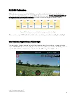
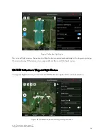
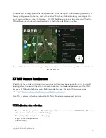
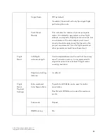
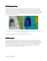
In the waypoint settings, you would need to add the action “Start point cloud modeling recording” at
the waypoint you want to start at, and add the action “Finish point cloud modeling recording” at the
point you would like to end at. In this case, if the IMU Calibration option is turned on, you’ll find the
IMU calibration section inserted automatically to the flight route (shown in yellow).
Figure: IMU calibration inserted to waypoint flight mission (Start point cloud modeling at Waypoint 1 and finish
at Waypoint 5)
3.3 RGB Camera Recalibration
When the L1 has regular colorization issues, such as multiple lines appearing in the point cloud with
ghosting effect, the user will need to recalibrate the internal and external parameters of the RGB
camera of L1 following the below steps. Before you start please check your firmware versions
referring to
Section 1. Supported Firmware and Software Versions
Note: This is a premium feature included in DJI Terra Pro and more advanced versions.
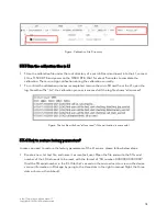
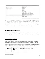
3.3.1 Calibration data collection
Create a 2D Mapping mission in DJI Pilot App and draw an area of around 200m*200m; The area
should have vertical structures like buildings;
Camera type: Zenmuse L1 - Lidar Mapping;
Flight Route Altitude: 100m;
Speed: 10m/s;

