Reviews:
No comments
Related manuals for ZENMUSE L1
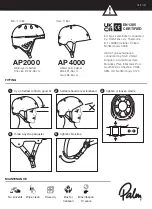
AP2000
Brand: Palm Pages: 14

Airo Walker
Brand: Toco Pages: 12

mydlink DSP-W110
Brand: D-Link Pages: 13

DCH-S161
Brand: D-Link Pages: 44

MR8003
Brand: CAME Pages: 4

VWZ MPS 40
Brand: Vaillant Pages: 80

XPAND 3D
Brand: Xpand Pages: 24

RF UTUNING KIT
Brand: Yaesu Pages: 2

FAZ3000-FB-2
Brand: Conrad Electronic Pages: 24

Atto Integral
Brand: kellermann Pages: 2

Inflatable Stand Up Paddle Board
Brand: Kings Adventure Pages: 3

i60
Brand: THIEYE Pages: 24

Whispbar K887W
Brand: Yakima Pages: 19

UCI-11C NTV-KIT331
Brand: Nav TV Pages: 4

PD1022Z3-EI
Brand: Siqura Pages: 2

THY-464-1
Brand: Doug Thorley Headers Pages: 5

IC-7000PT
Brand: Edimax Pages: 16

Optrel STAR
Brand: Sperian Pages: 22


