


ENGLISH
4
.
Map visualization Functions
4.1 How to consult the map
To pan manually on the map press the touchscreen with the stylus: the
map will be centered on the selected point.
4.2
Zoom in and Zoom out
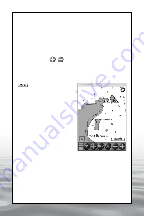
Zoom buttons
The zoom in and zoom out buttons allow to reduce or magnify the
map by shifting to a lower or higher scale map. The zoom centre is the
display’s center.
Map Scale
The Map scale icon is placed
at the bottom right corner of
the display (IMG 1). The unit of
measure can be changed in the
settings panel. To set the unit of
measure,click on the “Settings”
button, select the folder named
“Unit 1” and then choose the
desired unit for “Distance”:
Kilometres, Nautical Miles or
Statue Miles.
Click on OK to confirm your
choiceand to go back to the Map
visualization.
4.3 How to centre the map on
the boat
In order to centre the Map on your boat manually, click on the “HOME”
button on the bar menu; this button is activated only when GPS data is
received. It is also possible to activate the “auto-centre” function from
the settings menu so that when the GPS signal is received, the map is
automatically centred on the boat’s position. When activating any other
function, the auto-centre is temporarily deactivated.
It is possible to activate the “auto-centre”, function click on the “Settings”
button, select the first folder named “Map” and then mark the checkbox
to enable“auto-centre”. Click on OK to confirm your choice and to go
back to the map visualization.
IMG 1 - Zoom buttons and map scale
offered by www.Busse-Yachtshop.de email: [email protected]