A-3
Appendix
ProMARK X
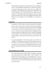
Receivers listen to signals from either three or four satellites at
a time. Three satellites are required for two-dimension position-
ing (which determines position only), and four satellites are
required for three-dimension positioning (to determine posi-
tion and elevation). The interval between the transmission and
reception of the satellite signal (range data) is used to calculate
the unit’s distance from each of the satellites being used. Those
distances are processed by the ProMARK X to compute a
position.
ACCURACY
In general, an SPS receiver can provide position information
with an error of less than 25 meters and velocity information
with an error of less than 5 meters per second. (The ProMARK
X is accurate to 15 meters.) Because the system is so accurate,
the U.S. Government has activated Selective Availability (SA) to
maintain optimum military effectiveness. Selective Availability
inserts random errors into the ephemeris information broadcast
by the satellites, which reduces the SPS accuracy to around 100
meters.
For many applications, 100-meter accuracy is more than ac-
ceptable. For applications that require much greater accuracy,
the effects of SA and environmentally produced errors can be
overcome by using a technique called Differential GPS (DGPS),
which increases overall accuracy. (DGPS is described in
Appen-
dix 2
.)
GPS INFORMATION SOURCES
The Civil GPS Information Center (GPSIC) in Virginia is operated
and maintained by the United States Coast Guard for the
Department of Transportation. It was established to accommo-
date the needs of the worldwide civil GPS user community, and
its primary function is to provide information and to serve as a
point of contact.
Содержание GPS PROMARK X
Страница 4: ......
Страница 10: ...vi...
Страница 14: ...Introduction ProMARK X 1 4...
Страница 92: ...Attributes ProMARK X 6 8...
Страница 188: ......


