


LX Zeus v 3.4.3
10.9.2014
- 14 -
2
nd
subpage is divided into map and 3D terrain
display or Artificial horizon (AHRS), if it is the part
of the system.
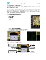
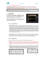
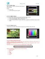
1.5.2.2.1 First navigation subpage
First navigation subpage is available after press on SUBP
button and this is valid for all three navigation modes. The
page is divided into two sections. Upper section is
reserved for vertical terrain profile,
the lower part shows
APT and TP data / circling log/ wind at different altitudes.
Subpage at TSK shows
task’s statistics by legs / circling
log / wind at different altitudes. Switching between lower
info can be done after press on 1-4 button.
Vertical terrain profile shows glider position regarding to
the terrain and the airspace. Final glide profile for MC 0
and actual MC is also visualized as a cone.
The terrain is shown in all 3 pages (TP, APT, TSK). The
profile of the terrain is chosen according to the terrain from
current position to selected TP, APT and through all TPs
on the TSK. The terrain mode also shows the airspaces in
a vertical profile with different colours. With Zoom knob
you can
adjust the scale
.
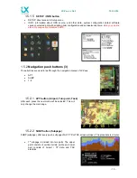
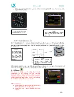
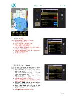
1.5.2.2.2 Second navigation subpage
This page shows 3D terrain data regarding to glider
present position. If the artificial horizon is integrated in the
Zeus, then the second navigation page will be an artificial
horizon (AHRS).