66
Staking a Road Alignment
General Guide to RoadPlus - 4.0.0en
∆∆∆∆∆
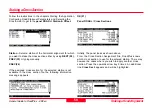
H from CL -
The vertical distance of the actual pole position
from the centre line.
∆
∆
∆
∆
∆
V from CL -
The vertical distance of the actual pole position
from the height of the centre line.
∆∆∆∆∆
V fmSlope -
The vertical distance of the actual pole position
above the slope. Only available once the reference point has
been stored.
Slope -
Slope value.
Slope Dist -
The slope distance of the actual pole position
from the hinge point. Once the reference point has been
found, this is the slope distance between the reference point
and the hinge point.
Elevation -
Height of the actual pole position.
According to the update rate, the individual values are
updated automatically. Note that the highest update rate in
this panel is 1 second even though the general update rate
might be set to a value < 1 second.
Either navigate to a point which is suitable as reference point
or until
∆
H and
∆
V from catch / hinge / centre line / slope
show required values. Place the antenna pole at the location.
Be sure that the antenna is levelled. If you decide not to stake
and store the reference point, press
CONT (F1).
It takes you
back to the
panel ROAD+ \ Catch Point.
Otherwise:
STORE (F3)
Panel Road+ \ Reference Point
Point ID -
Enter name under which the catch point will be
stored.
CONT (F1)
Panel Road+ \ Reference Point
CONT (F1)
Panel Road+ \ Catch Point
CONT (F1)
Panel Road+ \ Cross Sections


