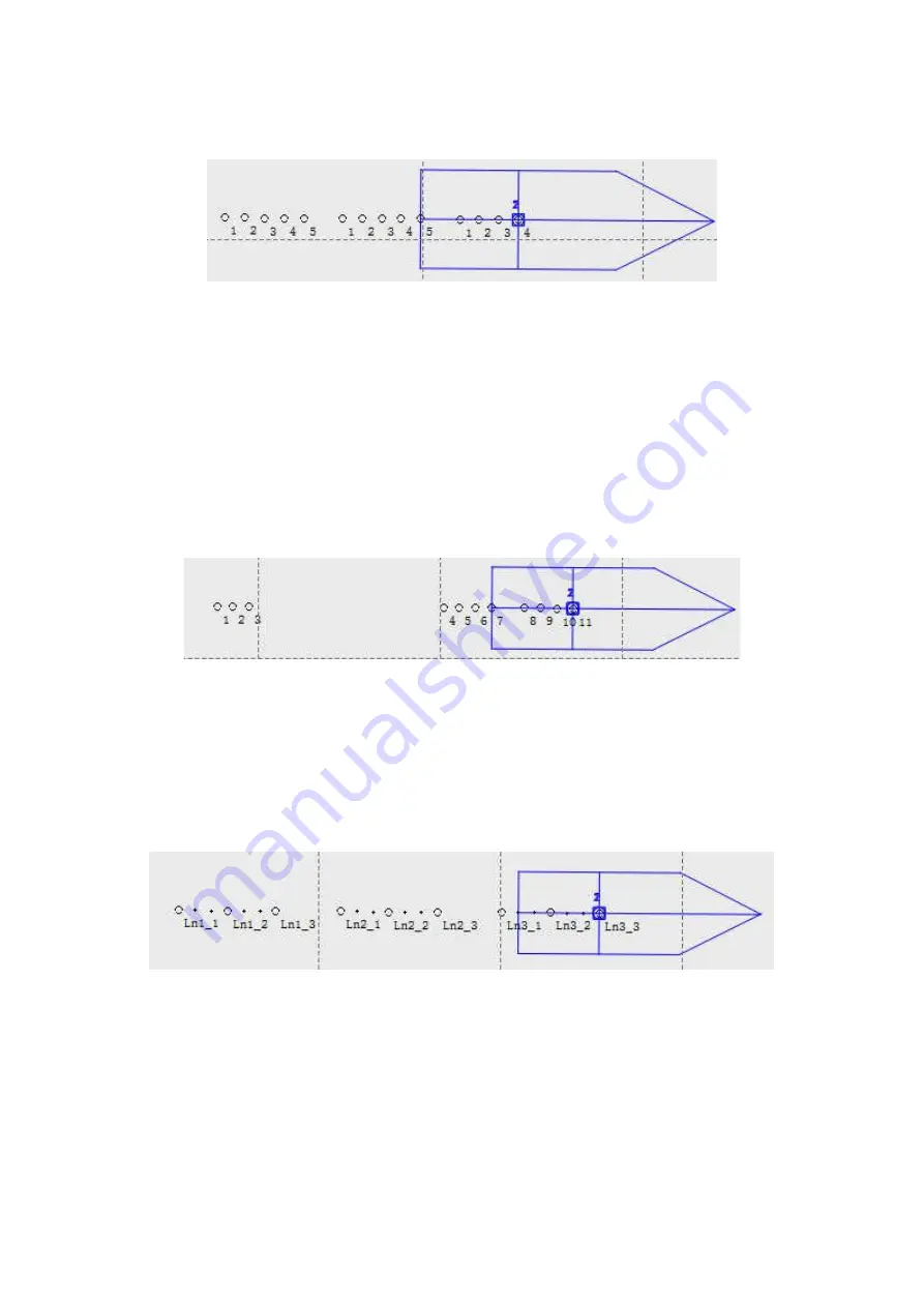
files measured, Ln1, Ln2 and Ln3.
Fig.3-49 Default naming
Continuous: Each time clicking on the measure button, the line number will increase by one, and
the point number in the file will increase according to the last point name. As shown in the figure
below, there are 3 files measured, Ln1, Ln2 and Ln3, in file Ln1, 3 points were measured and the
point number would be 1, 2, 3; then in file Ln2, there are 4 points and the point number starts
from 4, then increase to 5, 6,7; in file Ln3, 4 points were measured and the point number would
be 8, 9, 10, 11.
Fig.3-50 Continuous naming
Survey line+pt name: Each time clicking on the measure button, the line number will increase by
one, and the point name will increase by line point name, for example, as shown in the
figure below, there are 3 files, the point number is Ln1_1, Ln1_2, Ln1_3 in file Ln1, and Ln2_1,
Ln2_2, Ln2_3 in file Ln2.
Fig.3-51 Survey line + pt name
Data transmit
—It means that the software transfer the acquired GNSS data to the other port or
network server through the serial port or network, for the other software or devices use. Here
are 3 kinds of data source for transferring, GPS1 data, GPS2 data and custom string data. Which
data source needs to be transferred, check the enable box and click Setup button for further
settings.
Содержание SDE-28S
Страница 1: ...SDE 28S Digital Echo Sounder User Manual...


