7
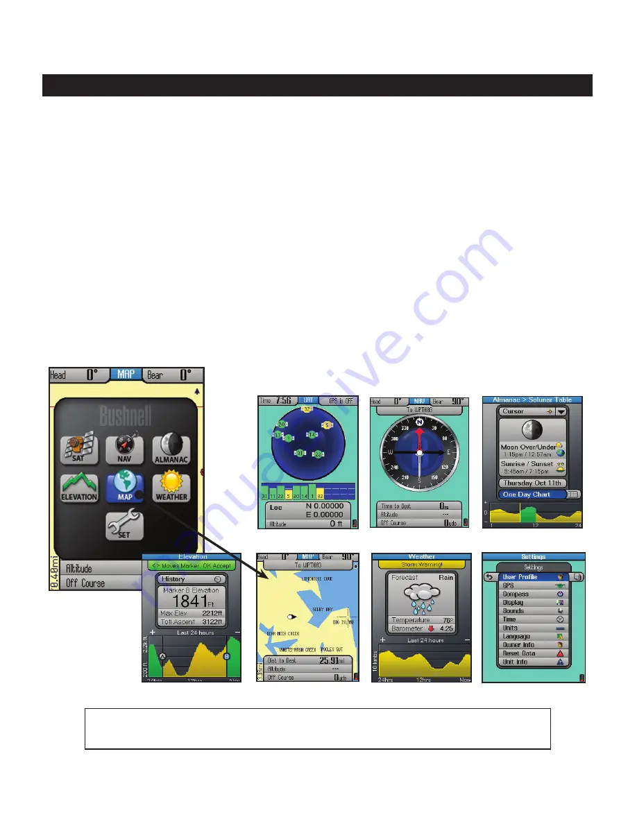
the seVen Pages of the oniX350
Press the MENU button briefly, use the 5-way keypad to select (highlight) a page
on the menu display, then press OK (center button) to view and use that page.
1. SAT
(Satellite) - this page allows you to monitor the signal strength of multiple GPS satellites, confirming
when you have a “lock”-adequate number and quality of satellites to ensure good reception.
2
. NAV
(Navigation) - a basic display of the digital compass. View your current heading and true or magnetic
north at any time by switching to this page.
3. ALMANAC
-
this page lets you view lunar and solar information for your chosen location, including
sunrise/sunset times and Solunar data graphs that can help predict the level of mammal and fish activity.
4. ELEVATION
-
your current altitude as well as a graph of changes in altitude over time as you travel on
a trail.
5. MAP
- you will likely spend the most time on the MAP page, since it shows your current location relative
to other objects and places. You can layer a compass, photos, and other navigation related items alone or in
combinations over the top of the base map, making it even more useful and informative.
6. WEATHER
-
Local temperature and barometric pressure data based on internal sensors, as well as a
weather forecast prediction and pressure graph derived from the sensor data, altitude, etc.
7. SET
(Setup) - go here to set your personal user preferences, enable XM satellite reception, setup a custom
user profile,
and other user adjustable operating utilities.
2. NAV Page
1. SAT Page
3. ALMANAC Page
Main MENU
7. SET Page
5. MAP Page
6. WEATHER Page
4. ELEVATION Page


