


29
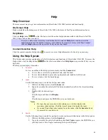
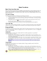
Basic Functions
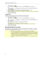
Basic Functions Overview
Map control in Street Atlas USA 2005 is accomplished by using standard mouse point-and-click functionality and
the Control Panel tools. Right-click options provide flexibility for labeling, routing, getting information, and so
forth. For more information, see other Basic Functions topics. If they are not currently displaying, double-click the
Basic Functions book.
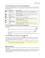
To Control the Map
The following list details the basic functions for controlling map movement.
•
The mouse is used to pan or center the map view. Click a spot on the map to center the map on that point.
•
A white hand displays when you point near the edge of the map. When the hand is visible, drag the map in
the desired direction.
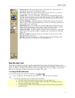
•
Use the black view box in the Overview Map window to pan the map. Point anywhere on the view box.
When the pointer becomes a
, drag the view box to the desired location.
•
The mouse button also allows you to quickly zoom the map using drag and zoom functionality.
To Use the Tabs
Click on a tab to view the available functionality. You can also use the keyboard arrow keys to browse through the
tab areas. If it is not possible to display all tabs, horizontal scroll arrows display to the right of the last visible tab.
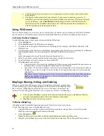
Drag and Zoom
One of the most convenient features of Street Atlas USA 2005 is the ability to quickly zoom in on the map by using
drag and zoom functionality. Zoom in by dragging the mouse in a down-right direction or zoom out by dragging the
mouse in an up-left direction.
To Zoom In
Zooming in increases the data zoom level number and shows a smaller geographic area at greater detail.
Use the following steps to zoom in.
1.
Drag the mouse in a down-right direction on the map to encompass the area you want to display. A view
box displays on the screen and changes dimension as you move the mouse. A label displays the data zoom
level at the current map center.
2.
Once you reach the desired area or data zoom level you want to display, release the mouse button. The area
you selected fills the map window, the map re-centers, and the map view adjusts to show the appropriate
level of detail.
Tip
: You can move the view box to another location by pressing the SHIFT key at anytime during this
procedure.
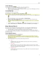
To Zoom Out
Zooming out decreases the data zoom level number and shows a larger geographic area at lesser detail. The
maximum zoom-out level is 2-0.
Use the following steps to zoom out.
1.
Drag the mouse in an up-left direction on the map. A staircase with a small circle displays on the screen.
2.
Continue dragging the mouse in an up-left direction. The small circle moves up the steps, one step per data
zoom level. A label displays the data zoom level to the bottom-right of the staircase.
3.
Once you reach the desired data zoom level you want to display, release the mouse button. The map view
adjusts to display the appropriate level of detail. The map center is retained on your screen.
Additional zoom features include the Data Zoom Level controls and the Zoom tools.
Содержание Street Atlas USA 2005
Страница 1: ...Street Atlas USA 2005 User Guide...
Страница 2: ......
Страница 10: ......
Страница 25: ...Getting Started with Street Atlas USA 2005 15...
Страница 38: ......
Страница 58: ......
Страница 74: ......
Страница 114: ......
Страница 124: ......
Страница 132: ......
Страница 138: ......
Страница 140: ......
Страница 142: ......


