MATRIX
®
430VF
JOB D
AT
A
CONFIGUR
ATION
INTR
ODUC
TION
CONSOLE
6
www.teejet.com
GUID
ANCE
Field View Navigation
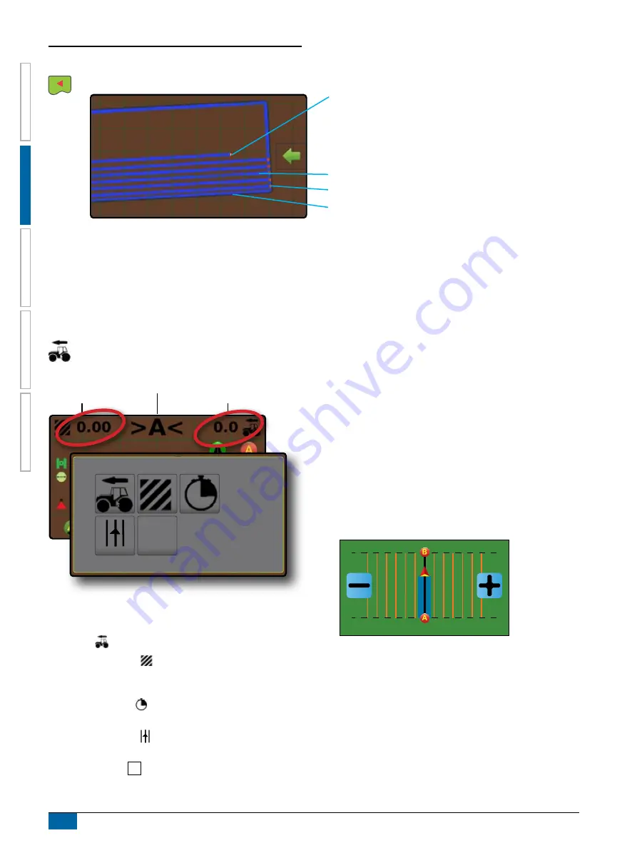
Field view guidance creates a computer-generated image of vehicle position and application area from an aerial perspective.
Painted Coverage Area
Overlap Coverage Area
Vehicle
Navigation and Guidance Options Tab
Boundary
On Screen Guidance
• Field Indicators:
W
Dark grey – boundary line
•
Coverage Area – illustrates applied area and overlap:
W
Blues – one application
W
Reds – two or more applications
• Points – markers for established points:
W
Red point – Return to point
W
Blue point – Mark A
W
Green point – Mark B
Guidance Bar
The guidance bar on the vehicle view guidance screen keeps you informed of your choice of selectable information (current
speed, total applied area, application time, cross track error) and navigation activity (guideline number, current activity and GNSS
status).
Navigation Activity
Selectable Information
Selectable Information
Selectable Information
1.
On vehicle view guidance screen, press current value and
select an information button:
X
Speed
– displays the current speed of travel
X
Total Applied Area – displays the total accumulated area
that has had application applied including double coverage
areas
X
Application Time – displays the total time application is
active during the current job
X
Cross Track Error – displays the distance from your
desired guideline
X
No Information – shows no information in the display area
Navigation Activity
X
GNSS Status – displays flashes “GPS” when GNSS is
unavailable
X
Current Activity – displays activities such as mark an A or B
point, distance to return to a marked point or when to turn or
mark the end of a swath path
X
Guideline Number – displays the current guideline number in
reference to the initial guidance line. Number will be shown
as a positive number when the vehicle is to the right of the AB
baseline or a negative number when the vehicle is to the left
of the AB baseline
1 2 3 4 5 6
-6 -5 -4 -3 -2 -1


