


© Satmap Systems Ltd
© Satmap Systems Ltd
71
17.00
OOI Menu:
Grids
17.00 Grids
Grids
consist of a group of square-shaped
AOIs in a large square/grid formation. They
allow you to overlay a square grid/table onto
the map. Grids are used to split an area into
searchable chunks. For example, search
and rescue teams can use grids for rescue
missions. Other examples of uses include
ornithology (bird watching), archaeology,
forestry, crime surveying, etc.
Each grid consists of 100 AOIs (or squares),
i.e. 10 across and 10 down. Each AOI is
300m x 300m. The grid follows a default
naming convention and individual AOIs can
be renamed individually
(section 17.05)
. As
you zoom into the map, the name of the AOI
appears in each square. Moving the locator
circle over individual squares shows the name
of the AOI in the top right-hand corner.
Rows are labeled AA, AB, AC, etc... and
columns are labeled 1, 2, 3, etc... so a square
or individual AOI can be referred to as “AA3”
or “AB2”.
(To avoid confusion with the number
1, the letter 'I' has been omitted).
You are able to change the color and pattern
of individual AOIs just like a regular AOI
(section 15.04e/15.04f)
. The grid appears on
the
PLANNING
screen once created. More
than one grid can be placed on the map.
Visibility can only be set for individual AOIs,
not for the entire grid.
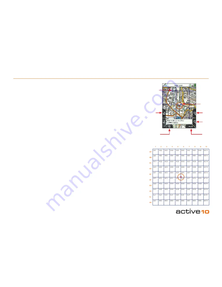
17.01 Add Grid Screen
(GPS MAP → MAIN MENU → OOI Menu →
Add Grid by Map)
To create a grid, select
Add Grid by Map
from the
OOI Menu
and press
Select
or
center press the joystick. This will take you to
the
Add Grid
screen where you will need to
set the center point of the grid
.
The orange locator circle has a red cross in
the center to indicate you are in edit mode
and on the
Add Grid
screen. Use the top
left '
+
' button or center press the joystick to
set the center point. This will take you to the
keypad to name your grid.
Note: The lower left 'x' button is not used on
this
screen
.
Buttons:
Add Grid (+)
Sets the center point of the grid
GPS Map
Return to
GPS MAP
screen
Zoom
Zoom in/out
Back
Go back to the
OOI Menu
Grid
(made
up of AOI
squares)
GPS Map
Add
Grid
(center
point)
Zoom
In
Locator
circle with
red cross
to indicate
edit mode
Zoom
Out
Back
Figure 17.01