Page
15
of
26
(
image of No GPS and alarm bell and note below)
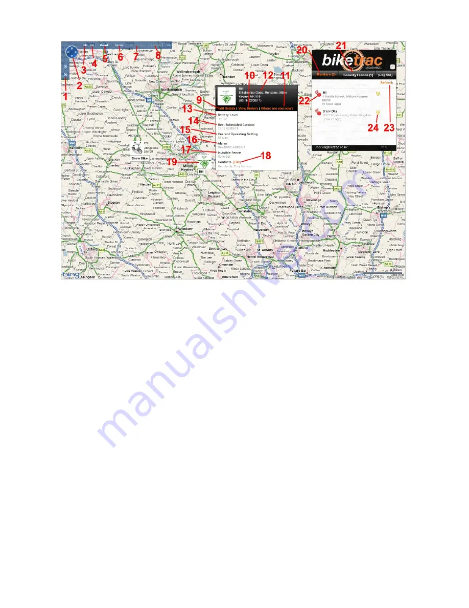
Overview of the Bike Trac portal (Please refer to Figure 1.0)
1.
Zoom in and out of map
2.
Allows to you ‘pan’ (move) the map in any direction
3.
Change the map to a 2 dimensional view
4.
Change the map to a 3 dimensional view (where available – Requires a Microsoft software download.
Simply click on ‘3D’ and this will start the download process)
5.
Change the map view to ‘Road’ view
6.
Change the map view to ‘Aerial’ (or satellite) view
7.
Change the map view to ‘Bird’s Eye view (not available in all areas)
8.
Add or remove road names and other labels that are overlaid on the map
9.
Allows you to edit the details of your bike on the system, as well as allowing you to change the method
by which you arm and disarm your Bike Trac unit (i.e. by movement or Geo-fence). This also allows the
user to edit the name of their bike (which is the name you use if you are arming and disarming your
Bike Trac unit(s) via text message,
if no ignition feed has been used),
and upload a picture icon to
represent their bike. You can also turn off features such as speed recording and Bike Down, and set
your low battery alert settings.
10.
Allows you to view your historic journeys for up to 3 months prior to the current date
11.
Allows you to refresh the location of your bike on the map. As the Bike Trac unit updates its position
only once every 4 hours if left in ‘armed’ mode (and it hasn’t moved), you may wish to refresh its
location for your peace of mind
12.
Displays the details of your bike and last known address (i.e. when Bike Trac last updated its location)
13.
Displays the charge level of the motorbikes battery


