


SHOUT ts User Guide Version B
Document Number: 451-92854-001B
46 of 62
7.5
M
AP
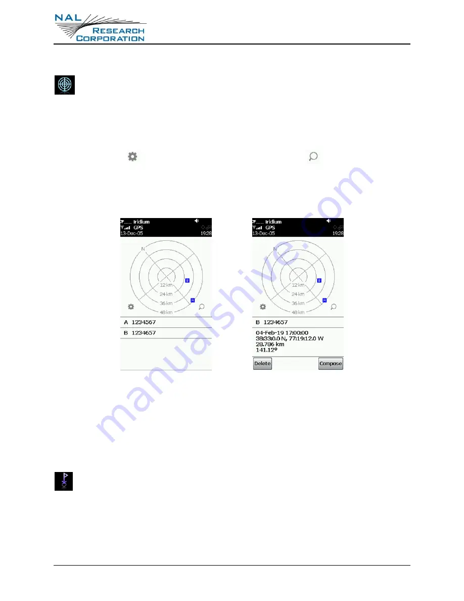
The
Map
screen allows you to view locations received from other trackers. The
locations are shown relative to your current position. Normally, north is aligned to
the top of the screen; however, if the device is able to accurately determine the heading,
the map rotates to orient to the direction of travel.
Below the map is a list of the points from the map with labels to match the letter shown on
the map. With the
icon, you can clear the map of points. The
icon allows you to
scale the zoom of the map, ranging from 40 m to 20 km. There is also a Best Fit zoom,
which scales the map to fit the points on the screen. The maximum zoom for this is limited
to 5,000 km.
Figure 23: Map
You can select a point from the list to view more detailed information. From there, delete
individual points by selecting pressing
Delete
. You can compose a message through the
Compose Screen
by selecting
Compose
. Pressing the back button reopens the list of points.
7.6
W
AYPTS
Use the Waypoints [
Waypts
] menu to acquire, view, save, delete, or send a waypoint
to a NOC. The SHOUT ts can save up to 1,000 waypoints in its circular memory.
SatTerm can be used to retrieve waypoints saved on the SHOUT ts.
A waypoint is a GPS location that you want to identify and mark with a specific name tag for
future reference.
1.
Select
New
. The SHOUT ts immediately turns the GPS receiver on to acquire a fix.