


SHOUT ts User Guide Version B
Document Number: 451-92854-001B
38 of 62
PMS features activated and can only be enabled by NAL Research at the request of an
authorized user. Functions related to PMS can be found in
6.3
L
INK
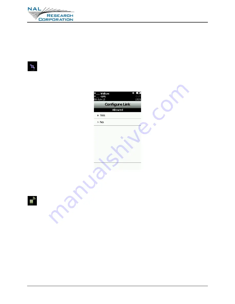
The SHOUT ts’ default setting is
Yes
to allow the Iridium link to be used to transmit
reports and messages. If the Iridium link is not allowed to be used (radio silence), set
the
Allowed
setting to
No
. If
Tracking
is on,
Data Logging
is on, and Iridium link is set to
No
,
tracking reports are saved in its circular memory.
Figure 18: Iridium Link Allowed
6.4
G
EOFENCES
In addition to “standard” tracking enabled through the
Rpt Rate
menu,
Geofences
is
another tracking option tailored for specific applications. Geofence tracking works
independently as a separate tracking mode or can be implemented along with standard
tracking. Setting geofence parameters is complex. NAL Research recommends the use of
both SatTerm and Google Maps®. You can also enter a sequence of latitude and longitude
pairs to define a fence using just SatTerm. Refer to the “SatTerm for SHOUT ts” manual [2].
A geofence is a set of connected latitude and longitude coordinates that defines a region or
zone of interest. A geofence must be bounded by a minimum of three coordinates and a
maximum of 50. Each fence has a unique tracking profile that triggers the SHOUT ts to
change its tracking behavior while inside a specific fence; e.g., it allows the SHOUT ts to
turn off the Iridium link for regions that require radio silence. A geofence can be configured
to send special arrival/departure reports upon entering and/or exiting the fence.