WayPoint Flight
With the
ARF-MikroKopter
and the MikroKopter-Tool WayPoints can be
set anywhere on the map and then flown automatically. Here now the
Bluetooth-Set is used.
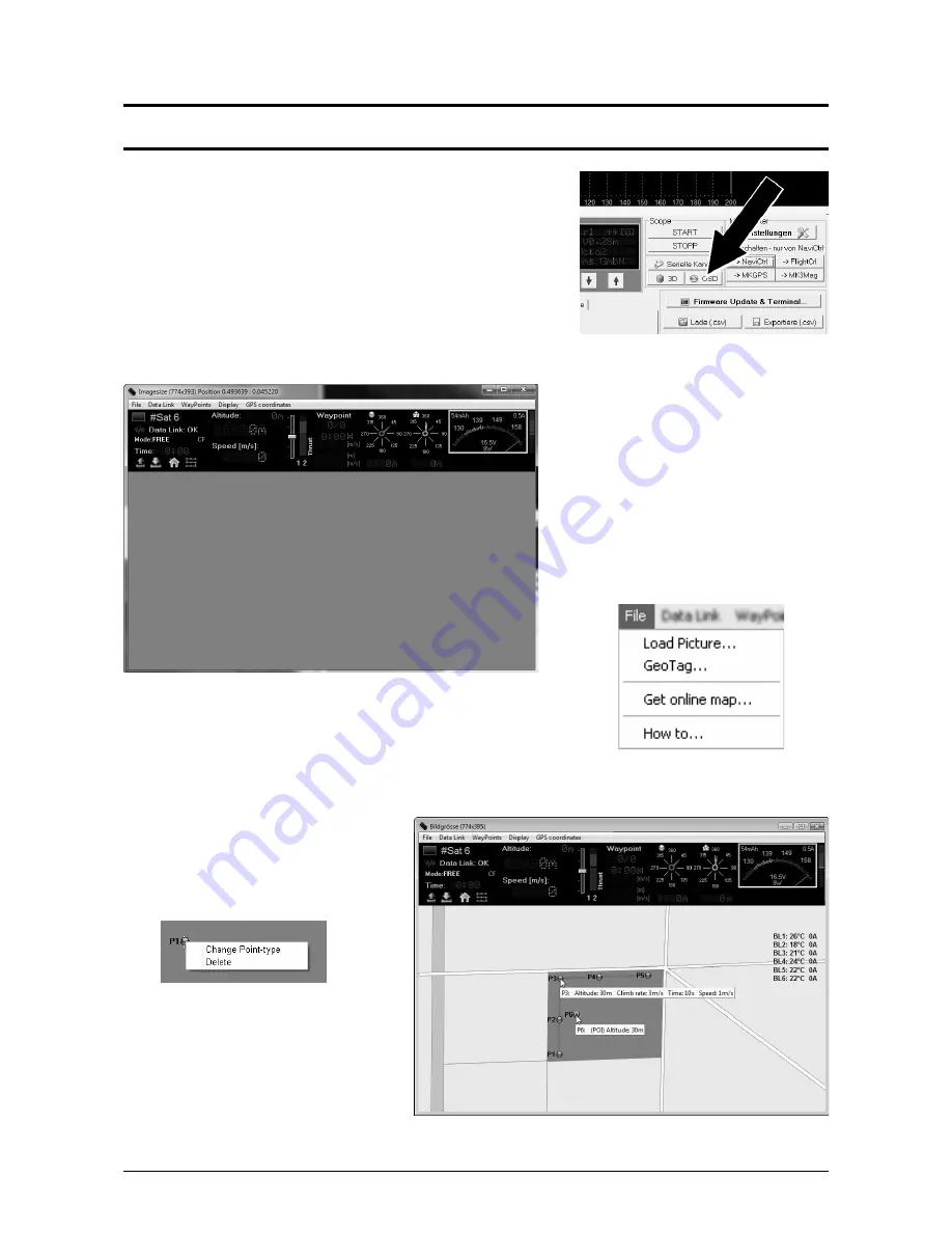
The WayPoint program can be opened after a „Click“ on the button „OSD“
in the KopterTool.
The WayPoint program „OSD“ opens:
Is the ARF-MikroKopter switched ON, all
telemetry data will be displayed via the
Bluetooth set in the upper field of the „OSD“ .
These will show battery voltage, number of
received satellites, set functions, height etc.
The field below in the „OSD“ is still empty.
Here a map of the flight field can be
displayed. That can be done with the „OSD“
via
File > Get map online ...
and be chosen and saved.
The saved map sections can be loaded into the WayPoint program via
Load image...
. You can store now Into this map
any WayPoint with a „right click“ of the mouse.
With a „Right click“ of the mouse on a
WayPoint in the map you can change that
WayPoint into a
Point of interest
(POI) .
In that way several WayPoints can be
changed into POI.
While the WayPoints are being flown the
camera can be focused on those POI.
Page 36 HiSystems GmbH
Summary of Contents for ARF OktoXL
Page 1: ...ARF MikroKopter OktoXL Instruction manual ...
Page 2: ......
Page 14: ...Final Assembly First Test Flight Page 10 HiSystems GmbH ...
Page 24: ...Settings Functions opt Accessories Maintenance Troubleshooting Page 20 HiSystems GmbH ...
Page 44: ...Transmitter assignment Graupner MX 20 Assignment Page 40 HiSystems GmbH ...
Page 45: ...Transmitter assignment Graupner MC 20 Assignment HiSystems GmbH Page 41 ...
Page 46: ...Transmitter assignment Graupner MC 32 Assignment Page 42 HiSystems GmbH ...


