


105
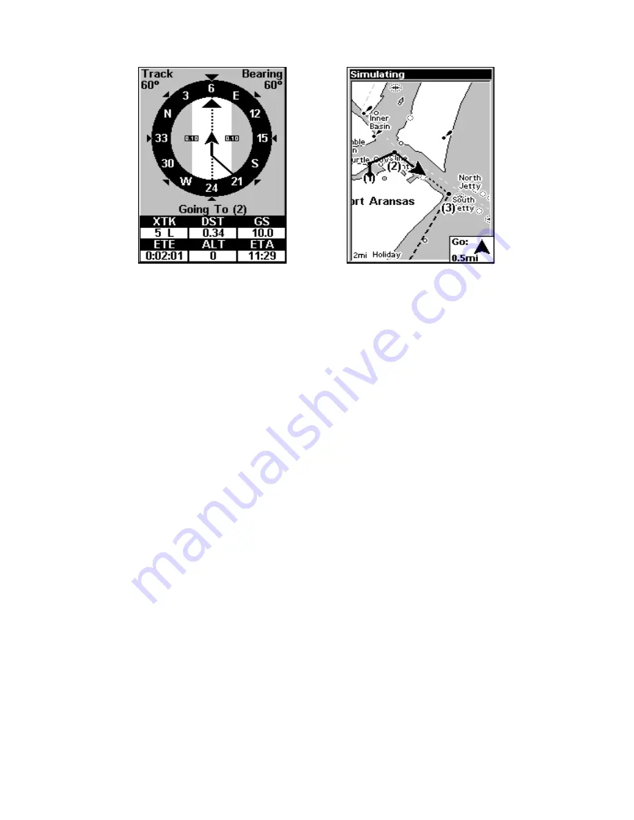
In Fig. 3 the traveler has turned northeast on his new course and is
heading straight for Wpt 2, which is 0.28 miles away. Fig. 4 shows route
navigation on the Map Page. In this figure, the traveler has reached Wpt
2 and is starting on the leg between Wpts 2 and 3.
Navigate a Route in Reverse
Here's how you run a route backward, from the end waypoint to the
beginning waypoint:
1. From the
N
AVIGATION
P
AGE
, press
MENU
|
ENT
or from the
M
AP
P
AGE
,
press
MENU
|
MENU
|
↓
to
R
OUTE
P
LANNING
|
ENT
.
2. Press
↓
to select
route name
|
ENT
|
→
to
R
EVERSE
R
OUTE
|
ENT
|
←
to
N
AVIGATE
R
OUTE
|
ENT
.
3. Upon arrival at your destination, cancel navigation:
press
MENU
|
MENU
|
↓
to
C
ANCEL
N
AVIGATION
|
ENT
|
←
to Y
ES
|
ENT
.
Trails
Delete a Trail
This is the command used to erase or delete a trail:
Press
MENU
|
MENU
|
↓
to
M
Y
T
RAILS
|
ENT
|
↓
to
trail name
|
ENT|
↓
to
D
ELETE
T
RAIL
|
ENT
|
←
to
Y
ES
|
ENT
.
Tip:
You can also delete all trails at once:
1. Press
MENU
|
MENU
|
↓
to
M
Y
T
RAILS
|
ENT
.
2. Press
→
to
D
ELETE
A
LL
|
ENT
|
←
to
Y
ES
|
ENT
.
Edit a Trail Name
To edit a trail name: press
MENU
|
MENU
|
↓
to
M
Y
T
RAILS
|
ENT
|
↓
to
trail
name
|
ENT|ENT
. Press
↑
or
↓
to change the first character, then press
→
Figure 4.
Figure 3.
Summary of Contents for M56 S/Map
Page 48: ...42 Notes ...
Page 74: ...68 Notes ...
Page 78: ...72 Notes ...
Page 138: ...132 Notes ...
Page 154: ...148 Notes ...
Page 157: ...151 Notes ...
Page 158: ...152 Notes ...


