50
Moving Around the Map: Zoom & Cursor Arrow Keys
The map is presented from a bird's-eye view perspective. The current
zoom range shows in the lower left corner of the screen. If the zoom
range says "4 mi," the map shows an area 4 nautical miles wide from
the left edge of the screen to the right edge of the screen.
1. Press the
ZIN
key (zoom in) to move in closer and see greater detail in
a smaller geographic area.
2. Press the
ZOUT
key (zoom out) to move farther away and see less map
detail, but a larger geographic area.
You can pan or scroll the map northward, southward, eastward or
westward by using the arrow keys, which launches the cross-hair map
cursor. To clear the cursor, press
EXIT
, which jumps the map back to
the current position or the last known position.
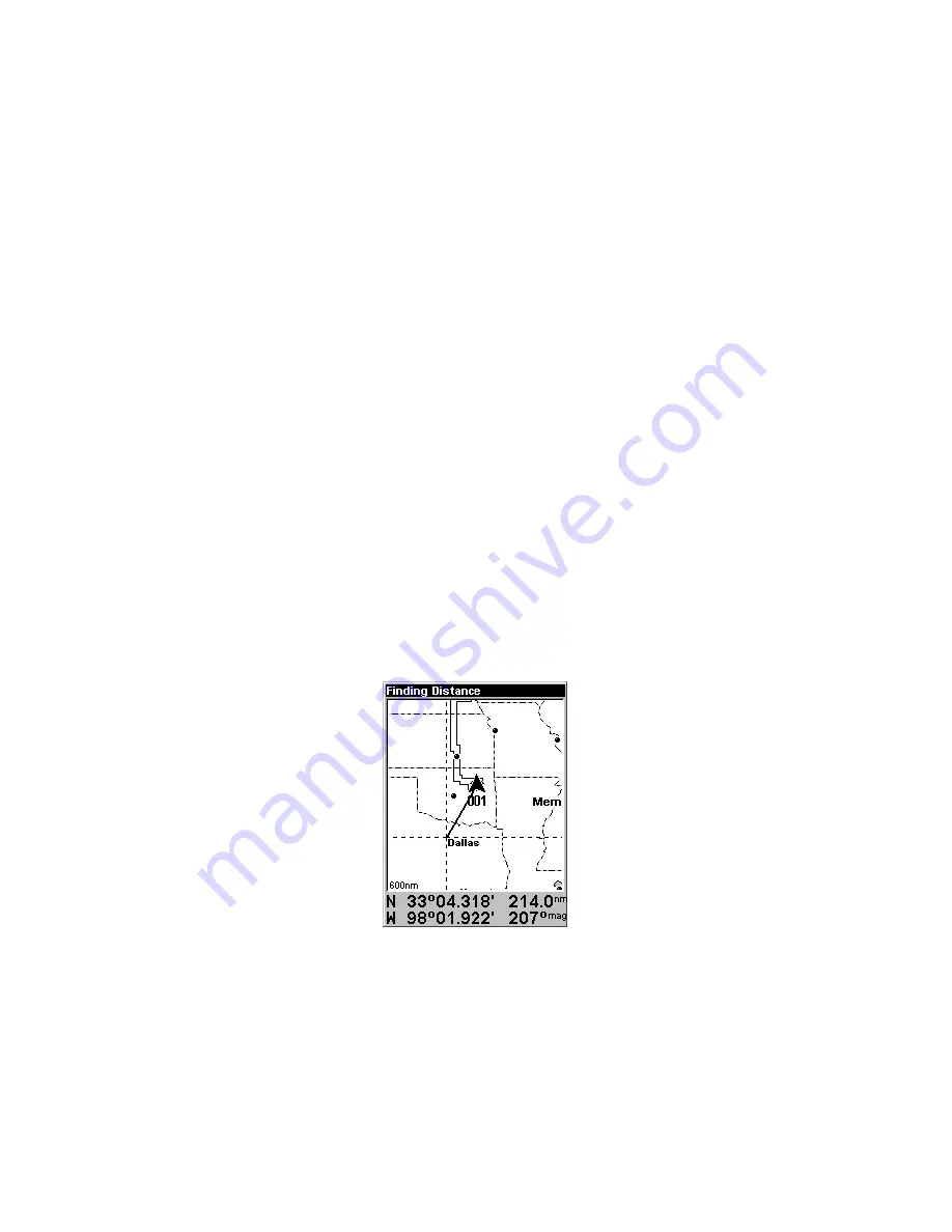
Find Distance From Current
Position To Another Location
1. While on the Map page press:
MENU
|
↓
to
F
IND
D
ISTANCE
|
ENT
.
2. Center your cursor over the position you want to find the distance to.
A rubber band line appears, connecting your current position to the
cursor's location. The distance along that line will appear in the lower
left-hand corner of the screen.
3. Press
EXIT
to return to regular operation.
The distance to Dallas from the starting point is 214.0 nautical miles.
Find Distance From Point to Point
You can also measure distance between two other points on the map.
1. While on the Map page press:
MENU
|
↓
to
F
IND
D
ISTANCE
|
ENT
.
2. Center your cursor over the first position. (A rubber band line ap-
pears, connecting your
current
position to the cursor's location.) Press
ENT
to set the first point, and the rubber band line disappears.
Summary of Contents for AirMap 500
Page 1: ...AirMap 500 Handheld Mapping GPS Receiver Operation Instructions...
Page 72: ...66 Notes...
Page 116: ...110 Notes...
Page 122: ...116 Notes...
Page 126: ...120 Notes...
Page 132: ...Visit our web site Copyright 2003 All Rights Reserved Printed in USA Lowrance Electronics Inc...


