The GPS 150XL’s map page is designed to be a flexible tool that can be custom-
tailored to your navigation needs. The
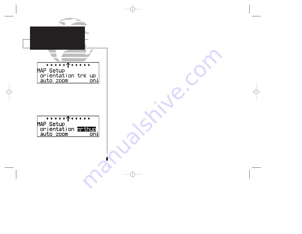
map setup page
provides access to many of
the features and functions that will help you configure the map page to your own
preferences. From the map setup page you can set the map orientation, automatic
zoom, and specify which waypoints and airspace boundaries you wish to display.
The map orientation setting allows you to orient the top of the map display to
your current ground track (‘trk up’), fix the top of the map to north like a paper chart
(‘nrth up’) or set the top of the map along your desired track (‘dtk up’).
To change the map orientation:
1. Press and hold
M
, then rotate
O
to select the ‘MAP Setup’ page.
2. Press
C
to highlight the orientation field.
3. Rotate
K
to select ‘trk up’, ‘dtk up’ or ‘nrth up’.
The automatic zoom feature will automatically adjust the map display scale dur-
ing your flight. Starting at an en route scale of 300 (nautical miles, statute miles or
kilometers) the scale will adjust through each lower scale, stopping at a scale of 1 as
you approach your destination waypoint.
To turn the automatic zoom feature on or off:
1. Press and hold
M
, then rotate
O
to select the ‘MAP Setup’ page.
2. Press
C
and rotate
O
to highlight the ‘auto zoom’ field.
3. Rotate
K
to select ‘on’ or ‘off’.
70
The map orientation may be set to north up, track
up or desired track up. This determines what
direction the top of the map display is oriented to.
Map setup page
SECTION
5
UNIT SETTINGS
Map Page Setup
150xl manual B 8/4/98 1:10 PM Page 70


