


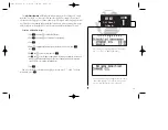


Winds aloft page
SECTION
1
NAV KEY
Winds Aloft &
VNAV Functions
Vertical navigation page
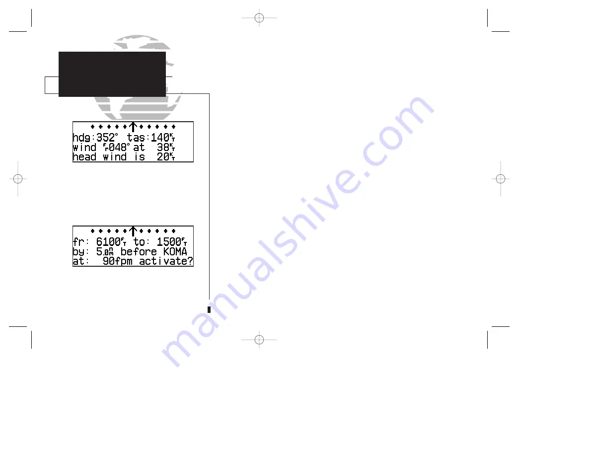
The GPS 150XL’s
winds aloft function
is used to calculate the true direction and
speed of the any winds, and indicates whether you are flying with a head wind or tail
wind, and the wind speed.
To calculate winds aloft:
1. Press
N
and rotate
O
until NAV Menu 1 is displayed.
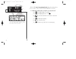
2. Press
C
and rotate
O
until ‘Winds?’ is highlighted. Press
E
.
3. Use
K
and
O
to enter your present heading in the ‘hdg:’ field. If your installation
includes a fuel/air data computer, this will be displayed automatically. Press
E
.
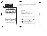
4. Use
K
and
O
to enter your true airspeed (TAS) in the ‘tas:’ field. If you have previously
calculated it using the density altitude/true air speed function, it will be displayed as the
default. Press
E
. The wind direction and speed and head/tail wind will be displayed.
The
VNAV function
calculates vertical speed requirements to reach a desired altitude before
or after a specified distance from a waypoint. This is helpful when you’d like to descend to a cer-
tain altitude near an airport or climb to an altitude before reaching a route or direct-to waypoint.
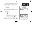
To calculate vertical navigation parameters:
1. Press
N
and rotate
O
until NAV Menu 1 is displayed.
2. Press
C
and rotate
O
until ‘Vnav Plan?’ is highlighted. Press
E
.
3. Use
K
and
O
to enter the initial (from) altitude. Your current GPS altitude will be dis-
played as the default. Press
E
.
4. Use
K
and
O
to enter the desired final (to) altitude. Press
E
.
5. Use
K
and
O
to enter the distance from the waypoint. Press
E
.
6. Use
K
to select ‘before’ or ‘after’ the waypoint. Press
E
.
7. Use
K
and
O
to select the waypoint identifier (it must be a waypoint in the active route
or a direct-to waypoint). Press
E
.
24
150xl manual B 8/4/98 1:09 PM Page 24