


Installation and Operation Manual
45
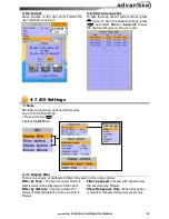
4-2 Chart Settings
To go to the chart settings:
1 Press and hold
.
2 Select the chart icon.
4-2-1 Rotation
Three types of display presentations are
provided. The default is heading up.
North up:
North is at the top of the display.
Heading up:
When course is set, the course
is at the top of screen all the times.
Course up:
When destination is set it is at
the top of the screen. This option is only
available when you are navigating to a
destination.
4-2-2 Palette
Palettes are used to enhance the visibility of
the display depending on the surrounding
light environments. Four types of displays are
provided; Normal, NOAA, Sunlight and Night.
4-2-3 General
Plotter mode:
this mode allows you to
zoom in and out at scales where cartographic
data are not available.
Mixing levels:
when the map coverage at
the current chart scale does not fill the entire
display, the GPS chart plotter draws the rest
of map using charts from above and below
the current scale. When this function is
turned on you will notice the display may
redraw 2 to 3 times to show all the detail.
AntiClutter:
when this option is selected,
less important information (names & icons)
are hiden when they are overlapped.
Value added data:
The Value Added
Data(VAD) is a collection of additional
cartographic objects which are not present on
the original paper chart. These objects have
been obtained from other sources and then
merged to the electronic charts in order to
provide more information useful for the
navigation.
Lat/Lon Grid:
Turns the displaying of the
latitude and longitude grid lines on or off on
the chart window.
Boundaries:
Turns the displaying of chart
boundaries on, off or auto mode which shows
the chart boundaries of the two charts below
the current scale.
Text/Icon Size:
change the size of text and
icon on the chart.
Names:
Display area names in the chart.
Nav-aids & Light Sector:
Turns the
presentation of Light, Signals, Buoys and
Beacons On, Off, No Sector (Nav-Aids are
shown, Light Sectors are hidden) or Animated
(The lights are flashed).
Nav-aids:
The way to display fog, radar and
radio station signals. (International and US)
Attention areas:
Turns the displaying of
Attention Areas where need to pay attention
more) On or Off.
Projected course:
Display the Projected
course in given set time.


