Version 15.0
AF-5000 Series Pilot Guide
48
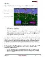
Flight Phase
LNAV:
L/VNAV:
LNAV+V:
LP:
LPV:
APR
:
TRM
:
ENR
:
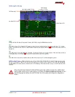
GPS Navigation Display
CRS (Course)
Vertical Deviation/Glide Path
Indicator
Full Scale CDI
TO/FROM
CDI Needle
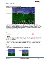
Vertical Deviation/Glide Path Indicator
The Glide Path Indicator (GPI) can be displayed from a WAAS GPS and is analogous to the glideslope for GPS
approaches supporting WAAS vertical guidance (LNAV+V,L/VNV, LPV)
NOTE:
Requires an IFD440, IFD540, GTN-650/750, GNS-430W/530W, along with an ARINC adaptor module.
CRS
(Course)
The Magenta GPS course indicator points to the current course selected on the GPS.
CDI
(Course Deviation Indicator)
The GPS CDI scale should be automatically set by the remote WAAS radio using the ARINC data line:
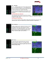
TRK
(Track)
The current GPS track over the ground is displayed on the HSI by a Magenta triangle. If there is a crosswind it will be
different than indicated magnetic heading.
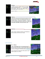
BTW
(Bearing to Active)
BTW displays the direct bearing to the active GPS waypoint and will be displayed on the HSI as a yellow line with two
arrows. When flying directly to the waypoint on the GPS Course, the BTW needle will be under the Magenta needle.
DTW
(Distance to Waypoint)
DTW displays the nautical miles to the current GPS waypoint.
WPID
(Waypoint Identifier)
WPID displays the current waypoint ID from the GPS.
Summary of Contents for AF-5400
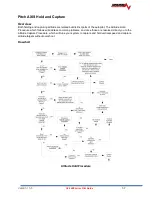
Page 58: ...Version 15 0 AF 5000 Series Pilot Guide 58 Flowchart Pitch Axis IAS Hold Procedure...
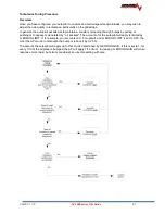
Page 60: ...Version 15 0 AF 5000 Series Pilot Guide 60 Altitude Capture Procedure Part 1 of 2 Part 2 of 2...
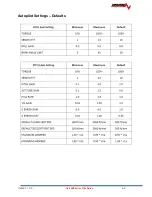
Page 62: ...Version 15 0 AF 5000 Series Pilot Guide 62 Autopilot Settings Defaults...
Page 73: ...Version 15 0 AF 5000 Series Pilot Guide 73 FREQ Tab RCNT Tab...
Page 88: ...Version 15 0 AF 5000 Series Pilot Guide 88 VFR Sectional Full Screen Mode Split Screen Mode...
Page 89: ...Version 15 0 AF 5000 Series Pilot Guide 89 IFR Low Altitude Chart Airport Diagrams...

