Copyright(C)2012ZeroUAV
All Rights Reserved
26
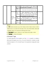
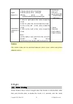
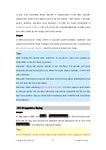
"Height", "Hovering time","Speed" and other key parameters, so must make
sure that click each waypoint with finger to select "edit waypoint" and correctly
setup.
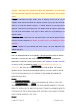
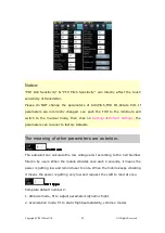
"Height"
"Height"
"Height"
"Height"
indicates the point where craft is staying, which can be set as
negative value below zero(when the takeoff position is too high and the craft
need to fly under the takeoff position). If height between two waypoints are
different ,craft will fly as climbing slop. The default value of height is 9999, that
is to say since the altitude is too high to reach, craft will fly according to the
present height.
"Hovering
"Hovering
"Hovering
"Hovering time"
time"
time"
time"
means the time that craft stays in the present position before
going to the next waypoint
(the default hovering time in first waypoint is 65535
seconds ).
"Speed"
"Speed"
"Speed"
"Speed"
means the flying speed that craft flies to the next waypoint from
present position.
Step2:
Step2:
Step2:
Step2:
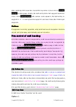
After the waypoints design is completed, it can be saved as file which can be
used next time. User can also click on
"Upload Waypoints"
to upload the
waypoints to Autopilot. Please check whether
each waypoint has been changed
to blue
to confirm a successful upload
(orange indicates the upload is not
successful),
and then get into
"Target Point"
to check whether the number
displays there is the same as uploaded waypoints, if not you need to upload
once more;If any waypoint is not changed to blue, please also upload the
waypoints once more.
Step3:
Step3:
Step3:
Step3:
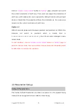
Click
“Remove Waypoints”
to make the blue waypoints recover to red; then
Select
“Verify waypoint”
from
“Tool”,
d
ownload uploaded waypoints to ground
Station for comparing, if all waypoints are blue it means the uploaded waypoints
is the same with that in GCS and waypoints verification is successful. Otherwise
need to upload waypoints once more.
Step4:
Step4:
Step4:
Step4:
Содержание YS-X6
Страница 60: ...Copyright C 2012ZeroUAV All Rights Reserved 60...

