Rand McNally Foris
TM
User Manual
26
11.2 Detailed view of a track
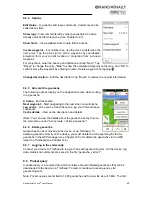
To select an existing track, tap it the list and then tap "OK."
Info
- Displays all the information about the track.
Map
- Displays the track on the map. You can zoom in and out and
move the map. Tap "Position" to show or hide your current position on
the map.
Altitude profile
- Displays the altitude profile for the track.
OK
- Starts the track navigation.
Modify
– Makes changes to the track.
11.3 Modify track
Invert track
– Reverses the direction of travel of the track—useful
when trying to find your way back to your starting point.
Edit name
– Changes the name of the track.
Delete track
– Deletes the track.
11. 4 Start track
Choose to start the track directly or convert it into a route in order to
obtain turn-by-turn directions.
11.4.1 TrackNav (Convert track to route)
The Convert track to route function calculates a route as similar as
possible to the original track. The route includes turn-by-turn
directions and displays the arrival time and the real distance.
Both the original track and the calculated route display on the map.
Choose "Route" to obtain turn-by-turn directions. Choose "Track" to
start guidance without turn-by-turn directions.
Choose whether to be guided to the starting point of the track or to the
nearest point along the track.
Note: If road segments do not exist in the map material or sections of
road are avoided by the route options, the alternative route will make
an appropriate detour. The calculated alternative route will be
compared with the original track so that you can choose which version
of the route you prefer.
11.4.2 Start track directly
"Start track guidance directly" starts the track without any changes.
Directional instructions are given on the map view, but no spoken
instructions relating to turns or distances.
Choose whether to be guided to the starting point of the track or to the
nearest point along the track.
Содержание Foris 850
Страница 1: ...User Manual ...


