


User Guide v6.7.7GOV – © Parrot, April 29, 2022
29
C
OORDINATES AND ADVANCED
RTH
SETTINGS
ANAFI USA
features a fly-by-coordinates function which allows you to instantly display,
reuse and share any coordinates in the surroundings of your drone – or indeed the GPS
position of your drone itself. This is especially useful to precisely locate any point of interest
or person
ANAFI USA
has detected.
This section explains how to access coordinates on the FreeFlight 6 app map, in flight or to
prepare a flight – same simple procedure.
It then presents the advanced RTH function of the drone, and notably the custom RTH option,
which relies on managing coordinates.
Managing coordinates
By default, coordinates are displayed on the FreeFlight 6 app map. They can be set as
latitude and longitude (LATLNG: default value), MGRS (Military Grid Reference System: NATO’s
geocoordinate standard), UTM (Universal Transverse Mercator), or DMS (degree, minute,
second – of arc). Refer to the
“PREFERENCES – Interface – Coordinates system setting”
section of this guide for information on selecting a coordinates system.
In the following example, coordinates system is set on DMS. The drone is offline and the
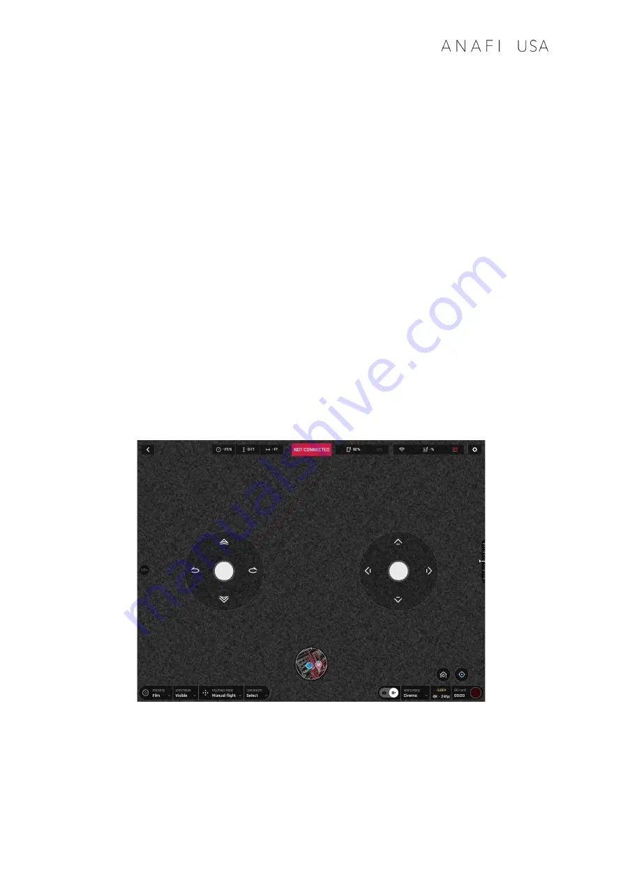
Parrot Skycontroller USA is connected to local Wi-Fi.
Offline FreeFlight 6 interface: tap minimap to open full screen
Tap “FLY” from the FreeFlight 6 homepage.
Tap the minimap on the bottom center of the offline interface to access the full
screen map.
Содержание ANAFI USA
Страница 1: ...n ...
Страница 2: ......
Страница 26: ...26 Wi Fi link is perfect Wi Fi link is good ...
Страница 66: ...66 x5 3 Zoom x32 Zoom ...
Страница 82: ...82 Same image hot Spot mode ...


