background image

B-4

Revision 6  Feb/2009

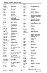
Common Weather Abbreviations

KMD 550/850 FIS Addendum

Appendix B

secondary location 
not available

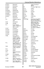
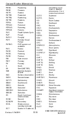
CHOP

Turbulence type 
characterized by 
rapid, rhythmic jolts

CHSPK Chesapeake
CI Cirrus
CIG

Ceiling

CIGS Ceilings
CIN

Convective inhibition

CLD Cloud
CLDNS Cloudiness
CLDS Clouds
CLKWS Clockwise
CLR Clear
CLRG Clearing
CLRS Clears
CMPLX Complex
CNCL Cancel
CNCLD Canceled
CNCLG Canceling
CNCLS Cancels
CNDN Canadian
CNTR Center
CNTRD Centered
CNTRLN Centerline
CNTRS Centers
CNTRL Central
CNTY County
CNTYS Counties
CNVG Converge
CNVGG Converging
CNVGNC Convergence
CNVTN Convection
CNVTV Convective
CNVTVLY Convectively
CONFDC Confidence
CO Colorado
COMPAR Compare
COMPARG Comparing
COMPARD Compared
COMPARS Compares

COMPR Compare
COMPRG Comparing
COMPRD Compared
COMPRS Compares
COND Condition
CONS

Continuous

CONT Continue
CONTD Continued
CONTLY Continually
CONTG Continuing
CONTRAILS Condensation 

trails

CONTS Continues
CONTDVD Continental 

Divide

CONUS Continental 

U.S.

COORD Coordinate
COR Correction
CPBL Capable
CPC

Climate Prediction 
Center

CRC Circle
CRCLC Circulate
CRCLN Circulation
CRLC Circulate
CRLN Circulation
CRNR Corner
CRNRS Corners
CRS Course
CS Cirrostratus
CSDR Consider
CSDRBL Considerable
CST Coast
CSTL Coastal
CT Connecticut
CTC

Contact

CTGY Category
CTSKLS Catskills
CU Cumulus
CUFRA Cumulus 

fractus

CVR Cover
CVRD Covered
CVRG Covering

Содержание Bendix/King KMD 550

Страница 1: ...N Revision 6 Feb 2009 006 18237 0000 Multi Function Display KMD 550 850 FlightInformationServices FIS Pilot s Guide Addendum B For Software Version 02 02 and later ...

Страница 2: ...any portion thereof by any means without the express written permission of Honeywell International Inc is prohibited For further information contact the Manager Technical Publications Honeywell One Technology Center 23500 West 105th Street Olathe Kansas 66061 Telephone 913 782 0400 The information contained in this manual is for reference use only If any information contained herein conflicts with...

Страница 3: ...light Information Services FIS Pilot s Guide Addendum Revision 6 February 2009 Part Number 006 18237 0000 Summary Added XM products Precipitation Type at Surface Freezing Levels Winds Aloft Translated Metars Temporary Flight Restrictions TFR s ...

Страница 4: ...R 2 Revision History Manual KMD 550 850 Flight Information Services FIS Pilot s Guide Addendum Revision 5 March 2007 Part Number 006 18237 0000 Summary Added XM Receiver functionality ...

Страница 5: ...tches MODE Softkey now displays product selection menu on FIS product displays Control Knob now allows cycling through graphical FIS products Airport icons and identifiers are now displayed on FIS graphical prod uct map displays per setting on Map Setup Page 2 Added VOR icons and identifiers to FIS graphical product map dis plays except graphical METARs per setting on Map Setup Page 2 Extended Tra...

Страница 6: ...50 Flight Information Services FIS Pilot s Guide Addendum Revision 3 June 2004 Part Number 006 18237 0000 Summary METARs and SPECIs now expire after 120 minutes Graphical METAR LIFR now displayed as magenta color Miscellaneous corrections ...

Страница 7: ...ces FIS Pilot s Guide Addendum Revision 2 November 2002 Part Number 006 18237 0000 Summary Added FIS subscription management Changed FIS Text Page format Changed FIS METARs time out Airports now shown on NEXRAD Page Changed FIS Network Page Miscellaneous corrections ...

Страница 8: ...R 6 Revision History Manual KMD 550 850 Flight Information Services FIS Pilot s Guide Addendum Revision 1 May 2002 Part Number 006 18237 0000 Summary Complete manual revision ...

Страница 9: ...evision History Manual KMD 550 850 Flight Information Services FIS Pilot s Guide Addendum Revision 0 November 2001 Part Number 006 18237 0000 Summary This is the original release of this publication R 7 ...

Страница 10: ...E ADDED SERVICE WEATHER PRODUCTS 12 NEXRAD 12 NEXRAD Abnormalities 13 NEXRAD Limitations 14 Intensity 15 PRECIPITATION TYPE AT SURFACE 16 FREEZING LEVELS 17 WINDS ALOFT 19 GRAPHICAL METAR 22 GRAPHICAL AIRMET 23 GRAPHICAL SIGMET 23 GRAPHICAL CONVECTIVE SIGMET 24 GRAPHICAL ALERT WEATHER WATCHES VDL ONLY 24 STARTUP 25 SUBSCRIPTIONS 25 VDL SUBSCRIPTIONS 25 Setting Up a VDL Subscription 27 Checking FIS...

Страница 11: ...e 51 GRAPHICAL SIGMETS PAGE 54 Graphical SIGMETs Page Operational Controls 54 Selecting And Using The Graphical SIGMETs Page 55 GRAPHICAL CONVECTIVE SIGMETS PAGE 58 Graphical Convective SIGMETs Page Operational Controls 59 Selecting And Using The Graphical Convective SIGMETs Page 59 GRAPHICAL ALERT WEATHER WATCHES PAGE AWW VDL ONLY 62 Graphical Alert Weather Watches Page Operational Controls 63 Se...

Страница 12: ...BSCRIPTIONS ARE CLOSE TO EXPIRING PLEASE REVIEW YOUR SUBSCRIPTIONS VDL ONLY 82 FIS ALERT ONE OR MORE FIS SUBSCRIPTIONS HAVE EXPIRED PLEASE REVIEW YOUR SUBSCRIPTIONS VDL ONLY 82 FIS ALERT DATA CARD UPDATE REQUIRED FOR CONTINUED RECEPTION OF FIS DATA VDL ONLY 83 FIS ALERT NEW DATA CARD NOT YET VALID UNABLE TO RECEIVE FIS DATA VDL ONLY 83 FIS ALERT DATA CARD HAS EXPIRED UNABLE TO RECEIVE FIS DATA VDL...

Страница 13: ...iv Revision 6 Feb 2009 KMD 550 850 FIS Addendum Table of Contents Intentionally left blank ...

Страница 14: ...f ferent systems are available for delivery of the weather data a ground based VHF Data Link VDL network and Baron WxWorx weather deliv ered via the XM Radio satellite system Data acquired from FAA approved weather sources is processed and then distributed to VDL Ground Stations and to the XM satellite network The Ground Stations broadcast the information over a VHF Data Link VDL to aircraft withi...

Страница 15: ...on shows how altitude influ ences FIS VDL coverage The following diagram illustrates how XM Wx data is received in the air craft The XM Satellite Radio weather system provides continuous coverage down to ground level over the entire continental United States A good view of the southern horizon must be available in order to receive at least one of the two satellites To receive FIS or XM WX products...

Страница 16: ...nd relative age and availability of the data that can be experienced weather data cannot be viewed as an absolute depiction of conditions at a specific location Introduction No cost VDL Subscription Fee based XM Subscription Aviation Routine Weather Reports METARs Aviation Routine Weather Reports METARs Aviation Selected Special Weather Reports SPECIs Aviation Selected Special Weather Reports SPEC...

Страница 17: ...g KMD 550 850 is shown below with the Text METAR Page selected CAUTION Datalink weather information is to be used as a strategic planning tool for pilot decisions on avoiding inclement weather areas that are beyond visual range or where poor visibility precludes visual acquisition of inclement weather Datalink weather information may be used as follows a To aid the pilot in situational awareness o...

Страница 18: ...sent page XM signal is marginal Black on a cyan background Weather data is currently being received from a signal and displayed on the present page XM signal is good Black on gray Weather data not being received nor dis played on the present page Black on gray Weather data is currently being received from a signal but not displayed on the pre sent page Black on gray with red slash Fault with conne...

Страница 19: ...ETAR are in order as follows 1 Type of report Basic Service Weather Products Icon Description Severe Weather Storm track information being received and displayed Severe Weather Storm track information being received but not dis played Severe Weather Storm track information not being received data invalid VDL Icon XM Icon Colors Description TFR data is not being received Black on gray TFR data is b...

Страница 20: ...ected Special Weather Report is related to the METAR SPECIs are issued when certain specific conditions or events have been observed at a particular location usually an airport A SPECI will contain the same elements as a METAR and will generally be issued for the following reasons 1 Sudden extreme changes in wind speed and or direction 2 Changes in surface visibility especially those that change t...

Страница 21: ...a Forecast is a statement of expected meteorolog ical conditions at an airport during a specified period of time Many aspects of the TAF are the same as a METAR Abbreviations are the same as in a METAR with addition of a few more discussed later Many of the data elements are formatted as those in a METAR report A TAF will contain elements in the following order 1 Type of report 2 ICAO station iden...

Страница 22: ...nt 12 Remarks may not always be present PIREPs available within the selected range of the selected area will be displayed up to a maximum of 25 reports These reports are displayed in an encoded textual format NOTE PIREPs older than 120 minutes are discarded See Appendix A for instructions on decoding textual PIREPs AIRMET An AIRMET Airman s Meteorological Information is an advisory of sig nificant...

Страница 23: ...SIGMETs address details regarding severe icing not associated with thunder storms severe or extreme turbulence not associated with thunderstorms dust or sand storms lowering visibility to less than 3 miles volcanic ash SIGMETs are considered widespread because they must either be affecting or forecast to affect an area at least 3 000 square miles However during the forecast period the actual affec...

Страница 24: ...ator 3 Validity period 4 Area of coverage 5 Location details 6 Weather phenomena details NOTE Convective SIGMETs older than the forecast period are dis carded Amended updated or corrected Convective SIGMETs generated withing the issuance period are provided as soon as they are available and the previous outdated Convective SIGMET is no longer transmitted See Appendix A for instructions on decoding...

Страница 25: ...site reflectivity Each NEXRAD ground radar site scan is composed of separate beam scans at several elevation angles for 360 around the site Base reflectivity is the highest precipitation echo reflec tivity contained in the lowest NEXRAD radar elevation angle scan 5 Composite reflectivity provides the highest precipitation echoes within all of the elevation scan angles The NEXRAD base or composite ...

Страница 26: ...g of the beam back down to the ground This often happens in areas where cool air interacts with prevailing warm air such as along coastlines and over oceans or other large bodies of water Blocky and linear features are characteristics of strobes within the displayed data 4 Sun strobes occur when a radar antenna points directly at the sun This shows up as high reflectivity for one or two radials Su...

Страница 27: ...depiction of high levels of precipitation for fully developed or late stage thunderstorms NEXRAD LIMITATIONS The following are limitations on the use of NEXRAD data 1 NEXRAD does not provide sufficient information to determine cloud layers precipitation characteristics frozen vs liquid hail vs rain etc nor does it provide information on turbulence only the amount of reflected energy from the preci...

Страница 28: ...e MORE INFO softkey will display the NEXRAD legend as shown in Figure 3a FIS VDL and 3b XM WX The column labeled dBz is a measure of the radar echo intensity The strength of a radar return signal typically varies as a function of distance i e weaker from distant tar gets stronger from those nearby and the object size Many weather sources avail able on the internet use color coding that is differen...

Страница 29: ...on Type selection When the MORE INFO soft key is pressed the Legend window is shown as in Figure 6 Pressing the OVERLAY button displays overlay selection soft keys on the right side of the screen This allows selection of any of the five different overlays depending upon availability for the Precipitation Type screen Overlay types are Flight Plan Storm Scope if installed Data Link Lightning and Sev...

Страница 30: ...e 8 The window will no longer be dis played when the overlay key is released FREEZING LEVELS XM ONLY The Freezing Level product decoded and displayed in a graphical format as shown in Figure 9 The color code for each altitude level is indi cated in the legend box on the right of the display Additionally the IN box in the legend indicates the cur rent level the aircraft is in Figure 9 Figure 8 Figu...

Страница 31: ... back to the Freezing Levels screen or it will return to it in 30 seconds Pressing the OVERLAY button displays the overlay selection soft keys on the right side of the screen This allows the flight plan to be overlaid on the Freezing Levels screen The selection is made by pressing FLIGHT PLAN soft key on the right side of the screen The overlay selection is high lighted on the legend on the left s...

Страница 32: ...ace SFC and from 3000ft to 18 000ft in 3000ft increments and from 24 000ft to 42 000ft in 6000ft increments The displayed level can be changed by pressing either the Flight Level up FL UP or Flight Level down FL DN soft keys on the right of the dis play as shown in Figure 14 The Winds Aloft Screen will display at zoom levels from 50 to 500 NM At the 320 and 500 NM range only the wind barb for the ...

Страница 33: ... joystick in any direction displays the MORE INFO soft key as shown in Figure 17 Pressing the RESET STICK soft key or after 30 seconds the display returns to the previous Winds Aloft selection Moving the joystick over Wind Bar markers displays the Speed and wind direc tion information associated with that particular marker See Figure 18 Pressing the RESET STICK soft key or after 30 seconds the dis...

Страница 34: ...Addendum 21 Pressing the MORE INFO key displays the Winds Aloft Legend as shown in Figure 19 Moving the joy Stick or after 30 seconds the display returns to the previous Winds Aloft selection Figure 19 Value Added Service Weather Products ...

Страница 35: ...or strategic plan ning purposes only Due to inherent delays areas of coverage and relative age and availability of the data that can be experi enced Graphical METAR data cannot be viewed as an absolute depiction of conditions at a specific location Graphical METARs are shown using two color coded boxes one indi cating ceiling upper box the other visibility lower box Next to the boxes is the ICAO s...

Страница 36: ... Level Wind Shear and Freezing Level information will not be displayed on the GRAPH ICAL AIRMET check the textual AIRMETs for this information NOTE If no location descrip tion is provided in the textual AIRMET the AIRMET cannot be depicted graphically These AIRMETs are denoted by displaying the AIRMET identifier in green within the textual AIRMET GRAPHICAL SIGMET The graphical SIGMET is derived fr...

Страница 37: ...ound to enhance situational awareness as shown on Figure 24 GRAPHICAL ALERT WEATHER WATCHES VDL ONLY The graphical Alert Weather Watches AWWs are derived from the location description in the textual AWW and displayed as a boundary box with the appropriate color for the con dition as shown in the legend for a description see ALERT WEATHER WATCHES in the Basic Weather Services section The IN box in ...

Страница 38: ...IPTIONS A current subscription VDL or XM and a current data card VDL only are required to receive services Subscriptions are used to gain access to services Some VDL services are offered at no cost and others are fee based All XM weather services are provided on a fee basis All services not identified as VDL Only are available with an XM subscription VDL SUBSCRIPTIONS A subscription must be set up...

Страница 39: ...sequence that permits access to the FIS VDL broadcast network in much the same way that a computer password permits access to a computer network When you subscribe for FIS VDL services the online system will ask for a FIS Display ID in order to provide you with the subscription code The FIS Display ID is a unique alphanumeric serial number associated with your display unit This ID is obtained by v...

Страница 40: ...Function Select Key to display the Auxiliary Mode Cover Page as shown in Figure 28 2 Press the WX SETUP softkey to display the WX Setup Cover Page as shown in Figure 29 FIS Subscriptions Figure 28 Figure 29 Select the desired services Go to Bendixking com or call 1 800 247 0230 to subscribe to FIS Services Get Display ID from unit in airplane Receive Subscription Code s and print them out Take pri...

Страница 41: ...ns may be displayed with the associ ated validity period and status The unique identifier for the individual KMD 550 850 is displayed in the FIS Display ID window The unique ID shown here is 0H0H0 00KX0 Obtain the unique ID for your system and visit the Wingman Services website on www bendixking com or call 1 800 247 0230 This ID will be used to obtain a Subscription Access Code NOTE For uninterru...

Страница 42: ...ontrol Knob until the second character of the Subscription Code is dis played Continue this sequence until the entire Subscription Code has been entered as shown in Figure 33 After selecting the last char acter space of the Subscription Code the ENTER softkey is now avail able 7 After entering the last Subscription Code character press the ENTER softkey The subscription should be accepted and proc...

Страница 43: ...eat steps 1 through 3 in the Setting Up a FIS VDL Subscription section 2 Press the FIS SUBSCR softkey A screen similar to Figure 37 should be dis played In this case subscrip tion 1 has expired and sub scription 2 is still valid The symbols that may appear in the Status column and their meanings are shown in Figure 38a Again subscriptions will only be valid when FIS subscription service is turned ...

Страница 44: ... connectors OR 1b Apply power to the display and receiver select the AUX key the WX SETUP softkey the FIS softkey and finally the FIS SUBSCRIPTION softkey Record the 8 digit receiver ID displayed at the bottom of the FIS Subscription Status page 2 Go to the website www xmradio com weather get_xm_wx html to select your weather subscription package 3 Apply power to the XM receiver and place the rece...

Страница 45: ...nd receiver status apply power to the display and receiver select the AUX key then the WX SETUP softkey the FIS softkey and finally the FIS SUBSCR softkey as in step 1b previ ously The Application IDs are dis played along with the receiver activation and sub scription status The Application IDs provide the groupings of products that are part of the subscription package Green checkmarks indicate th...

Страница 46: ...powered receiver has been in view of the satellites for 10 minutes or more and the correct products are not received Those products that are currently displayed on the KMD 550 850 with the XM capable software release installed are set in bold font FIS Subscriptions App ID Product App ID 10 Radar Coverage METARs County Warnings City Forecasts App ID 231 NEXRAD Radar TAFs Freezing Level TFRs App ID ...

Страница 47: ...in Figure 39a Figure 39b and Figure 39c for XM MODE will only be available when the KMD 550 850 is actively receiving weather data On startup this may take a few minutes Available weather products will be dis played in black text Products that are not yet available will be displayed in blue text and will not be selectable until they are available Wx Watches and PIREPs are not available for XM WX a...

Страница 48: ...tes north 4 Range Rings Outer ring radius is selected range and inner ring radius is one half the selected range 5 MODE Indicates the weather product being displayed 6 Control Knob Icon Displayed when the Control Knobs are available for cycling through the graphical weather products 7 Joystick Label Indicates joystick is active and can be used to pan map 8 No Coverage Area Crosshatch pattern indic...

Страница 49: ... lower left corner of the display with the outer range ring the displayed range and the inner range ring is half the displayed range The RNG button labels will not be displayed when their respective range limits are reached OVLY Allows selection of flight plan and Datalink Lightning and Storm Cell Identification and Tracking SCIT lightning data if Stormscope equipment is installed for overlay on t...

Страница 50: ...cted in the displayed age These delays can range from one to seven minutes If no data update has been received for 75 minutes the NEXRAD image is discarded and no longer displayed 2 Press the RNG RNG Key to zoom in on the display The map is centered on the present position indicated by the symbolic aircraft 3 To view a specific area of weather move the joystick in the desired direction A pointer w...

Страница 51: ...tion Press the RESET STICK softkey to return to the pre sent position display If no actions are taken for a period of 30 seconds the display will return to the present position 4 Press the OVLY Key to overlay flightplan or lightning data on the NEXRAD map see Figure 44 Lightning overlay capability will only be available if a Stormscope is installed with the system The FLIGHT PLAN and STORMSCOPE so...

Страница 52: ...creen Where ever severe weather is located the SCIT icon will be displayed on the screen The arrow of the icon will indi cate the forecasted track of the weather see Figure 47 If the cursor is moved by the joy stick over any of the SCIT icons on the screen a pop up screen showing Storm Top in kft Movement direction speed in knots Hail Max hail size in inches and Age Icon also indicated expira tion...

Страница 53: ...being displayed 6 Control Knob Icon Displayed when the Control Knobs are available for cycling through the graphical weather products 7 Joystick Label Indicates joystick is active and can be used to pan map 8 Range Rings Outer ring radius is selected range and inner ring radius is one half the selected range 9 Aircraft Symbol Indicates present aircraft position and heading if available or track 10...

Страница 54: ...r to the next range The upper button increases range the lower button decreases it The selected range is displayed in the lower left corner of the display with the outer range ring the displayed range and the inner range ring is half the displayed range The RNG button labels will not be displayed when their respective range limits are reached OVLY Allows selection of flight plan data for overlay o...

Страница 55: ...icates the weather product being displayed 6 Control Knob Icon Displayed when the Control Knobs are available for cycling through the graphical weather products 7 Joystick Label Indicates joystick is active and can be used to pan map 8 Range Rings Outer ring radius is selected range and inner ring radius is one half the selected range 9 Aircraft Symbol Indicates present aircraft position and headi...

Страница 56: ...o the next range The upper button increases range the lower button decreases it The selected range is displayed in the lower left corner of the display with the outer range ring the displayed range and the inner range ring is half the displayed range The RNG button labels will not be displayed when their respective range limits are reached OVLY Allows selection of flight plan data for overlay on t...

Страница 57: ...MODE Indicates the weather product being displayed 6 Control Knob Icon Displayed when the Control Knobs are available for cycling through the graphical weather products 7 Joystick Label Indicates joystick is active and can be used to pan map 8 Range Rings Outer ring radius is selected range and inner ring radius is one half the selected range 9 Aircraft Symbol Indicates present aircraft position a...

Страница 58: ...e next range The upper button increases range the lower button decreases it The selected range is displayed in the lower left corner of the display with the outer range ring the displayed range and the inner range ring is half the displayed range The RNG button labels will not be displayed when their respective range limits are reached OVLY Allows selection of flight plan data for overlay on the F...

Страница 59: ... issuing airport Note that ICAO identifiers are not displayed on all range settings 4 North Pointer Indicates north 5 MODE Indicates the weather product being displayed 6 Control Knob Icon Displayed when the Control Knobs are available for cycling through the graphical weather products 7 Joystick Label Indicates joystick is active and can be used to pan map 8 Range Rings Outer ring radius is selec...

Страница 60: ...bels will not be displayed when their respective range limits are reached OVLY Allows selection of flight plan data for overlay on the FIS map Control Knobs Used to select and or cycle through the available graphical weather products displays SELECTING AND USING THE GRAPHICAL METARS PAGE 1 Press the WX Function Select Key until the FIS Graphics Page is displayed If necessary turn the Control Knob ...

Страница 61: ...reaches the edge of the display the map will pan to keep up with pointer movement Release the joystick to stop moving the pointer When the pointer moves over a graphical METAR icon a box will pop up containing the IDENT NAME and CITY STATE pertaining to the location and the AGE of the report see Figure 51 4 Press the RNG RNG keys to zoom in or out on the pointer position 5 Press the MORE INFO soft...

Страница 62: ...e legend will be displayed as in Figure 53 Move the joystick to remove the legend from the display 9 Press the OVLY Key to overlay flightplan data on the Graphical METAR map see Figure 54 The FLIGHT PLAN softkey toggles the overlay on or off as in Figure 55 Press the SAVE EXIT softkey to retain the selection on the display Figure 53 Figure 55 Figure 54 Normal Operation ...

Страница 63: ...roduct being displayed 5 Control Knob Icon Displayed when the Control Knobs are available for cycling through the graphical weather products 6 Joystick Label Indicates joystick is active and can be used to pan map 7 Range Rings Outer ring radius is selected range and inner ring radius is one half the selected range 8 Aircraft Symbol Indicates present aircraft position and heading if available or t...

Страница 64: ...ive range limits are reached OVLY Allows selection of flight plan and lightning data if Stormscope equipment is installed for overlay on the FIS map Control Knobs Used to select and or cycle through the available graphical weather products displays SELECTING AND USING THE GRAPHICAL AIRMETS PAGE 1 Press the WX Function Select Key until the FIS Graphics Page is displayed If necessary turn the Contro...

Страница 65: ...report is accessed from the map the text will automatically be scrolled to the beginning of the weather information Some report identifiers may be highlighted in green CHIZ02 and SLCZ01 These are AIRMET reports that contain insufficient loca tion information to be dis played on the AIRMET Map 6 Press the AIRMET MAP Softkey to return to the pre vious display 7 Press the RESET STICK Softkey to retur...

Страница 66: ... a Stormscope system is not installed the STORMSCOPE Softkey will not be displayed The FLIGHT PLAN softkey toggles the overlay on or off as in Figure 61 The STORMSCOPE Softkey will toggle the lightning display symbols on or off if a Stormscope is installed Press the SAVE EXIT softkey to retain the selection on the display Figure 61 Figure 60 Normal Operation ...

Страница 67: ...orth 4 MODE Indicates the weather product being displayed 5 Control Knob Icon Displayed when the Control Knobs are available for cycling through the graphical weather products 6 Joystick Label Indicates joystick is active and can be used to pan map 7 Range Rings Outer ring radius is selected range and inner ring radius is one half the selected range 8 Aircraft Symbol Indicates present aircraft pos...

Страница 68: ...ge The RNG button labels will not be displayed when their respective range limits are reached OVLY Allows selection of flight plan and lightning data if Stormscope equipment is installed for overlay on the FIS map Control Knobs Used to select and or cycle through the available graphical weather products displays SELECTING AND USING THE GRAPHICAL SIGMETS PAGE 1 Press the WX Function Select Key unti...

Страница 69: ...ure 64 The text describing SIGMET location is displayed in green to help differentiate between location information and weather information When the text report is accessed from the map the text will automatically be scrolled to the beginning of the weather information 6 Press the SIGMET MAP Softkey to return to the pre vious display 7 Press the RESET STICK Softkey to return to the pre sent positi...

Страница 70: ... a Stormscope system is not installed the STORMSCOPE Softkey will not be displayed The FLIGHT PLAN softkey toggles the overlay on or off as in Figure 67 The STORMSCOPE Softkey will toggle the lightning display symbols on or off if a Stormscope is installed Press the SAVE EXIT softkey to retain the selection on the display Figure 66 Figure 67 Normal Operation ...

Страница 71: ...ed 5 Control Knob Icon Displayed when the Control Knobs are available for cycling through the graphical weather products 6 Joystick Label Indicates joystick is active and can be used to pan map 7 Range Rings Outer ring radius is selected range and inner ring radius is one half the selected range 8 Aircraft Symbol Indicates present aircraft position and heading if available or track 9 Convective SI...

Страница 72: ...e range limits are reached OVLY Allows selection of flight plan and lightning data if Stormscope equipment is installed for overlay on the FIS map Control Knobs Used to select and or cycle through the available graphical weather products displays SELECTING AND USING THE GRAPHICAL CONVECTIVE SIGMETS PAGE 1 Press the WX Function Select Key until the FIS Graphics Page is displayed If necessary turn t...

Страница 73: ...on is displayed in green to help differentiate between location information and weather information When the text report is accessed from the map the text will automatically be scrolled to the beginning of the weather information 6 Press the C SIG MAP Softkey to return to the pre vious display 7 Press the RESET STICK Softkey to return to the pre sent position display If no actions are taken for a ...

Страница 74: ...72 If a Stormscope system is not installed the STORMSCOPE Softkey will not be displayed The FLIGHT PLAN softkey toggles the overlay on or off as in Figure 73 The STORMSCOPE Softkey will toggle the lightning display symbols on or off if a Stormscope is installed Press the SAVE EXIT softkey to retain the selection on the display Figure 72 Figure 73 Normal Operation ...

Страница 75: ... Displayed when the Control Knobs are available for cycling through the graphical weather products 6 Joystick Label Indicates joystick is active and can be used to pan map 7 Range Rings Outer ring radius is selected range and inner ring radius is one half the selected range 8 Aircraft Symbol Indicates present aircraft position and heading if available or track 9 Weather Watch Boundary Color coded ...

Страница 76: ...e range limits are reached OVLY Allows selection of flight plan and lightning data if Stormscope equipment is installed for overlay on the FIS map Control Knobs Used to select and or cycle through the available graphical weather products displays SELECTING AND USING THE GRAPHICAL ALERT WEATHER WATCHES PAGE 1 Press the WX Function Select Key until the FIS Graphics Page is displayed If necessary tur...

Страница 77: ...ayed in green to help dif ferentiate between location information and weather information When the text report is accessed from the map the text will automati cally be scrolled to the begin ning of the weather informa tion 6 Press the AWW MAP Softkey to return to the pre vious display 7 Press the RESET STICK Softkey to return to the pre sent position display If no actions are taken for a period of...

Страница 78: ... 78 If a Stormscope system is not installed the STORM SCOPE Softkey will not be displayed The FLIGHT PLAN softkey toggles the overlay on or off as in Figure 79 The STORMSCOPE Softkey will toggle the lightning display symbols on or off if a Stormscope is installed Press the SAVE EXIT softkey to retain the selection on the display Figure 78 Figure 79 Normal Operation ...

Страница 79: ...the cursor over the next report in the AVAILABLE REPORTS field 9 Available Reports Shows available reports based on the selection in the AREA field Special urgent or amended reports are highlighted in yellow 10 Scroll Bar Left Right Indicates there are more available reports than can be displayed on the screen Move the joystick left right to cycle through the reports 11 Change Area Soft Key Cycles...

Страница 80: ...vailable when viewing textual weather products that are available graphically and will reflect the selected weather product METAR AIRMET SIGMET etc When this softkey is pressed the corresponding graphical weather product map will be displayed with the map centered on the location of the selected report SCAN DATA The SCAN feature is only available when FLPN WPT is the selected AREA The DATA feature...

Страница 81: ...ELECTED AREA will be displayed When viewing FIS textual reports of Area Products such as AIRMETs as in Figure 82 SIGMETs Convective SIGMETs and Weather Watches VDL Only the description of the affected area will be dis played in green The descrip tion of the weather phenom enon will be displayed in black If the textual page is accessed from one of the graphical area product pages the page will auto...

Страница 82: ...field lists closest first furthest last For instance the display shown in Figure 80 lists all available METARs within 50nm of KIXD the selected AREA KIXD is also a reporting sta tion which is listed first in the REPORTS AVAILABLE IN AREA Use the joystick to scroll across through the available reports Urgent special or amended reports will be highlighted in yellow Note that the displayed report in ...

Страница 83: ...tween the selected AREA and the selected MODE SELECTING IDENTIFIERS USING THE DATA SCAN KNOB Scanning Flightplan Waypoints If FPLN WPT is selected in the AREA field as shown in Figure 86 the SCAN Knob can be used to sequence through all the waypoints on the active flightplan The next waypoint from the current position will be displayed Turn the inner knob clockwise to sequence forward through the ...

Страница 84: ...ise to move the cursor to the next character field as shown in Figure 89 Turn the inner knob to select the desired character 3 Turn the outer knob one click clockwise to move the cursor to the next character field Turn the inner knob to select the desired character See Figure 90 4 Turn the outer knob one click clockwise to move the cursor to the next character field Turn the inner knob to select t...

Страница 85: ...TAR MAP softkey is only available when viewing METARs and valid data for graphical METARs is being received Finding User Defined Areas by Name or City When the identifier of the desired location is known the method previ ously described can be used to select it However if the identifier is not known the name of the location can be entered The system will also allow entry of just the first few char...

Страница 86: ...ight the N as shown in Figure 94 3 Turn the inner knob coun terclockwise until an E is selected as shown in Figure 95 4 Turn the outer knob clock wise until the cursor is posi tioned for the next character Turn the inner knob to select a A as in Figure 96 Figure 96 Figure 95 Figure 94 Normal Operation ...

Страница 87: ...ired location is now displayed because it is the first instance in the database with a G in this field To Scan for Location Name Sometimes only a portion of the airport name may come to mind The following example shows scanning for EAGLE GROVE MUN when EAGLE is the only portion of the name remembered 1 Repeat Step 1 through 6 of the previous procedure 2 Press the KNOB SCAN softkey The Control Knob...

Страница 88: ... the data base beginning with EAGLE stopping at the desired name as in Figure 100 NOTE This same method may be used with the name of the city where the airport is located This method is also used to choose the desired airport among those of identical names but located in different cities Figure 100 Normal Operation ...

Страница 89: ...work Status Page displays the location and identifier of installed VDL ground stations This page can also be used to determine which stations are being received and the status of each station The following illustration describes the FIS Network Status Page display 4 2 9 6 5 1 3 7 8 10 Indicates selected range ...

Страница 90: ... to display the Auxiliary Mode Cover Page as shown in Figure 101 2 Press the WX SETUP softkey to display the WX Setup Cover Page as shown in Figure 102 3 Press the FIS softkey to display the FIS Setup Cover Page as shown in Figure 103 Figure 101 Figure 102 Figure 103 Normal Operation ...

Страница 91: ...en moment the FIS receiver may not be receiving the closest transmit ting site This is not a problem since all stations transmit the same data 5 Ground station status and it s identifier number can be viewed by moving the joy stick to position the pointer over the desired ground sta tion as shown in Figure 105 NOTE Visit Wingman Services at www bendixking com to view the latest information about n...

Страница 92: ...he KDR 610 XM Receiver a message such as that shown in Figure 107 will be displayed If this message persists it may indicate a problem with the Receiver or the wiring between the KDR 510 610 and the KMD 550 850 PRODUCT NOT AVAILABLE DATA NOT RECEIVED If no valid graphical FIS data is received a message such as the NEXRAD Image product example in Figure 108 will be displayed This message usually me...

Страница 93: ...played Figure 110 if FIS data has previously been received but it has been 15 minutes or more since the last reception The message can be cleared by pressing the OK softkey The mes sage will not appear again unless data is again received then again lost for 15 min utes NO PRODUCT AVAIL ABLE DATA NOT RECEIVED This message will be dis played as in the METARs example in Figure 111 if no FIS product d...

Страница 94: ...NG SUBSCRIPTION CODE VDL ONLY This message will be dis played Figure 113 when there is a problem processing the Subscription Code Cycling power to the unit and re entering the code usually resolves the problem If this message persists the problem may be with the Database Card or the decryption hardware FIS DECRYPTION FAILURE UNABLE TO ACCEPT A NEW SUB SCRIPTION CODE VDL ONLY This message will be d...

Страница 95: ...DL ONLY This message will be dis played Figure 116 if the system detects at least one subscription is within 7 days of it s displayed ending date FIS ALERT ONE OR MORE FIS SUBSCRIP TIONS HAVE EXPIRED PLEASE REVIEW YOUR SUB SCRIPTIONS VDL ONLY This message will be dis played Figure 117 if the system detects at least one subscription is within the 1 day of it s displayed ending date Services pertain...

Страница 96: ...ction until reaching the ending date of the data card FIS ALERT NEW DATA CARD NOT YET VALID UNABLE TO RECEIVE FIS DATA VDL ONLY This message will be dis played Figure 119 if the system detects the system date is prior to the starting date of the data card FIS ALERT DATA CARD HAS EXPIRED UNABLE TO RECEIVE FIS DATA VDL ONLY If the system detects the system date is after the ending date of the data c...

Страница 97: ...n in Figure 121 will be displayed if there is a problem internal to the data card FIS ALERT FIS DECRYPTION ERROR UNABLE TO RECEIVE FIS DATA VDL ONLY This message is similar in appearance to that shown in Figure 121 This message indicates that a decryption hardware failure has occurred after system startup and a successful self test Figure 121 Messages ...

Страница 98: ...fied by a person this element will be omitted COR indicates a corrected report 5 Wind 22015G25KT 220 is the 3 digit true direction to the nearest 10 Airport advisory service ATIS and ATC towers report wind direction as magnetic VRB in this place indicates variable winds less than or equal to 6 knots If wind direction is varying more than 60 with speeds over 6 knots an entry similar to 180V260 will...

Страница 99: ...wers The second two letter designator RA indicates moderate rain Moderate is indicated by the absence of a or VC preceding the designation These preceding designations represent the fol lowing Heavy Light VC In the vicinity Other possible designations could be as follows BR Mist DS Dust Storm DU Widespread Dust DZ Drizzle FC Funnel Cloud FC Tornado Water Spout FG Fog FU Smoke GR Hail GS Small Hail...

Страница 100: ... is 16 Celsius An M preceding the dew point means the dew point is below 0 Celsius 10 Altimeter Setting A2992 A indicates the setting is in inches of mercury 2992 is the altimeter setting The first two digits are inches and the second two are hundredths 11 Remarks RMK SLP013 T01760158 PK WND 22030 15 RMK designates the beginning of the remarks Remarks can con tain anything but often include the fo...

Страница 101: ...s a Terminal Area Forecast TAF AMD indicates an amended forecast 2 ICAO Station Identifier KPIT This is the airport for which the TAF pertains 3 Date and Time of Issue 091730Z The 9th day of the month at 1730Zulu or UTC 4 Date and Time Valid 091818 The 9th day of the month valid for 24 hours from 091800Z to 101800Z An amended forecast TAF AMD will be valid for only the time interval remaining usua...

Страница 102: ...ANDING METARs section for details 11 Forecast Visibility 5SM See 6 in the UNDERSTANDING METARs section for details 12 Forecast Weather Phenomenon SHRA See 7 in the UNDERSTANDING METARs section for details 13 Forecast Sky Conditions OVC020 See 8 in the UNDERSTANDING METARs section for details 14 Change in Conditions BECMG 1315 BECMG indicates becoming over the time interval between 1300Z 13 and 150...

Страница 103: ...ditions PROB40 0407 PROB40 indicates a 40 probability of described conditions occurring between 0400Z 04 and 0700Z 07 The described con ditions follow this element UNDERSTANDING PIREPS The following is an example of a typical PIREP with an explanation of the elements 1 Station Identifier KCRW This is the station identifier of the nearest weather reporting location to the reported conditions 2 Repo...

Страница 104: ... Air Turbulence CHOP Choppy Turbulence OCNL Occasional NEG No Turbulence ABV Above BLO Below LGT Light Momentarily causes slight erratic changes in altitude and or attitude MOD Moderate Greater intensity changes in altitude and or attitude but aircraft remains in positive control at all times Usually causes changes in indicated airspeed SEV Severe Causes large and abrupt changes to aircraft altitu...

Страница 105: ...ple translates to moderate MDT mixed MXD icing during climb DURGC from Roanoke VA KROA northwestbound NWBND between Flight Level 080 and 100 FL080100 at 1750Z UNDERSTANDING AIRMETS The following is an example of a typical AIRMET with an explanation of the elements 1 Forecast Area CHIT This is the forecast area identifier of the issuing Weather Service Forecast Office BOS Boston CHI Chicago DFW Dal...

Страница 106: ... COR in this field would indicate a corrected AIRMET RTD indicates a delayed AIRMET 5 This line indicates that there is a second 2 update UPDT to this AIRMET issued for turbulence FOR TURB More than one meteo rological condition may be addressed as shown in the following FOR IFR AND MTN mountain OBSCN obscuration FOR ICE AND FRZLVL freezing level FOR STG strong SFC surface WINDS AND LLWS low level...

Страница 107: ...ample of a typical SIGMET issued for turbulence with an explanation of the elements 1 Forecast Area CHIR This is the forecast area identifier of the issuing Weather Service Forecast Office BOS Boston CHI Chicago DFW Dallas Ft Worth MIA Miami SFO San Francisco SLC Salt Lake City The R denotes report ROMEO A new alphabetic designator is given each time a SIGMET is issued for a new weather phenom eno...

Страница 108: ...ate abbreviations other area abbreviations may be seen here such as TX CSTL WTRS Texas Coastal Waters 6 Location of weather phenomenon Three letter designators for navaids or airports are used to describe boundaries of coverage If the weather phenomenon extends across multiple forecast areas the location is described as if no boundaries exist 7 Details of weather phenomenon The example is typical ...

Страница 109: ...a typical Convective SIGMET with an explanation of the elements 1 Station Identifier MKCC MKC is the station identifier of the Aviation Weather Center AWC in Kansas City The C denotes the report is for the Central portion of the continental United States The choices are as follows C Central E East W West Convective SIGMETs are issued for Severe weather including a Surface winds 50 knots b Surface ...

Страница 110: ... Three letter designators for navaids or airports are used to describe boundaries of coverage The starting and ending point are identical for an area of thunder storms like this FROM 90W MOT GFK ABR 90W MOT from 90 nm west of Minot ND to Grand Forks ND to Aberdeen SD to 90 nm west of Minot ND A Single Cell thunderstorm 35 nm west of Kansas City would look like this 35WMKC A Line of severe thunders...

Страница 111: ...pos sible UNDERSTANDING ALERT WEATHER WATCHES AWW The following is an example of a typical Alert Weather Watch with an explanation of the elements 1 Station Identifier SPC SPC is the station identifier for the Storm Prediction Center in Norman Oklahoma AWWs are issued for Tornado Damaging winds or winds 58 knots Hail 3 4 inch in diameter 2 Report Type AWW AWW indicates this is an Alert Weather Wat...

Страница 112: ...south southeast of Dothan Alabama Connect the lines to form the box Sometimes it might be defined as EAST AND WEST OF A LINE or EITHER SIDE OF A LINE 8 Aviation coordinates of the watch box area Draw a line 65NM N S 65 nautical miles north and south of a line The endpoints of the line are 37SW MOB 51WNW TLH 37 nautical miles southwest of Mobile Alabama and 51 nautical miles west northwest of Talla...

Страница 113: ...A 16 Revision 6 Feb 2009 KMD 550 850 FIS Addendum Appendix A Understanding Weather Reports Intentionally left blank ...

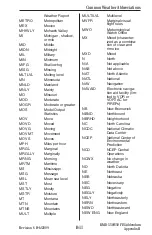
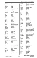
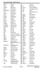
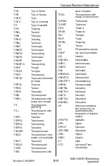
Страница 114: ...ately ADRNDCK Adirondack ADVCT Advect ADVCTD Advected ADVCTG Advecting ADVCTN Advection ADVCTS Advects ADVN Advance ADVNG Advancing ADVY Advisory ADVYS Advisories AFCT Affect AFCTD Affected AFCTG Affecting AFDK After dark AFOS Automated Field Operations System AFSS Automated Flight Service Station AFT After AFTN Afternoon AGL Above ground level AGN Again AGRD Agreed AGRS Agrees AGRMT Agreement AHD...

Страница 115: ...ation ATCT Air Traffic Control Tower ATLC Atlantic ATTM At this time ATTN Attention AUTO Automated report AVBL Available AVG Average AVN Aviation model AWC Aviation Weather Center AWIPS Advanced Interactive Weather Processing System AWOS Automated Weather Observing system AWT Awaiting AWW Alert Weather Watch AZ Arizona AZM Azimuth B Began BACLIN Baroclinic BAJA Baja California BATROP Barotropic BC...

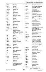
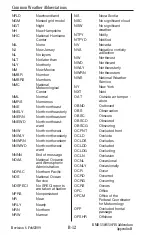
Страница 116: ...us CA California or cloud to air lightning in PIREPs CAA Cold air advection CAPE Convective available potential energy CARIB Caribbean CAS Committee for Aviation Services CASCDS Cascades CAT Clear air turbulence CAVOK Ceiling and visibility OK CAVU Ceiling and visibility unlimited CB Cumulonimbus CBMAM Cumulonimbus Mammatus clouds CC Cirrocumulus CCCC Generic WMO format code group for a four lette...

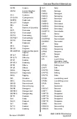
Страница 117: ...N Convection CNVTV Convective CNVTVLY Convectively CONFDC Confidence CO Colorado COMPAR Compare COMPARG Comparing COMPARD Compared COMPARS Compares COMPR Compare COMPRG Comparing COMPRD Compared COMPRS Compares COND Condition CONS Continuous CONT Continue CONTD Continued CONTLY Continually CONTG Continuing CONTRAILS Condensation trails CONTS Continues CONTDVD Continental Divide CONUS Continental U...

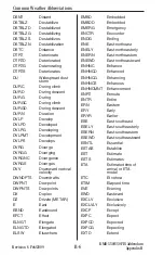
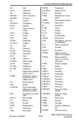
Страница 118: ...ed DISCG Discontinuing DISRE Disregard DISRED Disregarded DISREG Disregarding DKTS Dakotas DLA Delay DLAD Delayed DLT Delete DLTD Deleted DLTG Deleting DLY Daily DMG Damage DMGD Damaged DMGG Damaging DMNT Dominant DMSH Diminish DMSHD Diminished DMSHG Diminishing DMSHS Diminishes DNDFTS Downdrafts DNS Dense DNSLP Downslope DNSTRM Downstream DNWND Downwind DP Deep DPND Deepened DPNG Deepening DPNS D...

Страница 119: ...drafts DWPNT Dew point DWPNTS Dew points DX Duplex DZ Drizzle METAR E East EBND Eastbound EFCT Effect ELNGT Elongate ELNGTD Elongated ELSW Elsewhere EMBD Embedded EMBDD Embedded EMERG Emergency ENCTR Encounter ENDG Ending ENE East northeast ENELY East northeasterly ENERN East northeastern ENEWD East northeastward ENHNC Enhance ENHNCD Enhanced ENHNCG Enhancing ENHNCS Enhances ENHNCMNT Enhancement E...

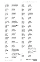
Страница 120: ...ng FIR Flight information region FIRAV First available FIS Flight Information Service FIS B Flight Information Service Broadcast FIRST First observation after a break in cov erage at manual station FL Florida or flight level FLG Falling FLRY Flurry FLRYS Flurries FLT Flight FLW Follow FLWG Following FM From FMGGgg From the time UTC indicated by GGgg Generic WMO format code group indi cating a sign...

Страница 121: ...Y Greatly GRTR Greater GRTST Greatest GRTLKS Great Lakes GS Small hail or snow pellets smaller than 1 4 inch in diameter GSTS Gusts GSTY Gusty GTS Global Telecommuni cation System GV Ground visibility HAZ Hazard HCVIS High clouds visible HDFRZ Hard freeze HDSVLY Hudson Valley HDWND Head wind HGT Height HI High or Hawaii HIER Higher HIFOR High level forecast HLF Half HLTP Hilltop HLSTO Hailstones H...

Страница 122: ...termittently INTR Interior INTRMTRGN Intermountain region INTS Intense INTSFCN Intensification INTSFY Intensify INTSFYD Intensified INTSFYG Intensifying INTSFYS Intensifies INTSTY Intensity INTVL Interval INVRN Inversion IOVC In overcast INVOF In vicinity of IP Ice pellets IPV Improve IPVG Improving IR Infrared ISOL Isolate ISOLD Isolated JCTN Junction JTSTR Jet stream KFRST Killing frost KLYR Smo...

Страница 123: ...G Lightning LTGCA Lightning cloud to air LTGCC Lightning cloud to cloud LTGCG Lightning cloud to ground LTGCCCG Lightning cloud to cloud cloud to ground LTGCW Lightning cloud to water LTGIC Lightning in cloud LTL Little LTLCG Little change LTR Later LTST Latest LV Leaving LVL Level LVLS Levels LWR Lower LWRD Lowered LWRG Lowering LYR Layer LYRD Layered LYRS Layers M Minus or Less than lowest senso...

Страница 124: ...ountains MULT Multiple MULTILVL Multilevel MVFR Marginal visual flight rules MWO Meteorological Watch Office MX Mixed character ized as a combina tion of clear and rime ice MXD Mixed N North N A Not applicable NAB Not above NAT North Atlantic NATL National NAV Navigation NAVAID Electronic naviga tion aid facility lim ited to VOR or VORTAC for PIREPs NB New Brunswick NBND Northbound NBRHD Neighborh...

Страница 125: ...PECI No SPECI reports are taken at station NPRS Nonpersistent NR Near NRLY Nearly NRN Northern NRW Narrow NS Nova Scotia NSC No significant cloud NSW No significant weather NTFY Notify NTFYD Notified NV Nevada NVA Negative vorticity advection NW Northwest NWD Northward NWLY Northwesterly NWRN Northwestern NWS National Weather Service NY New York NXT Next OAT Outside air temper ature OBND Outbound ...

Страница 126: ...iods PDMT Predominant PE Ice pellets PEN Peninsula PERM Permanent PGTSND Puget Sound PHYS Physical PIBAL Pilot balloon obser vation PIREP Pilot weather report PK WND Peak wind PL Ice pellets PLNS Plains PLS Please PLTO Plateau PM Postmeridian PNHDL Panhandle PNO Precipitation amount not available PO Dust sand swirls POS Positive POSLY Positively PPINA Radar weather report not available PPINE Radar...

Страница 127: ...SG Passage PSN Position PSND Positioned PTCHY Patchy PTLY Partly PTNL Potential PTNLY Potentially PTNS Portions PUGET Puget Sound PVA Positive vorticity advection PVL Prevail PVLD Prevailed PVLG Prevailing PVLS Prevails PVLT Prevalent PWB Pilot weather briefing PWINO Precipitation identi fier sensor not avail able PWR Power PY Spray QN Question QPFERD NCEP excessive rainfall discussion QPFHSD NCEP...

Страница 128: ...RI Rhode Island RIME Type of icing char acterized by a rough milky opaque appearance RIOGD Rio Grande RLBL Reliable RLTV Relative RLTVLY Relatively RM Remarks RMK Remark RMN Remain RMND Remained RMNDR Remainder RMNG Remaining RMNS Remains RNFL Rainfall RNG Range ROT Rotate ROTD Rotated ROTG Rotating ROTS Rotates RPD Rapid RPDLY Rapidly RPLC Replace RPLCD Replaced RPLCG Replacing RPLCS Replaces RPR...

Страница 129: ... Second SCNDRY Secondary SCSL Stratocumulus standing lenticular SCT Scatter or Scattered describing cloud cover or weather phenomena 3 to 4 octas cloud amount SCTD Scattered SCTR Sector SD South Dakota SE Southeast SEC Second SELY Southeasterly SEPN Separation SEQ Sequence SERN Southeastern SEV Severe SEWD Southeastward SFC Surface SFERICS Atmospherics SG Snow grains SGFNT Significant SGFNTLY Sign...

Страница 130: ...specially SPD Speed SPECI Special observation SPENES Satellite precip estimate statement SPKL Sprinkle SPLNS Southern Plains SPRD Spread SPRDG Spreading SPRDS Spreads SPRL Spiral SQ Squall SQAL Squall SQLN Squall line SR Sunrise SRN Southern SRND Surround SRNDD Surrounded SRNDG Surrounding SRNDS Surrounds SS Sunset or sand storm METAR SSE South southeast SSELY South southeasterly SSERN South south...

Страница 131: ...NS Synopsis SYS System T Thunder TA Temperature TACAN UHF Tactical Air Navigation Aid TAF Terminal Area Forecast TB Turbulence TCNTL Transcontinental TCU Towering cumulus TDA Today TEI Text element indi cator TEMP Temperature TEMPO Temporary THD Thunderhead THDR Thunder THK Thick THKNG Thickening THKNS Thickness THKR Thicker THKST Thickest THN Thin THNG Thinning THNR Thinner THNST Thinnest THR Thr...

Страница 132: ...erstorm infor mation not available TSNT Transient TSQLS Thundersquall TSTM Thunderstorm TSW Thunderstorm with snow showers TSW Thunderstorm with heavy snow showers TURBC Turbulence TURBT Turbulent TWD Toward TWDS Towards TWI Twilight TWR Tower TWRG Towering TX Texas UA Pilot weather reports UDDF Up and downdrafts UN Unable UNAVBL Unavailable UNEC Unnecessary UNKN Unknown UNL Unlimited UNRELBL Unre...

Страница 133: ...es VLNT Violent VLNTLY Violently VLY Valley VMC Visual meteorolog ical conditions VOL Volume VOR VHF Omnidirectional Radio Range VORT Vorticity VORTAC VOR and TACAN combination VR Veer VRB Variable VRG Veering VRBL Variable VRISL Vancouver Island BC VRS Veers VRT MOTN Vertical motion VRY Very VSB Visible VSBY Visibility VSBYDR Visibility decreasing rapidly VSBYIR Visibility increasing rapidly VT V...

Страница 134: ...rse WS Wind shear WSHFT Windshift WSFO Weather Service Forecast Office WSO Weather service office WSR 88D NWS Doppler Radar WSTCH Wasatch Range WSW West southwest WSWLY West southwesterly WSWRN West southwestern WSWWD West southwest ward WTR Water WTSPT Waterspout WUD Would WV West Virginia or wind WVS Waves WW Severe weather watch WWD Westward WWS Severe weather watches WX Weather WY Wyoming XCP ...

Страница 135: ...B 22 Revision 6 Feb 2009 Common Weather Abbreviations KMD 550 850 FIS Addendum Appendix B Intentionally left blank ...


Страница 136: ...ral Aviation Honeywell International Inc One Technology Center 23500 West 105th Street Olathe KS 66061 Telephone 913 712 0400 FAX 913 712 1302 www honeywell com 006 18227 0000 Rev 6 02 09 2001 2002 2004 2007 2009 Honeywell International Inc ...

Отзывы: