


89
Figure 6-9
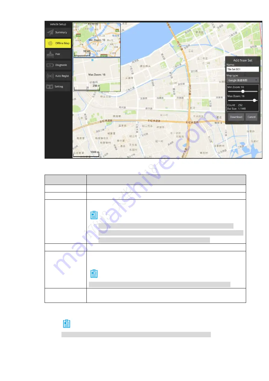
Step 2 Set parameters of offline map. Please refer to Table 6-1 for details.
Parameter
Note
Name
Input mission name.
Map type
Select map type according to actual requirement.
Min. zoom
Minimum level value of offline map, ranging from 3 to 17.
Note
The minimum level value shall not exceed maximum level value.
Each level value is corresponding to different map scale. The higher
the level value is, the bigger the map scale becomes.
Max. zoom
Maximum level value of offline map, ranging from 3 to 17.
Count
Set the interval value of max. and min. level; automatically calculate the
quantity of pictures.
Note
The offline map is the result of several mutually overlaying pictures.
Estimated size
Set the interval value of max. and min. level; automatically calculate the
internal storage of the map.
Table 6-1
Step 3
Click “Download” to download the configured offline map.
Note
The size of downloaded offline map is the size displayed by the screen.
View the downloaded offline maps in the “Offline Map” tab.
Содержание Navigator X820
Страница 1: ...NAVIGATOR X820 User s Manual V1 0 1 ZHEJIANG DAHUA VISION TECHNOLOGY CO LTD ...
Страница 18: ...5 Figure 2 2 ...
Страница 21: ...8 2 2 1 Visible Light PTZ Camera 2 2 1 1 Dimensions Figure 2 4 ...
Страница 22: ...9 Figure 2 5 ...
Страница 24: ...11 2 2 2 Thermal PTZ Camera Optional 2 2 2 1 Dimensions Figure 2 7 ...
Страница 25: ...12 Figure 2 8 ...
Страница 27: ...14 2 3 Remote Control 2 3 1 Dimensions Figure 2 10 ...
Страница 40: ...27 2 4 Ground Control Station GCS 2 4 1 Dimensions Figure 2 25 Figure 2 26 ...