AV8OR User’s Guide
Aviation Mode Operation
VFR Moving Map Function
Pub. No D200803000008 Page 3-58 Rev 3 Apr 2009
© Honeywell International Inc. Do not copy without express permission of
Honeywell.
and distance (PDIS) are shown on two lines at the bottom left of the
screen
To select a user defined point on the map:
If the user taps on a point on the map that is not a NAVAID pointer
stored in database, taps on the
PTR MENU
soft key and then taps
the
soft key, a temporary WPT named USRXXX is created at
the pointer position on the map and a new course from the aircrafts
present position directly to the selected NAVAID point is created.
The new course line is colored magenta.
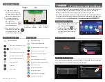
Figure 3-68: Map – Navigate to a user defined WPT
PTR MENU – OBS Navigation
To select a NAVAID point on the map:
If the user touches a NAVAID point on the map and taps the
PTR
MENU
soft key, the
OBS
soft key will be shown. After the
OBS
soft
key is tapped, the OBS window shows the magnetic course to the
NAVAID.


