194
|
Index
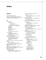
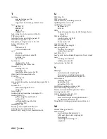
getVertices() method, controlling layer access
from 53
GIS (geographic information systems) 30
about 30
and map authors 19
concepts 30
features 30
understanding 30
GIS Design Server.
See
Autodesk GIS Design Server
glossary 177
groups, creating accounts 83
H
hard disk, space requirements 15
hardware requirements 15
HDR files 108
header files
example 107
for georeferencing raster images 107
Help 21
how Autodesk MapGuide components work
together 31–42
how to use this book 18
HREF tag, using 39
HTML pages
client-side scripts and applications 39
dynamic 40
embedding maps 39
responsibility for creating 20
HTML scripts
security 53
I
implementing Autodesk MapGuide application
46
improving map performance 62
insertion point.
See
reference points 110
installing
Autodesk MapGuide Author 124
Autodesk MapGuide Server 68
mandatory components 43
MapAgents 69
report engine 75
Web server 68–75
Web server software 69
Intergraph DGN files, converting to SDFs 33
intermediate Autodesk MapGuide users (getting
started) 18
Internet Explorer, supporting 65
intranet, defined 35
IP address, editing remote server 72
ISAPI, MapAgent 54
J
Java
choosing as scripting language 63
skills for application developers 20
writing applications with 36, 40
Java Viewer.
See
Autodesk MapGuide Viewers
JavaScript
and client-side scripting 39
choosing as scripting language 63
skills for application developers 20
JScript.
See
JavaScript
K
keys 113
access.
See
access keys
defined 98
parsing 113
L
labels for features, overlapping 172
latitude, for zoom locations 147
latitude/longitude coordinates, converting 118
layer groups 154
advantages of 159
creating 159
deleting 176
examples 155
rebuilding 175
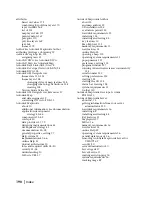
layers
access keys, assigning to 52
accessing via the API 45
adding
from external files 175
to maps 175
to reports 45
adding symbols
to point layers 111
to SMB files 110
and access keys 173
Autodesk DWG 158
available 136
changing priority 159
changing URLs 174
changing visibility status 174
controlling access with access keys 52
coordinate system units 166
copying 174
creating test layers 44
data sources for 160
deleting 176
deselecting 137
Содержание 15606-011408-9008 - MAPGUIDE R6.3 NAMED-100U PK
Страница 1: ...15306 010000 5000 October 2001 Autodesk MapGuide Release 6 User s Guide ...
Страница 8: ...viii ...
Страница 92: ...92 ...
Страница 152: ...152 ...
Страница 188: ...188 ...
Страница 204: ......


