Glossary
|
181
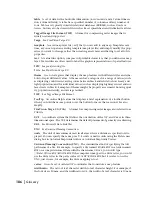
Joint Photographic Experts Group (JPEG)
A format for compressing raster images
that offers a compression ratio of up to 20:1. Note that some image information is lost
when a raw image such as TIFF or BMP is converted to JPEG format.
JPEG
See
Joint Photographic Experts Group.
key
An alphanumeric character string or an integer used to uniquely identify a map
feature or a record in an attribute table. If a spatial feature in an SDF and a record in an
attribute table use the same key, they are linked, so you can select that spatial feature
and retrieve the data in that record. This is useful for generating reports because you can
select the spatial features you want and then generate a report containing the attribute
data for those features only. Keys must be unique; if more than one spatial feature or
record uses the same key, the links between the spatial features and the attribute data do
not work. Note that for an SDF and for OLE DB providers linked to an SDF, the key must
be a string. See also
primary key.
latitude/longitude system
A global coordinate system in which locations are
expressed by geographical coordinates (the geodetic latitude and longitude) that depict
angular measurements relative to the Earth’s ellipsoid. These coordinates are often
expressed in decimal degrees or degrees
°
minutes' seconds". See also
arbitrary XY
coordinates.
layer
See
map layer
.
layer group
A collection of related map layers. You create layer groups in Autodesk
MapGuide Author.
legend
A key to or an explanation of the symbols in a map, and their meaning or val-
ues. In the View tab of the Autodesk MapGuide Author Map Explorer and in Autodesk
MapGuide Viewer, you can use the legend to turn layers on and off so that the map fea-
tures they contain are no longer visible or selectable.
line
A drawing entity with start and end coordinates connected by a single straight
line. Lines typically represent the shape of map features too narrow to be displayed as
an area at the given scale (contours, street centerlines, or streams), or linear features with
no area (county boundary lines).
line spacing ratio
The ratio of the distance between lines of text to text character
height. For example, if the distance between lines of text is 10 mm, and the line spacing
ratio is 0.5, the font height is 20 mm.
linetype
A property of a line that defines its appearance. Examples of linetypes include
continuous, dashed, and dotted.
linked table or database
A table or database linked to a layer using Autodesk
MapGuide Author. The records in the table are linked to the spatial features in the layer
via common keys.
map
An abstract representation of the physical features of a portion of the Earth’s sur-
face graphically displayed on a planar surface. Maps display signs, symbols, and spatial
relationships among the features. They typically emphasize, generalize, and omit certain
features from the display to meet design objectives. For example, railroad features might
be included in a transportation map but excluded from a highway map.
map feature
Any spatial feature on a map. In the Autodesk MapGuide products, map
features can be points, polylines, polygons, or text. Although raster images are techni-
cally not map features, you can display them in raster layers.
Содержание 15606-011408-9008 - MAPGUIDE R6.3 NAMED-100U PK
Страница 1: ...15306 010000 5000 October 2001 Autodesk MapGuide Release 6 User s Guide ...
Страница 8: ...viii ...
Страница 92: ...92 ...
Страница 152: ...152 ...
Страница 188: ...188 ...
Страница 204: ......


