


GeoSteer®
63
PN 2006410—ENG Rev. B
The NTRIP Auto-Connect feature is enabled for a pre-defined duration after the operator first manually connects to a
stream. The length of time the NTRIP Auto-Connect will be in effect will depend on the type of cell modem installed in the
GeoSteer system. The time outs are:
CDMA Modems
—25 hours (Used primarily in North America)
GSM Mode
—365 days (Primarily the rest of the world)
PLANNING TOOL
If the system has been shut down longer than the time period limit, the operator must reconnect to the NTRIP stream
manually. Once the manual reconnect has been reestablished, the NTRIP Auto-Connect will then work until the duration
limit is reached again. If the operator presses the Disconnect button in the NTRIP, General screen, the NTRIP Auto Connect
feature will be disabled until it is manually restarted. The NTRIP Auto-Connect will also be disabled if a login error occurs
where the stream is already in use. NTRIP Auto-Connect will only work if the system is in RTK Only, Flex High Accuracy, or
Flex Low Accuracy.
The Planning Tool screen provides information about the
predicted quality of the computed position and expected
satellites availability. It allows the operator to make decisions
about farming applications based on GPS availability.
The following Planning Tool options are available:
To access the GPS Planning screen, select the GPS tab from the
main AutoSteer Setup screen and then press the Planning Tool
button.
The options that can be available in the GPS Planning screen are:
General
—This provides the location of the vehicle.
Sky Plot
—This provides a graphical representation of the location of the GPS and GLONASS (when enabled) satellites in
the sky.
Forecast
—This provides an estimate of how many satellites will be available over time and what the predicted accuracy
of position will be.
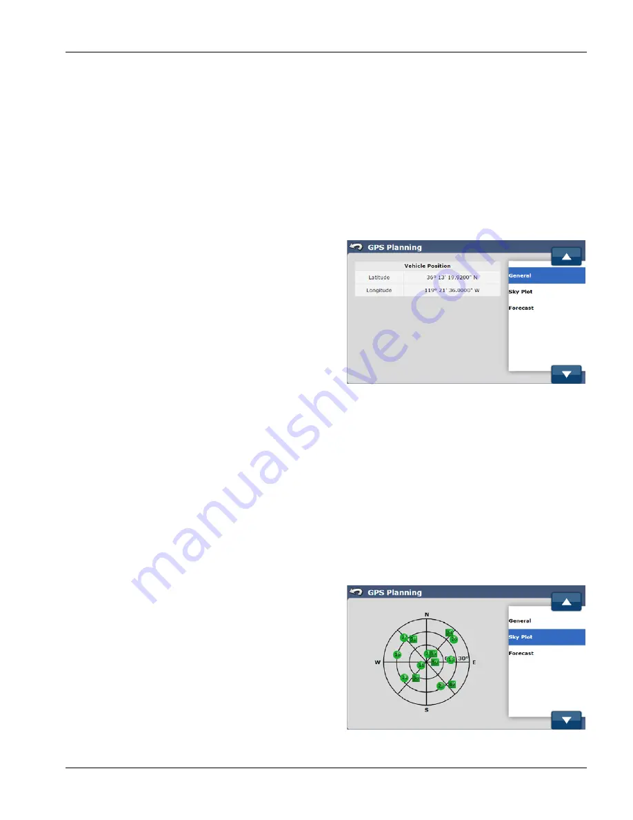
GENERAL
The General screen shows the current vehicle position in latitude and longitude
To access the General screen, select the GPS tab from the main AutoSteer Setup screen, press the Planning Tool button,
and then select General from the list on the right.
The information available in the General screen is:
Latitude
—The latitude of the vehicle's position.
Longitude
—The longitude of the vehicle's position.
SKY PLOT
The Sky Plot screen shows which satellites are being tracked and
their relative position in the sky.
To access the Sky Plot screen, select the GPS tab from the main
AutoSteer Setup screen, press the Planning Tool button, and
then select Sky Plot from the list on the right.
The information available in the Sky Plot screen is:
Graph
—This is a graphical representation of all the GNNS
satellites that are being tracked by the GeoSteer system.


