


6. Navigation and Control System
SMF-MP10S User guide V1.1 Shanghai Seer Intelligent Technology Corporation
39
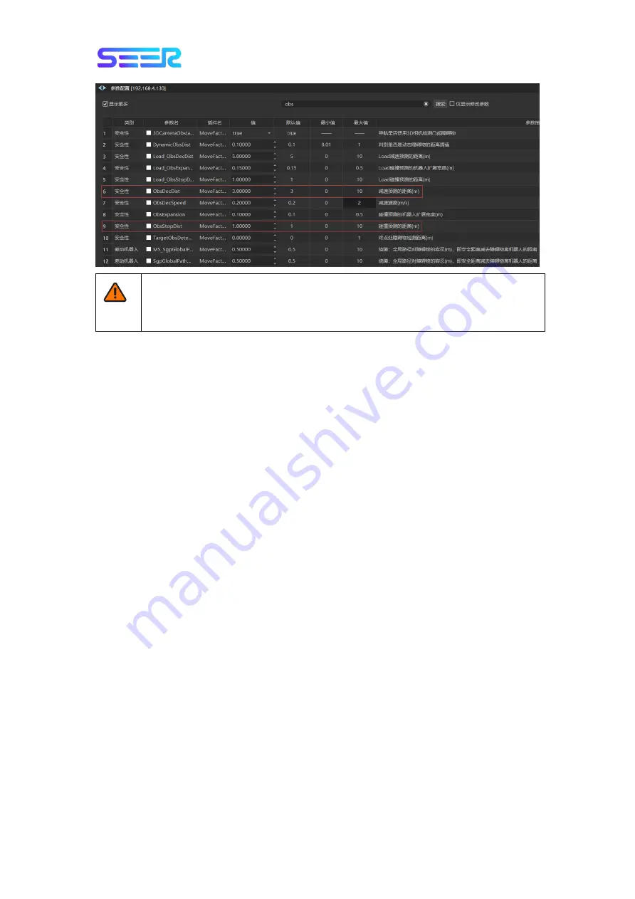
Precautions for Parameter Configuration of Robot
●
The collision detection will be turned off when ObsStopDist is set as 0. A collision
may occur at this time. Be careful!
6.7 Localization
The purpose of the localization process is to determine the current location of the robot. The
robot has 3 input items to determine its current location:
The initial location of the robot is used as a reference point for localization.
IMU and encoder data are used to determine the distance and speed of the robot from
the initial location.
The laser scanning data is used to determine the approximate location of the robot by
comparing the location data of the wall on the map.
The particle filter uses the above data to determine the approximate location of the robot
on the map.
IMU and Encoder
The data of inertial measurement unit (IMU) and motor encoder can be used to calculate the
distance and speed of the robot from the initial location. The combined use of these two
sets of data results in a more accurate position.
Laser and Particle Filtering
The robot controller uses a particle filter algorithm to confirm the best match by comparing
the laser input data with the wall on the map. Since the laser input data is only compared
the robot’s estimated position based on the IMU and encoder data, it is necessary to
confirm the initial location.
To ensure that the robot can be accurately positioned through particle filtering, we need to
confirm when building the map:
The map must have unique, recognizable static landmarks which are easily identifiable.
The landmark should be a permanent structure that the robot can use to determine its
own direction, such as corners, doorways, pillars and shelves.
The robot must be able to detect static landmarks marked on the map in order to
approach its current location.


