Black plate (30,1)
Most of the information provided by your navigation system can be seen on the map. You need to be-
come familiar with how information appears on the map.
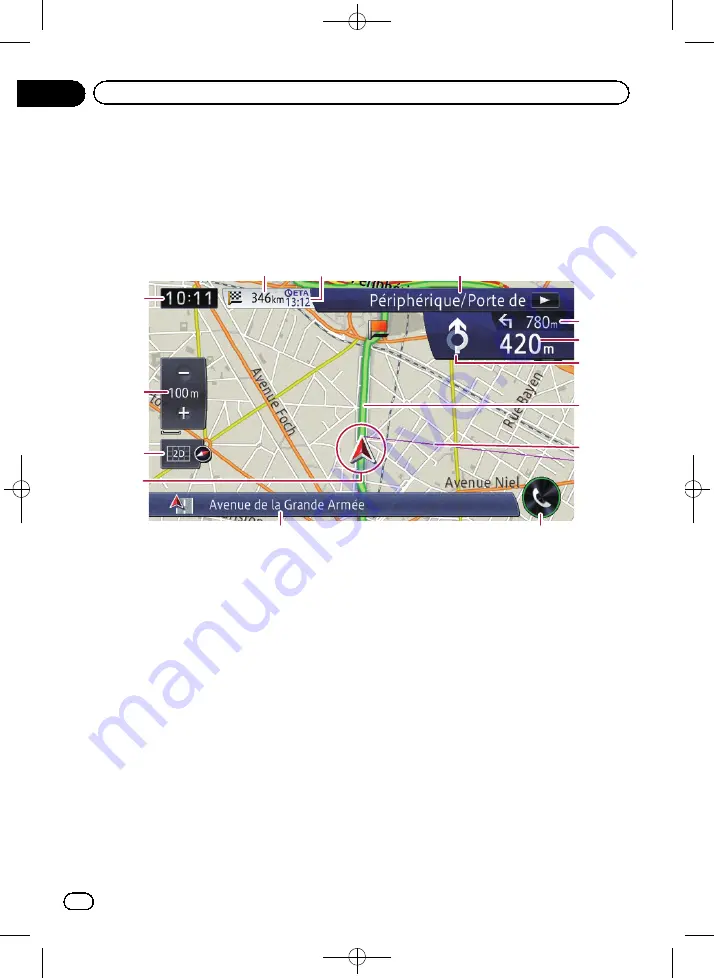
How to read the map screen
This example shows an example of a 2D map screen.
1
5
e
d
c
6
2
3
a
9
7
8
4
b
p
Information with an asterisk (*) appears
only when the route is set.
p
Depending on the conditions and settings,
some items may not be displayed.
1
Current time
2
Scale display touch panel key
Touching [+] or [
–
] changes the map scale.
You can change the map scale between 10
metres and 2 000 kilometres (10 yards and
1 000 miles).
p
The
“
_
”
mark shown below indicates the
scale distance (2D display only).
3
Map control
The
“
View
”
screen that can set the view mode
and the map orientation appears.
=
For details of the operation, refer to
=
For details, refer to
4
Current position
Indicates the current location of your vehicle.
The apex of the triangular mark indicates your
orientation and the display moves automati-
cally as you drive.
p
The apex of the triangular mark is the
actual current position of the vehicle.
5
Information bar
Each touch of this key changes the display in-
formation as follows.
!
The information of where your vehicle is
travelling along
p
When
“
Street Name
”
is selected on
“
Current location info.
”
of
“
Navi
Settings
”
, the street name or city
name is displayed. Also,
“
Coordi-
nates
”
is selected, latitude and longi-
tude are displayed.
=
For details, refer to
<CRB4228-A>30
Engb
30
Chapter
03
How to use the map


