background image

Aan-/uitzetten

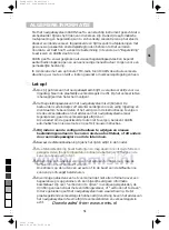
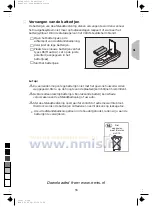
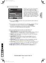
Het systeem wordt aan- en uitgezet met het autocontact.

Op het beeldscherm verschijnt eerst een melding omtrent het veilige
gebruik van het systeem.

Bevestig de melding met toets

ENTER/O.K.

.

Het hoofdmenu verschijnt.

Na enkele seconden is het systeem geïnitialiseerd en kunt u de
navigatiefuncties kiezen (verlichte opties).

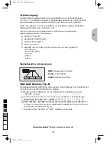
Waakstand (stand-by)

Als u hinder ondervindt van de helderheid van het beeld (bijv. ‘s nachts of in
tunnels), kunt u het display uitschakelen.

Kies “Stand-by” in het hoofdmenu.

Het display wordt uitgeschakeld.

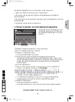
Als een externe luidspreker (optie) op het systeem is aangesloten, kunt u het
begeleidingsadvies toch horen.

Druk op een van de cursortoetsen

4

,

6

,

8

,

2

, toets

ENTER/O.K.

of

MENU

op de afstandsbediening om het systeem weer te activeren.

Zet u het autocontact uit terwijl het navigatiesysteem stand-by is, dan
begint het systeem ook in stand-by wanneer u het autocontact weer aanzet.

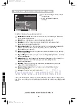
Instellen van het volume

Druk op toets

+

of

-

op de afstandsbediening om het volume van het

gesproken begeleidingsadvies te wijzigen.

Tijdens het instellen hoort u “harder” of “zachter”.

Deze instelling beïnvloedt zowel het volumeniveau van een externe
luidspreker (indien aanwezig) als dat van de ingebouwde luidspreker (in het
beeldscherm).

56

0

5

25

75

95

100

522nl_5.chp

Wed Dec 02 08:55:58 1998

Farbprofil: Deaktiviert

Komposit  Standardbildschirm

Downloaded from www.nmis.nl

Summary of Contents for Carin 520

Page 1: ...user guide gebruiksaanwijzing CARiN 522 520 GB NL cover522_gb_nl qxd 09 11 98 15 17 Seite 2 Downloaded from www nmis nl ...

Page 2: ...under all circumstances Attentie Gebruikt U het systeem uitsluitend dan wanneer de verkeersveiligheid het toelaat Het is belangrijker om op het verkeer te letten en de handen aan het stuur te houden Daar de verkeersituatie zich doorlopend wijzigt kan geen 100 nauwkeurigheid gegarandeerd worden 3 0 5 25 75 95 100 522en_p2 chp Wed Dec 02 09 15 34 1998 Farbprofil Deaktiviert Komposit Standardbildschi...

Page 3: ... T T R R R R P P ENTER O K NAVIGATION SYSTEM NAVIGATION SYSTEM BRIGHT MENU VOLv Fig 1a Fig 1b Fig 2a Fig 2b Fig 3 MENU 1 3 0 5 25 75 95 100 522en_p2 chp Wed Dec 02 09 15 47 1998 Farbprofil Deaktiviert Komposit Standardbildschirm Downloaded from www nmis nl ...

Page 4: ...0 5 25 75 95 100 522en_p2 chp Wed Dec 02 09 15 47 1998 Farbprofil Deaktiviert Komposit Standardbildschirm Downloaded from www nmis nl ...

Page 5: ...6 ONDERHOUD 86 WAT IS HET CARiN NAVIGATIESYSTEEM 87 SCHERMSYMBOLEN 90 TMC SYMBOLEN 91 MENU OVERZICHT 92 VERHELPEN VAN STORINGEN 93 GB NL Contents GENERAL INFORMATION 7 CONTROLS 10 THE CARiN MENU SCREEN 16 MAIN MENU 17 DESTINATION INPUT 18 GUIDANCE 25 EMERGENCY 32 ALTERNATIVE ROUTE 33 DESTINATION STORE 34 VIA POINTS 36 SYSTEM SETTINGS 38 MAP CDs 42 MAINTENANCE 42 HOW DOES CARIN NAVIGATION WORK 43 S...

Page 6: ...6 0 5 25 75 95 100 522en_p2 chp Wed Dec 02 09 15 49 1998 Farbprofil Deaktiviert Komposit Standardbildschirm Downloaded from www nmis nl ...

Page 7: ...t traffic situation and the advice of the navigation system are in contradiction traffic regulations always have priority over advice given by the system In case you decide not to follow the suggested route CARiN will automatically calculate a new route and provide new suggestions automatic re routing function aWe recommend that you change system settings or enter new destinations only when the ca...

Page 8: ...t only rely on the navigation system It cannot be guaranteed that the CARiN database contains all available emergency services in your neighbourhood Use your own judgment and abilities to ask for directions in such a situation The CARiN Navigation System does not take into account the relative safety of the suggested routes The suggested routes do not reflect road closures or construction weight o...

Page 9: ...hout valid GPS data but the accuracy of positioning may decrease As soon as sufficient GPS data is received the colour of the satellite icon in the GPS window changes from red to green On motorways the distance indications of CARiN for exits are different from those on the motorway signs The motorway signs refer to the distance to the beginning of the exit whereas CARiN refers to the end of the ex...

Page 10: ... Increase voice volume of guidance advice MENU Show Main Menu MAP Enter exit the route map or car position map in all menus where a map option is available Only highlighted options can be selected with the cursor keys If you use your remote control in it s holder the internal batteries are not used When the batteries are exhausted the icon lights up in the status line of the display Slide the remo...

Page 11: ...exhausted batteries may not be disposed of with your household waste Please determine how to dispose of exhausted batteries according to local regulations aOnly use leak proof batteries Battery leakage can cause damage to the remote control or to your car aNever expose the remote control to direct sunlight or extreme heat The batteries are discharged and the risk of leakage is increased If you per...

Page 12: ...s connected to your system optional you will still hear the guidance advice Press one of the cursor keys 4 6 8 2 the ENTER O K key or the MENU key on the remote control to switch on the display again If the navigation system was switched off in stand by mode it restarts in stand by mode when switching the ignition on again Volume adjustment Press or key on the remote control to adjust the voice vo...

Page 13: ...ume Briefly press the MENU key one or more times until the Volume option is activated Adjust the volume of the built in loudspeaker with the and keys on top of the display Without entering the OSD menu Press the or key on top of the display and adjust the volume The display automatically enters the Volume menu Adjusting brightness Briefly press the MENU key one or more times until the Brightness o...

Page 14: ...e MENU key as often as necessary until you leave the setup menu Automatic brightness control If you set the brightness control BrightContr to Auto the display brightness is automatically adjusted to the surrounding light conditions see Additional settings With the Brightness option of the OSD menu you can adjust the maximum and minimum brightness of the display During daylight adjust the maximum b...

Page 15: ...deo input GND Ground Audio and video Audio Audio signal input Video Video signal input PAL Standard 4 3 display Fig 2b The standard display is equipped with two thumb wheels for volume and brightness control located on top of the display housing For adjustment of the screen brightness use the BRIGHT thumb wheel For volume adjustment of the built in speaker use the VOL v thumb wheel We recommend to...

Page 16: ...r example during route planning command is received from the remote control the batteries in the remote control need replacing TMC status of the Traffic Message Channel only if a TMC radio is connected l audible info voice messages disabled t route planning criteria For further information on configuration of the status line see System Settings page 38 8 Cursor Move with the cursor keys 4 6 8 and ...

Page 17: ...nu Destination input Enters the Destination Input menu Select this option to enter the city road junction or the special facility of the destination you want to travel to See page 18 Map Offers you a map with the area around the current car position Settings Enters the System Settings menu Select this option to set your own preferences See page 38 Guidance Enters the guidance screen and activates ...

Page 18: ...s the guidance function Destination store Store destination addresses in the address book and recall the last used destination addresses Via point Enter via points on the way to the current destination address Delete destination Delete the last entered destination address Return Back to the Main Menu If more than one country is stored on the inserted map CD The country code of the selected country...

Page 19: ...pewriter window and select the desired country from the list This is only possible if more than one country is stored on the inserted map CD Enter the city name To delete characters previously entered select Delete and confirm by pressing ENTER O K To enter a space select Space If you know the destination address exactly enter the road and junction the same way For this use options Road and Juncti...

Page 20: ...er you can also enter the desired house number If you wish to enter a name with the German character ß select the S twice The data base also accepts this spelling Depending on the map CD inserted the data base also accepts the spelling of other languages For example you can enter MUNICH or MUNCHEN instead of MÜNCHEN 2 Selecting the destination from database entries Select the city road and junctio...

Page 21: ...red category for example HOTEL PETROL STATION If a larger number of facilities is available in the database the typewriter is shown Enter the name of the desired facility or select List Select the desired facility from the list If travel guide information on special destinations is stored on the map CD the info icon is displayed in the information window of the Main and Destination Input menu In t...

Page 22: ... shows you the direction to where the destination is located In addition the distance to the destination is shown The special facilities are sorted in order of their distance from the current car position i e the nearest facility is on top of the list Facilities outside the digitized area With some map CDs it is possible that the roads leading to a special facility you previously selected are not ...

Page 23: ... is stored as the new destination address for guidance Select Return if you do not wish to store the selected facility as the destination address The display again shows the list of special destinations When using map CDs with travel guide information additional screen icons may appear in the map display You can find the description of these icons in the booklet supplied with the map CD Business I...

Page 24: ... Move the crosshair with cursor keys to the desired position The map is automatically shifted if you move one of the crosshair lines to the edge of the screen To store the selected location as the destination address press ENTER O K and then select Store from the menu Storing a destination address from the destination map is only possible with map scales 100 m 200 m 500 m and 1 km TIP First select...

Page 25: ...information 5 GPS reception status As soon as valid position data is received by the GPS receiver the colour of the satellite icon is green 6 Turn into street Road you have to turn into next 7 Distance to the next direction change 8 Options menu Menu goes to the Main Menu Map shows the route map Info opens the Route Information menu or Detour opens the detour menu if an obstruction is ahead only i...

Page 26: ...from the guidance screen to open the Route Information menu The following menu options are available Route list Shows a list of all sections of the planned route Only if you are on a digitized road Next via point Shows the next via point and gives you the opportunity to delete this via point Route selection To select the route planning criteria See also page 38 Return Back to the guidance screen 2...

Page 27: ...ale of the map Confirm Scale with the ENTER O K key and change the scale with the cursor keys 4 or 6 Confirm the new scale with the ENTER O K key Positioning Selects the orientation of the map Northwards or Steer dir The map is displayed in Steer dir mode only if the map scale is 100 m 200 m 500 m or 1 km TMC info Selects the kind of TMC announcements which are displayed on the map only if a RDS T...

Page 28: ...ulations always have priority over the advice given by the navigation system Always obey road signs and traffic regulations Automatic re routing The system automatically plans a new route within a few seconds if you don t wish to follow a guidance advice you missed an advice or it is not possible to follow it due to traffic demands Adjustment of the average speed setting For calculation of the rem...

Page 29: ...MC traffic information Switch on the radio Switch on the TMC mode on the radio see radio manual Tune to a station broadcasting TMC information see radio manual The status line of the CARiN display shows the state of the TMC TMC icon yellow The tuned station broadcasts TMC information TMC icon red The tuned station does not broadcast TMC information TMC icon grey The inserted map CD does not suppor...

Page 30: ...tructions off the route arrows may indicate the driving direction for which the obstruction is valid Detailed information Traffic obstructions covering a certain distance are displayed with driving direction and length on larger map scales for example slow moving queuing or stationary traffic etc The traffic density slow moving queuing or stationary traffic and the length of the obstruction is mar...

Page 31: ...ce screen or press the ALT R key The Detour menu appears Confirm Plan a detour if you wish to bypass the traffic obstruction CARiN plans a detour within a few seconds Select Pass through if you want to pass through the obstruction Do you prefer to plan a detour or to pass through the traffic problem Detour Pass through Plan a detour t 16 12 28 08 1998 GB 31 0 5 25 75 95 100 520_e_5 chp Thu Nov 12 ...

Page 32: ... specific Emergency phone number is only displayed if you travel within the boundaries of the currently loaded map CD Storing an Assistance number You can store a telephone number of your own choosing in the Emergency menu for example the number of a breakdown service automobile club etc Select Setting from the Emergency menu The typewriter window is opened Enter the telephone number you want to s...

Page 33: ... procedure by selecting the option Yes Within a few seconds an alternative route is calculated for the chosen distance If you want to cancel the procedure select No or press the MENU key Even without the alternative route function the navigation system plans a new route automatically when you leave the advised route Simply leave the advised route to bypass traffic jams or to drive a route of your ...

Page 34: ...the address book Name Enter a name for the destination address consisting of max 10 characters Delete address Delete an entry from the personal address book Delete prev dest Delete the 10 destination addresses last entered Return Leave the destination store menu Notes The number of 30 entries is the guaranteed minimum for the personal address book The number of entries can increase up to 100 depen...

Page 35: ...ow shown as the new menu title Select Store address The address is now stored in the address book under this name The menu title now changes back to Name Retrieve addresses from the address book Select Retrieve address from the destination store menu The list of all addresses already stored in the address book is shown The list is sorted in alphabetical order Select the desired address from the li...

Page 36: ... load an address from the address book as a via point Store via point To store the entered via point in the memory List via point To show the list of stored via points Delete via point To delete a via point from the memory Return To return to the Destination Input menu Notes The maximum number of stored via points is 25 The via points are reached in the order of entry You can enter new via points ...

Page 37: ...nation address If you have already stored the current destination address in the address book skip the first point Store the current destination address in the address book Select Delete destination from the Destination Input menu Confirm the security check Delete via points with Yes All via points and the destination address are deleted Load the last used destination address with Retrieve address...

Page 38: ...the criteria which influence the route planning You can select between these four options Optimised for travel time t good compromise for any situation Optimised for travel distance d recommended for routes within a city As much as possible along main roads w recommended if travelling on main roads is preferred As little as possible along main roads W recommended if travelling on main roads is not...

Page 39: ...daytime display Optimized contrast is guaranteed by the options Blue Green and Red This setting is active when the headlights are turned off Status line left Select the kind of information shown in the lower left corner of the screen None Status line left switched off Clock Time display Date Date display Remaining travel time Time remaining until you arrive at the next via point or the destination...

Page 40: ...avel time and the estimated time of arrival aWARNING The Diagnosis option should only be performed by an authorized service centre for service purposes Traffic information The Traffic Information menu offers the following options TMC Info On Off Activate deactivate the display of all categories of TMC traffic information at the same time Message selection Select the type of TMC information by cate...

Page 41: ...th year and month day year Volume If you select Volume the Volume Control menu with the following options are shown SDVC Select one of the SDVC curves for Speed Dependent Volume Control This is to compensate the surrounding noise by increasing the volume level depending on the car speed Find a suitable compensation by trying out the different curves Audible info Voice on off To activate deactivate...

Page 42: ...CD Fig 3 page 3 Press the W key on the navigation computer once if the red power LED is on normally when the ignition is switched on Press the W key twice if the red power LED is not on The CD is ejected Take out the CD and gently insert the new CARiN map CD with the printed side facing up until it is retracted The system needs a few seconds for initialisation after changing the map CD Note If the...

Page 43: ...e reception of navigation signals from a total of 24 GPS satellites at a height of 21 000 km To determine the position with sufficient accuracy signals from at least 4 satellites must be received The CARIN GPS receiver can handle up to 8 satellite signals simultaneously This allows an accuracy of about 30 m to 100 m which is further improved by the other sensors When the vehicle is parked for a lo...

Page 44: ...high buildings In multi storey car parks or garages in tunnels and under bridges In forests or tree lined avenues During heavy rain showers and thunderstorms In valleys and in mountainous regions Unfavourable satellite constellations in conjunction with the mounting position of the GPS antenna In this case GPS reception may be obstructed for a longer period If the GPS antenna has been properly ins...

Page 45: ...the distance to the beginning of the exit Areas with limited road attributes In some areas not all attributes of a road are available on the map CD For example information on prohibited turning one way streets or pedestrian areas are missing If you are entering this kind of area the navigation system will show you a warning The local traffic regulations always have priority over the advice given b...

Page 46: ...tre k Civic centre J Clinic G Council office g Court house Z Destination L Education O Embassy y Entertainment F Ferry f Fire station Y Golf course Icon Meaning c Hire car company H Hospital h Hotel i Industrial estate o Library m Marina n Military base D Monument M Museum p Park R Park Ride T Petrol station B Police b Post office e Railway station E Restaurant q Services S Shopping centre X Sport...

Page 47: ...th directions In detail and in the guidance screen R Roadworks A Danger F Slippery road Y Poor weather conditions K Poor road conditions N Limited visibility H Heavy winds Symbol Explanation U Accidents B Queueing traffic J Stationary traffic ä Delays g Unusual load v Road narrows p No available parking G Ghostdriver Please do not overtake c Closed road S SMOG alert D Vehicle height restriction r ...

Page 48: ...g you to enter data Menu option Menu option opening a following menu Menu Via Point Input City Cntry Road Junction Store via point Special dest Destination map Delete via point Load address Return List via point Name Name Load address Prev destinations Store address Store current loc Delete address Delete prev dest Return System Settings Language Route selection Settings Screen config System infor...

Page 49: ...entered a destination address System plans no route although a destination was entered Car is not on a digitized road Drive in the direction of a digitized displayed road Guidance advice not audible Make sure that Voice is set to on in the System Settings menu l icon is not in the display Make sure that the Volume is not set to minimum in the System Settings menu If no external speaker is connecte...

Page 50: ...m is possible If you frequently discover greater inaccuracy contact an authorized service centre Displayed car position does not correspond with actual car position Bad GPS reception for a longer period of time When sufficient GPS reception is resumed the position is corrected automatically If necessary wait a few minutes Guidance advice does not correspond with actual traffic situation It is poss...

Page 51: ...dvies van het navigatiesysteem elkaar tegenspreken gaan de verkeersregels altijd voor Als u besluit om de geadviseerde route niet te volgen berekent CARiN automatisch een nieuwe route en geeft zij nieuwe instructies aWij raden u aan de configuratie alleen te wijzigen en nieuwe bestemmingen alleen in te voeren als de auto stilstaat of dit anders door een medepassagier voorin te laten doen aBewaar d...

Page 52: ...rbags niet belemmeren Als u een hulpdienst nodig hebt dient u niet uitsluitend op het navigatiesysteem af te gaan We kunnen niet garanderen dat alle aanwezige hulpdiensten in de database van CARiN zijn opgenomen Ga op uw eigen oordeel en mogelijkheden af om in een dergelijke situatie om hulp te vragen Het CARiN navigatiesysteem houdt geen rekening met de relatieve veiligheid van de voorgestelde ro...

Page 53: ...egevens volledig functioneel maar de nauwkeurigheid van de positiebepaling kan afnemen Zodra het systeem voldoende GPS gegevens ontvangt verandert de kleur van het satellietsymbool op het GPS logo van rood in groen Op autosnelwegen komen de door CARiN opgegeven afstanden voor afritten niet overeen met de op de verkeersborden aangegeven afstanden Dit komt omdat de verkeersborden de afstand tot aan ...

Page 54: ...eleidingsadvies Verhogen van het volume van het gesproken begeleidingsadvies MENU Oproepen van het hoofdmenu MAP Oproepen verlaten van de route of positiekaart in menu s waarin een kaartenoptie ter beschikking staat Alleen de verlichte opties op het beeldscherm kunnen met de cursortoetsen geselecteerd worden Als u de afstandsbediening bij gebruik in de houder laat zitten worden de batterijen niet ...

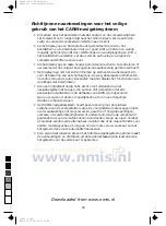
Page 55: ...eel landen mogen lege batterijen niet met het gewone huisvuil worden weggegooid Stel u op de hoogte van de plaatselijke richtlijnen hieromtrent aGebruik alleen lekvrije batterijen Een lekkende batterij kan schade veroorzaken aan de afstandsbediening of uw auto aStel de afstandsbediening nooit aan fel zonlicht of extreme warmte bloot Hierdoor worden de batterijen ontladen en neemt de kans op lekkag...

Page 56: ...aangesloten kunt u het begeleidingsadvies toch horen Druk op een van de cursortoetsen 4 6 8 2 toets ENTER O K of MENU op de afstandsbediening om het systeem weer te activeren Zet u het autocontact uit terwijl het navigatiesysteem stand by is dan begint het systeem ook in stand by wanneer u het autocontact weer aanzet Instellen van het volume Druk op toets of op de afstandsbediening om het volume v...

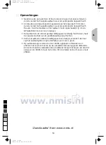
Page 57: ...n Volume instellen Voor het verlaten van het OSD menu MENU knop net zo lang achter elkaar indrukken totdat het menu verlaten wordt Volume van de geïntegreerde luidspreker met de en knoppen op de bovenkant van de display afstellen Zonder eerst het OSD menu op te roepen of knop op de bovenkant van de display indrukken en volume afstellen De display gaat automatisch naar het menu Volume Helderheid in...

Page 58: ...instelling uitvoeren Voor het verlaten van het setup menu MENU knop net zo lang achter elkaar indrukken totdat het menu verlaten wordt Automatische regeling helderheid Als in het setup menu de automatische helderheidsregeling BrightContr op Auto is ingesteld wordt de helderheid van de display automatisch aan het omgevingslicht aangepast zie Extra instellingen In het OSD menu Brightness kunt u de m...

Page 59: ...1 Wide 2 Stekkerbezetting tv video ingang GND Massa audio en video Audio Audiosignaal Video Videosignaal PAL Standard Display Fig 2b De standaarddisplay beschikt op de bovenkant van de display over draaiknoppen om het volume en de helderheid af te stellen Gebruik voor de afstelling van de helderheid de draaiknoppen waar BRIGHT op staat Gebruik om het volume van de ingebouwde luidspreker af te stel...

Page 60: ...n commando van de afstandsbediening ontvangen de batterijen van de afstandsbediening zijn leeg TMC status van het Traffic Message Channel alleen als een TMC radio is aangesloten l Gesproken boodschappen uitgeschakeld d Criterium voor routeplanning Zie voor verdere informatie over de samenstelling van de statusregel hoofdstuk Configuratie op pagina 82 8 Cursor Verplaats de cursor met de cursortoets...

Page 61: ...ingsinvoer Kies deze optie om de plaatsnaam straat kruising of specifieke locatie van uw bestemming in te voeren Zie pagina 62 Kaart Met deze optie kunt u een wegenkaart oproepen van het gebied rond de huidige autopositie Begeleiding Met deze optie roept u het begeleidingsscherm op en activeert u de begeleidingsfunctie alleen als een bestemmingsadres is ingevoerd Zie pagina 69 Instellingen Met dez...

Page 62: ...Begeleiding en het activeren van de begeleiding Geheugen Voor het opslaan van bestemmingsadressen in een persoonlijk adressenbestand of voor het oproepen van de laatst gebruikte bestemmingsadressen Viapunt Voor het invoeren van viapunten passeerpunten voor het ingevoerde bestemmingsadres Bestemming wissen Voor het wissen van het laatst ingevoerde bestemmingsadres Terug Terugkeren naar het hoofdmen...

Page 63: ...vervolgens het gewenste land uit de lijst Dit is alleen mogelijk als er meerdere landen op de geplaatste kaart CD staan Voer de plaatsnaam in Om een reeds ingevoerde letter te wissen kiest u met de cursortoetsen Wissen en bevestigt u de keuze met ENTER O K Om een spatie in te voeren selecteert u Spatie Als u het bestemmingsadres precies kent dient u de straat en de kruising op dezelfde wijze in te...

Page 64: ...en van de straatnaam met de typemachine kunt u tevens het gewenste huisnummer ingeven Indien u een naam wilt invoeren waarin het Duitse teken ß voorkomt voert u tweemaal het teken s in De database accepteert ook deze spelling Afhankelijk van de geplaatste kaart CD accepteert de database ook de spelling van andere talen U kunt bijv MUNICH of MUNCHEN ingeven in plaats van MÜNCHEN 2 Invoeren van een ...

Page 65: ...abase een groot aantal locaties bevat verschijnt de typemachine op het beeldscherm Voer de naam van de gewenste locatie in of kies Lijst Selecteer de gewenste locatie uit de lijst Indien de kaart CD reisgidsinformatie over bijzondere locaties bevat wordt het infosymbool weergegeven in het informatievenster van het hoofdmenu en het bestemmingsmenu In dat geval wordt een speciaal scherm met aanvulle...

Page 66: ...l achter de instelling steeds in welke windrichting deze bestemming ligt Bovendien wordt de verwijdering van deze bestemming weergegeven De bijzondere bestemmingen worden in de lijst gesorteerd op de verwijdering ten opzichte van de huidige positie dat wil zeggen dat de dichtstbijzijnde bestemming bovenaan de lijst staat Bijzondere bestemmingen buiten het gedigitaliseerde gebied Bij enige kaart CD...

Page 67: ...uwe bestemmingsadres waarnaar u begeleid wilt worden Kies Terug als u de geselecteerde speciale locatie niet wilt vastleggen als het bestemmingsadres Het scherm toont opnieuw de lijst van speciale locaties Bij het gebruik van kaart CD s met reisgidsinformatie kunnen extra schermsymbolen op de kaart verschijnen U kunt de betekenis van deze symbolen vinden in de bij de kaart CD geleverde documentati...

Page 68: ...igeer de kruiscursor met de cursortoetsen 8 en 2 naar de gewenste positie Als u een van de lijnen van de kruiscursor naar de rand van het scherm beweegt wordt de kaart automatisch verschoven Om de gekozen locatie als bestemmingsadres vast te leggen drukt u op ENTER O K en kiest u vervolgens Vastleggen uit het menu Vastleggen van een bestemmingsadres vanaf de bestemmingskaart is alleen mogelijk bij...

Page 69: ...te verschijnt alleen bij een aangesloten RDS TMS radio en als er sprake is van TMC verkeersinformatie voor de geplande route 5 GPS ontvangststatus Zodra de GPS ontvanger geldige gegevens over de positie ontvangt wordt de kleur van het satellietsymbool groen 6 Eerstvolgende weg die u moet inslaan 7 Afstand tot de volgende verandering van richting 8 Keuzemenu Menu naar het hoofdmenu Kaart weergave r...

Page 70: ... Info te kiezen uit het begeleidingsscherm Het menu biedt de volgende opties Routebeschrijving Toont een lijst van alle segmenten van de berekende route Alleen als u zich op een weg bevindt die op de kaart CD is vastgelegd Volgende viapunt Toont het volgende viapunt en biedt u de gelegenheid dit viapunt te wissen Routekeuze Voor het kiezen van het criterium voor routeberekening Zie tevens pagina 8...

Page 71: ...aal Wijzigen van de schaal van de kaart Bevestig Schaal met ENTER O K en wijzig de schaal met cursortoets 4 of 6 Bevestig de nieuwe schaal met ENTER O K Richting Kiezen van de kaartrichting Noordricht of Rijrichting De kaart wordt alleen in rijrichting weergegeven bij een schaal van 100 m 200 m 500 m of 1 km TMC Keuze Kiezen van het soort TMC gebeurtenissen dat op de kaart moet worden weergegeven ...

Page 72: ...ijd voorrang boven het advies van het navigatiesysteem Neem altijd de verkeersborden en verkeersregels in acht Automatische planning van nieuwe route Als u een begeleidingsadvies niet wilt opvolgen een advies gemist hebt of als een advies als gevolg van de verkeerssituatie niet opgevolgd kan worden plant het systeem binnen enkele seconden automatisch een nieuwe route Aanpassing van de ingestelde g...

Page 73: ...ijnde verkeersinformatie hoorbaar weergegeven TMC melding herhalen Druk op de REP knop op de afstandsbediening U hoort de actuele begeleidende aanwijzingen en de laatste TMC melding Weergave van TMC verkeersinformatie Zet de radio aan Schakel de TMC functie van de radio in zie de handleiding van de radio Stem af op een station dat TMC informatie uitzendt zie de handleiding van de radio In de statu...

Page 74: ...detailleerd weergegeven Verkeersinformatie op de geplande route wordt voorzien van een rode rand verkeersinformatie die niet op de route betrekking heeft wordt voorzien van een grijze rand Bij verkeersopstoppingen die niet op de geplande route liggen kunnen bovendien pijlen in de TMC symbolen de rijrichting weergegeven waar de verkeersopstopping zich bevindt Gedetailleerde informatie Verkeersopsto...

Page 75: ...mleiding te plannen Zodra er zich een verkeersopstopping op uw route bevindt en de optie Omweg in het begeleidingsscherm geactiveerd is Kies de optie Omweg in het scherm Bestemming of druk op de ALT R knop Het menu Omweg wordt weergegeven Kies Plan en omweg als u de verkeersopstopping wilt omzeilen CARiN plant binnen een paar seconden een nieuwe route Kies Door het problem als u ondanks de verkeer...

Page 76: ...ystem goed werkt aHet landelijke alarmnummer wordt enkel op het scherm weergegeven als u zich binnen de grenzen van de geladen kaart CD bevindt Vastleggen van een hulpnummer U kunt in menu Noodgeval een nummer naar keuze vastleggen bijvoorbeeld van de ANWB Selecteer Wijzigen uit menu Noodgeval Het typemachinevenster wordt geopend Typ het telefoonnummer van de hulpdienst dat u wilt vastleggen Selec...

Page 77: ...kiezen en op ENTER O K te drukken Binnen enkele seconden wordt voor de gekozen afstand een alternatieve route berekend Als u geen alternatieve route wilt kunt u de procedure afbreken door Nee te kiezen of op toets MENU op de afstandsbediening te drukken Het CARiN navigatiesysteem plant ook automatisch een nieuwe route als u de geadviseerde route verlaat Als u verkeersopstoppingen wilt omzeilen of ...

Page 78: ...and Naam Invoeren van een naam voor het bestemmingsadres max 10 letters Adres wissen Wissen van een adres uit het persoonlijke adressenbestand Vorige best wissen Wissen van de 10 laatst ingevoerde bestemmingsadressen Terug Verlaten van het geheugenmenu Opmerkingen Het genoemde aantal van 30 adressen is het gegarandeerde minimum voor het persoonlijke adressenbestand Afhankelijk van het soort inform...

Page 79: ...nt nu als nieuwe menutitel Selecteer Adres opslaan en druk op ENTER O K Het adres is nu onder deze naam in het adressenbestand opgeslagen De menutitel verandert weer in Naam Adressen uit het adressenbestand oproepen Selecteer Adres lezen uit het geheugenmenu Er verschijnt nu een lijst met adressen die in het adressenbestand zijn opgeslagen De lijst is alfabetisch gerangschikt Selecteer het gewenst...

Page 80: ...s uit het adressenbestand als viapunt Viapunt opslaan Opslaan van het ingevoerde viapunt in het geheugen Viapunt tonen Tonen van de lijst met opgeslagen viapunten max 25 Viapunt wissen Verwijderen van een bestemmingsadres uit de lijst met viapunten Terug Terugkeren naar het geheugenmenu Opmerkingen Het maximum aantal viapunten is beperkt tot 25 De viapunten worden gepasseerd in de volgorde van inv...

Page 81: ...ehoud van het huidige bestemmingsadres Als u het huidige bestemmingsadres al in het adressenbestand hebt opgeslagen kunt u het eerste punt overslaan Sla het huidige bestemmingsadres op in het adressenbestand Selecteer Bestemming wissen uit menu Bestemmingsinvoer Bevestig de controlevraag Viapunten wissen met Ja Alle viapunten worden samen met het bestemmingsadres gewist Laad het laatst gebruikte b...

Page 82: ... Voor het kiezen van de criteria die van invloed zijn op de routeplanning U kunt kiezen uit vier criteria Optimale reistijd t goed compromis voor alle situaties Optimale afstand d aanbevolen voor routes binnen een stad Zo veel mogelijk over hoofdwegen w aanbevolen als u liever over hoofdwegen reist Zo min mogelijk over hoofdwegen W aanbevolen als u liever niet over hoofdwegen reist U kunt de route...

Page 83: ...ntrast wordt bereikt door de opties Blauw Groen en Rood Deze kleurencombinatie is actief bij uitgeschakelde koplampverlichting Statusregel links Kies een van de aanduidingen in de linkerbenedenhoek van het scherm Geen Statusregel links uitgeschakeld Klok Tijdaanduiding Datum Datumaanduiding Resterende reistijd Tijd die u volgens CARiN nodig hebt om op het volgende viapunt of wanneer geen viapunten...

Page 84: ...lde snelheid Is van invloed op de berekening van de resterende reistijd en de geschatte aankomsttijd aWAARSCHUWING De optie Diagnose mag alleen voor servicedoeleinden worden uitgevoerd door een geautoriseerd servicecentrum Verkeersinformatie Het menu Verkeersinformatie biedt de volgende opties TMC Info aan uit Weergave van alle TMC informatie in de kaart aan of uitschakelen Berichtselectie Keuze v...

Page 85: ...elijke volumeregeling Het omgevingslawaai wordt gecompenseerd doordat het volume harder wordt naarmate de snelheid van de auto toeneemt Probeer verschillende curven uit om de juiste compensatie te vinden Gesproken info aan uit Voor het aan uitzetten van het gesproken begeleidingsadvies Het symbool l verschijnt op de statusregel als u het begeleidingsadvies uitzet Volume Voor het harder zachter zet...

Page 86: ...Druk eenmaal op toets W van de navigatiecomputer als het rode aan uit lampje brandt dit is het geval als het autocontact is ingeschakeld Druk tweemaal op toets W als het rode aan uit lampje niet brandt De CD wordt uitgeworpen Neem de CD uit het apparaat en plaats een nieuwe CARiN kaart CD met het label naarboven in de CD speler Enkele seconden na het verwisselen van de kaart CD is het systeem gere...

Page 87: ... van navigatiesignalen van in totaal 24 GPS satellieten die zich op een hoogte van 21 000 km bevinden Om de positie voldoende nauwkeurig te kunnen bepalen moet het systeem de signalen van minstens 4 satellieten ontvangen De CARiN GPS ontvanger kan maximaal 8 satellietsignalen tegelijk verwerken Dit geeft een nauwkeurigheid van ongeveer 30 m tot 100 m Deze nauwkeurigheid wordt verder verbeterd door...

Page 88: ...n worden of interferentie kan optreden Tussen hoge gebouwen In parkeer garages tunnels en onder bruggen In bossen of lanen met bomen erlangs Tijdens zware regenbuien en stormen Bij een ongunstige satellietconstellatie ten opzichte van de gemonteerde antenne In dit geval kan de GPS ontvangst langere tijd belemmerd worden In dalen en bergachtig terrein Als de GPS antenne op de juiste wijze gemonteer...

Page 89: ...met beperkte wegattributen In sommige gebieden staan niet alle wegattributen op de kaart CD Zo zal bijv informatie over verboden af te slaan straten met eenrichtingsverkeer of voetgangersgebieden ontbreken Wanneer u zo n gebied binnenkomt geeft het navigatiesysteem een waarschuwing De ter plaatse geldende verkeersregels hebben altijd voorrang boven het advies van het navigatiesysteem Neem altijd d...

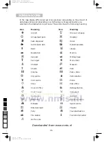
Page 90: ...BUSSTATION k CULTUREEL CENTRUM r GARAGE u GELDAUTOMAAT Y GOLFTERREIN H HOTEL i INDUSTRIETERREIN m JACHTHAVEN K KERKGEBOUW n MILITAIRE BASIS D MONUMENT M MUSEUM Symbool Betekenis L OPLEIDINGSCENTRUM G OVERHEID p PARK R PARK RIDE P PARKEERPLAATS J POLIKLINIEK B POLITIE b POSTKANTOOR V PRETPARK g RECHTBANK E RESTAURANT X SPORTCENTRUM C STADSCENTRUM e STATION U THEATER F VEERPONT y VERMAAK a VLIEGVELD...

Page 91: ...egeleidingsscherm R Werk in uitvoering A Gevaar F Slipgevaar Y Slechte weersomstandigheden K Slecht wegoppervlak N Slecht zicht H Zware wind Symbool Betekenis U Ongelukken B Verkeer loopt vast J Filemeldingen d Lengte file W Vertragingen g Speciale transporten v Versmalling rijbaan p Parkeerproblemen G Spookrijders Niet inhalen c Wegversperringen S SMOG alarm D Beperking doorrijhoogte r Luister na...

Page 92: ...rmatie Volume Bestemmings kaart Maateenheden Terug Positie Verkeers informatie Datum Klok Geheugen Viapunt Best wissen Terug Menu optie Menu optie die om gegevens vraagt Menu optie die een ander menu opent Menu Viapunt invoeren Plaatsnaam Land Straat Kruising Bijzondere best Viapunt opslaan Adres lezen Viapunt tonen Viapunt wissen Bestemmings kaart Terug Naam Naam Adres lezen Vorige bestemming Adr...

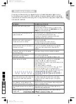
Page 93: ...ing uit het hoofdmenu kan niet worden gekozen Voer een bestemmingsadres in Het systeem plant geen route hoewel een bestemming is opgegeven U bevindt zich niet op een ingetekende weg Rij in de richting van een ingetekende getoonde weg Begeleidingsadvies is niet te horen Kies Gesproken info aan in het menu Configuratie symbool l staat niet op de scherm Zet Volume in het menu Configuratie niet in de ...

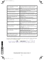
Page 94: ...ng is niet nauwkeurig Een afwijking van maximaal 30 m is toegestaan Als u regelmatig grotere afwijkingen ontdekt neem dan contact op met uw dealer De getoonde autopositie komt niet overeen met de reële autopositie Slechte GPS ontvangst gedurende langere tijd Bij voldoende GPS ontvangst wordt de positie automatisch gecorrigeerd Wacht zo nodig enkele minuten Het begeleidingsadvies komt niet overeen ...

Page 95: ...3112 316 0810 3 10 98 ri cover522_gb_nl qxd 09 11 98 15 17 Seite 1 Downloaded from www nmis nl ...

Reviews: