37
How do I remove maps from my Navman?
1. Open NavDesk, and then click
My Map
s.
2. From the My Navman panel, select the checkbox next to the map you want to remove.
3. Click
Remove Maps
to remove the selected maps.
4. Confirm that you want to remove the selected map when prompted. The map is
removed from your Navman. You can reinstall these maps at any time via NavDesk.
Custom POIs
Note:
This feature is not available on all models.
NavDesk
Custom POIs
IThe
Custom POIs
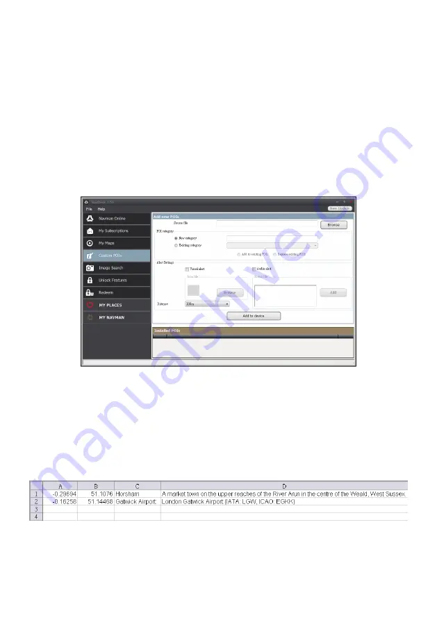
application allows you to create or import your own POI files. These
are called custom POIs. Unlike preinstalled POIs, custom POIs can be removed from your
Navman and can have audio as well as visual alerts associated with them.
To create your POI files, open Microsoft Excel and then enter the POI location details
(including the longitude, latitude, name, and description) in separate cells. Always use
decimal degrees for coordinates and start a new location from a new line. When done, click
File
Save As
to save it as a *.csv file. Now you have successfully created a POI CSV file.
The following displays the example of creating the POI file by using Microsoft Excel:
Note:
Various POI files are available for free download or by subscription from third-party websites.
Ensure that downloaded files are in .csv (Comma Separated Values) format. Navman is not
responsible for the content or accuracy of the information or the reliability or availability of these
websites. The use of information regarding safety camera locations may be subject to local laws in the
country of use. You are responsible for checking that you can use the information in your country or in
the country where the information will be used.


