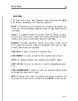


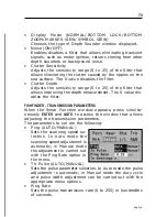


67
English
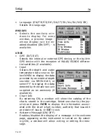
Tide or current forecast at the nearest survey station
NOTE: This function is available only with the NAVIONICS cartridges containing
Tides and Currents data.
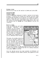
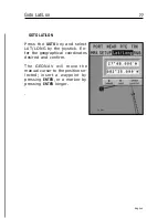
This function allows displaying, within the space of twenty-
four hours with respect to the selected date, the tide level and
tidal current speed and direction at a survey station in the
vicinity. Unlike the estimated data shown in the Info win-
dow, this forecast is much more accurate, being supplied di-
rectly by tidal surveying stations.
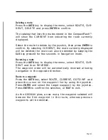
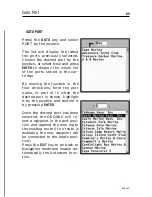
Press the
GOTO
key, select NEAREST by the joystick, choose
the Tides or Currents service, then press
ENTER
to confirm.
The GEONAV will allow selecting one of the three nearest
Tides and Currents stations. Use the joystick to choose the
station desired, then press
ENTER
to confirm. A window will
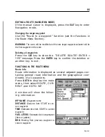
show the information reported below.
Tide station
•
Name of the station
•
Forecast reference date
•
Time and height with respect
to the cursor’s position in the
graph
•
Time and height of high/low
water
•
Dawn and sunset time
•
Moonrise and moonset time
•
Moon phase
•
Tide level graph (24 hours)
Summary of Contents for Geonav 5 Touring
Page 1: ...User and Installation Guide 5Touring...
Page 2: ......


