


19
English
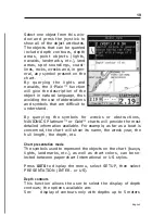
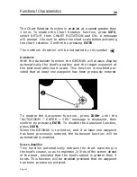
Select one object from this win-
dow and press the joystick to
show all of the object attributes.
The objects that can be queried
include depth contours, depth
areas, point objects (lights,
navaids, landmarks, etc.), land
areas, spot soundings, coast-
lines, rocks, wrecks and, in gen-
eral, any symbol present on the
chart.
By querying the lights and
navaids, the X-Plain™ function
will give the description of the
object in natural language, thus
avoiding the use of abbreviations
and symbols that are difficult to
understand.
By querying the symbols for wrecks or obstructions,
NAVIONICS Platinum™ or Gold™ charts will provide the most
detailed information available. For example, as far as a boat is
concerned, the chart will show its name, the wreck year, the
hull length, the depth, etc.
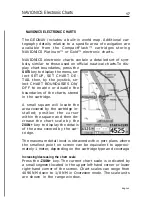
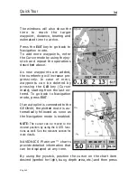
Chart presentation mode
The symbols used to represent the objects on the chart (buoys,
lights, landmarks, etc.), as well as chart colors, can be se-
lected between paper-chart International or US styles.
Press
GOTO
to display the menu, select SETUP, then select
PRESENTATION (INTER. or US).
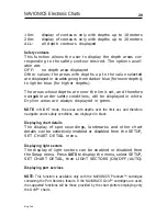
Depth contours
This function allows the user to select the display of depth
contours; the options available are:
5m:
display of contours only with depths up to 5 meters
Summary of Contents for Geonav 5 Touring
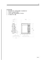
Page 1: ...User and Installation Guide 5Touring...
Page 2: ......