


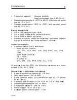


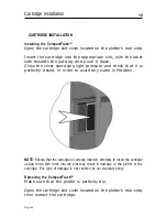


17
English
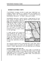
NAVIONICS ELECTRONIC CHARTS
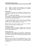
The GEONAV includes a built-in world map. Additional car-
tography details relative to a specific area of navigation are
available from the CompactFlash™ cartridges storing
NAVIONICS Platinum™ or Gold™ electronic charts.
NAVIONICS electronic charts contain a detailed set of sym-
bols, similar to those used on official nautical charts.To dis-
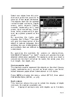
play chart boundaries, press the
GOTO
key to display the menu, se-
lect SETUP, SET CHART DE-
TAIL then, by the joystick, se-
lect CHART BOUNDARIES ON/
OFF to enable or disable the
boundaries of the charts stored
in the cartridge.
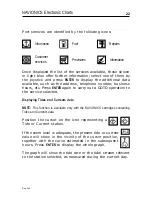
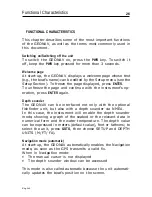
A small square will locate the
area covered by the cartridge in-
stalled; position the cursor
within the square and then de-
crease the chart scale by the
ZOOM+
key to display the details
of the area covered by the car-
tridge.
The maximum detail level is obtained within port plans where
the smallest point on screen can be equivalent to approxi-
mately 1 meter, depending on the cartridge type and coverage.
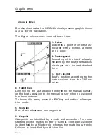
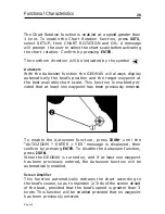
Increasing/decreasing the chart scale
Press the
-ZOOM+
key. The current chart scale is indicated by
a small segment located in the upper left-hand corner or lower
right-hand corner of the screen. Chart scales can range from
4096 NM down to 1/8 NM in Overzoom mode. The scale units
are shown in the range window.
NAVIONICS Electronic Charts
Summary of Contents for Geonav 5 Touring
Page 1: ...User and Installation Guide 5Touring...
Page 2: ......


