29
ENG
Getting started with navigation
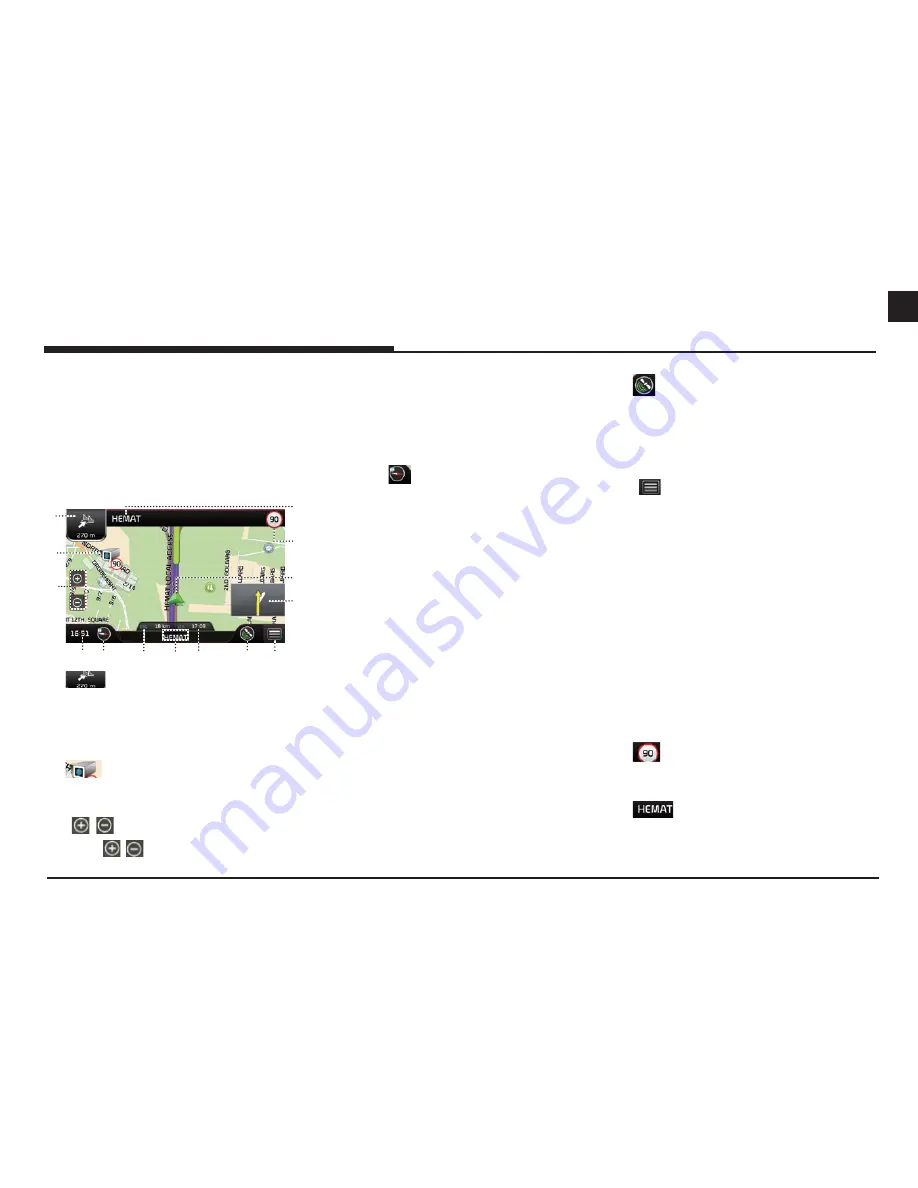
Operating navigation screen
The navigation system displays various
information on the map screen.
Map screen
Press [MAP] or [NAV] > [Map] to access the map
screen.
1
2
3
4 5
6
7
9 10
8
11
14
13
12
1.
Displays the distance to next turn, maneuver
at next turn and serial turn. Press to repeat
voice instructions.
2.
Displays speed cameras.
3. [ / ] button
Press [ / ] button to set the zoom level
on the map screen.
4. Clock display
Displays the current time.
5. Map view button
Changes the map view perspectives.
Press
[
] repeatedly to switch them.
- 2D North-up: The map always points
north regardless of the direction that the
vehicle is moving.
- 2D Heading-up: The map always displays
the vehicle’s direction as proceeding
towards the top of the screen.
- 3D Heading-up: The map always displays
the basic outline and details of the
surrounding roads and general area.
6. Remaining distance display
Displays the remaining distance to the
destination.
7. Street/city information display
Displays the current street information or city
information. Press to switch the display.
8. Arrival time display
Displays the estimated time until the arrival at
the destination.
9.
Displays GPS receiver status. Press to check
GPS information.
- The status is green: GPS signal good.
- The status is red: GPS signal lost.
10. [
] button
Displays functions in the sub menu.
11. PIP (Picture In Picture)
Displays the upcoming route with the
enlarged and simple picture when driving.
12. Vehicle position mark
Displays current vehicle position and direction.
- The mark is green: GPS signal good.
- The mark is Yellow: GPS signal weak.
- The mark is red: GPS signal lost.
- The mark is grey: When simulating.
13.
Displays speed limit information on the road.
14.
Displays the instruction for current turn.
Press to access the turn list.


