


Total Station Manual
-
93 -
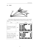
○
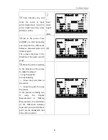
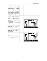
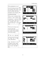
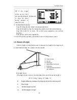
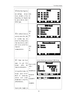
5 Start to measure the
second target point. Aim at
the second target point and
press [F1](ALL) or [F2](DIST)
+ [F3](REC) to finishing
measurement.
※
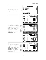
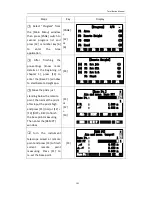
1
PAGE1
Press
[F1]
or
[F2] +
[F3]
ALL
[Polygonal]
DIST
REC
↓
偏置模式 :
偏置模式 :
PT1 : 1
T.H. : 1.500 m
: 3.563 m
: 3.563 m
PT2 : 2
1
2
1/3
Find
[Polygonal]
List
Coord.
↓
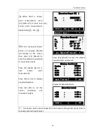
偏置模式 :
偏置模式 :
PT1 : 1
T.H. : 1.500 m
: 3.563 m
: 3.563 m
PT2 : 2
1
2
2/3
EDM
[Polygonal]
|←
偏置模式 :
偏置模式 :
PT1 : 1
T.H. : 1.500 m
: 3.563 m
HA : 125°14′53″
VA : 85°35′42″
PT2 : 2
1
2
3/3
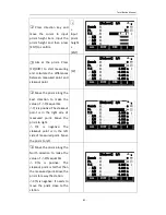
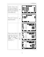
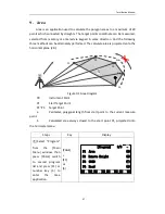
○
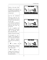
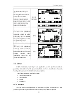
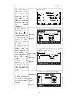
6
Show the result of
polygonal tie distance.
[NewPt1]: Start a new
polygonal tie distance.
[NewPt2]: This polygonal tie
distance’s second point will
be the new polygonal tie
distance’s first point and
then go to
○
5 to measure
the new second target point.
[Radia]Radial: Go to Radial
tie distance.
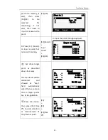
NewPt1
PT1 : 1
NewPt2
Radial
偏置模式 :
12°27′13″
PT2 : 2
Slope : 2.9%
△ :
△ :
△ :
Azimuth :
+1.232m
-0.562m
+0.362m
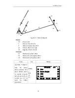
※
1
:
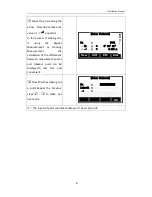
The target points can be measured, selected from the memory, or input using
the keypad.
Summary of Contents for HTS-420R
Page 1: ......
Page 11: ...Total Station Manual 10 1 Name and function of eachpart 1 Name ...
Page 12: ...Total Station Manual 11 ...
Page 192: ......