Geophysical Survey Systems, Inc.
UtilityScan with GS Software
Manual
MN71-307 Rev B
22
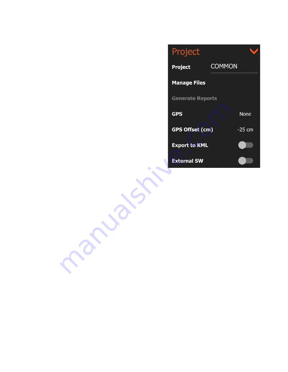
Project
This section allows you to manage reporting outputs,
transfer/delete data, and load base maps to use with GPS.
Project:
Tapping the current project name will open a
browser which enables you to create a new project or switch
to an existing one. New data files will be saved into that
project folder and the root name of those files will be the same
as the project name.
Manage Files:
Tapping this option will bring up a list of
project folders containing data files. You can browse these to
select files for copying or deletion. See the section of this
guide on data transfer and file maintenance for more details.
Generate Reports:
Tapping this option will create a
UtilityScan survey report of data already collected. To access
this feature, you will need to be in Playback Mode. You will
also need to tap the pause button when you have the image
you want in your report on the screen even if the file is
completely displayed already. Tapping Generate Reports will
create a preset report including an image and your RADAR
parameters. This report is placed in your Project folder under
Reports as an .html file.
GPS:
Toggles your choice of GPS between None, G2-GPS for the Panasonic G2’s internal GPS, and any
external GPS units that have been previously connected via Bluetooth. See Appendix A for details on
connecting a third-party GPS to the system.
GPS Offset (cm/in):
This is the distance that your GPS is offset from the threading on the top portion of
the antenna near the handle attachments. If your GPS is mounted on a pole using the threading on the
antenna, your GPS Offset value will be zero. If your GPS centered closer to the front of the antenna, your
offset (cm/in) will be positive. If your GPS is centered closer toward the handles of the antenna, your
offset (cm/in) will be negative. If you are using the Panasonic G2 internal GPS, measure the horizontal
distance from the threads on the antenna to the center of the tablet. If you are not using GPS, this value
can be zero.
Summary of Contents for UtilityScan 50350HS
Page 1: ...MN27 151 Rev A MN71 307 Rev B ...
Page 4: ...Geophysical Survey Systems Inc UtilityScan with GS Software Manual ...
Page 6: ...Geophysical Survey Systems Inc UtilityScan with GS Software Manual ...
Page 8: ...Geophysical Survey Systems Inc UtilityScan with GS Software Manual MN71 307 Rev B 2 ...
Page 14: ...Geophysical Survey Systems Inc UtilityScan with GS Software Manual MN71 307 Rev B 8 ...
Page 20: ...Geophysical Survey Systems Inc UtilityScan with GS Software Manual MN71 307 Rev B 14 1 2 3 4 ...
Page 46: ...Geophysical Survey Systems Inc UtilityScan with GS Software Manual MN71 307 Rev B 40 ...
Page 47: ...Geophysical Survey Systems Inc UtilityScan with GS Software Manual MN71 307 Rev B 41 ...


